

Festival and venue plans
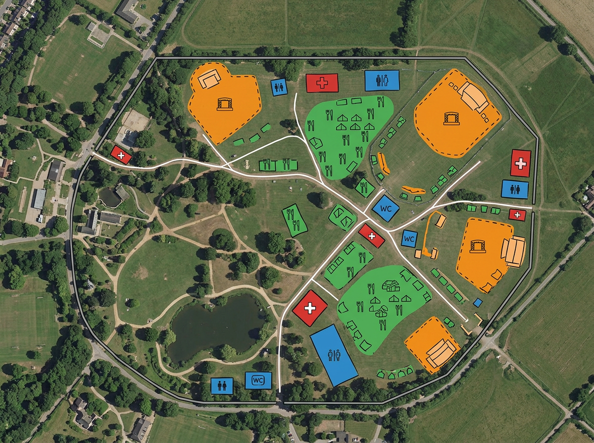
Lay out stages, food vendors, restrooms, first-aid stations, info booths and entry gates on a shared site map.

 English
 Español
 Français
 Deutsch
 Português
 日本語
 中文
 العربية
 한국어
 Italiano
 Русский
 Türkçe
 Nederlands
 Polski
 हिन्दी
 Dansk
 Čeština
 Română
 Ελληνικά
 Tiếng Việt
 Suomi
 Українська
 Indonesia
 Svenska
 Norsk bokmål
 Hrvatski
 Magyar
 Български
 中文(繁體)
 Slovenčina
 Srpski
 ไทย
 Eesti
 Català
 Lietuvių
 עברית
 Slovenščina
 فارسی
 Latviešu
 Azərbaycan
 Беларуская
 Melayu
 Bosanski
 ქართული
 Shqip
 Gaeilge
 Монгол
 ဗမာ
 O‘zbek
 اُردو
 Македонски
 ខ្មែរ
 Nynorsk
 বাংলা
 Galego
 Euskara
 Íslenska
 தமிழ்
 ລາວ
 ગુજરાતી
 Latina
 मराठी
 Қазақ тілі
 ਪੰਜਾਬੀ
 Afrikaans
 नेपाली
 አማርኛ
 తెలుగు
 ChiShona
 Cymraeg
 Føroyskt
 অসমীয়া
 Brezhoneg
 Esperanto
 Basa Jawa
 کٲشُر
 Ирон
 Sardu
Festival footprints, marathon courses, parade routes and venue plans. Layer it all and share with vendors, security, medical and the public.
 4.7 / 5 · G2上有 200 則評論
★ ★ ★ ★ ★“Scribble Maps replaced the need for static screenshots and messy hand drawn maps. It helped with planning events, managing routes, and keeping everyone on the same page visually.”
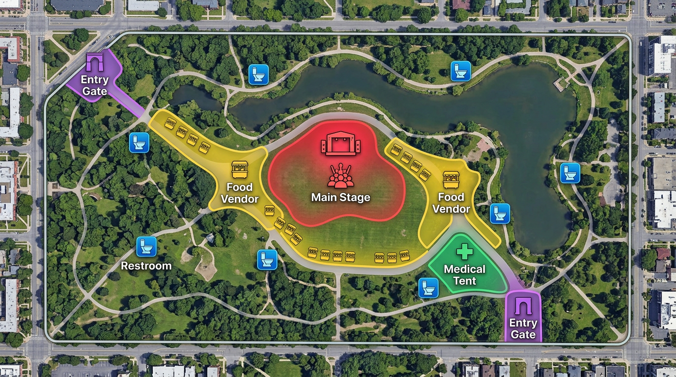
Drop stages, vendors, restrooms, medical tents and gates directly on satellite imagery. No design tool required.
Share a public-facing version with attendees and a private version with security, vendors and medical. Both are one click away.
Import vendor lists, course GPX files or city permits. Toggle layers to brief any stakeholder on what they need.
Lay out stages, food vendors, restrooms, first-aid stations, info booths and entry gates on a shared site map.
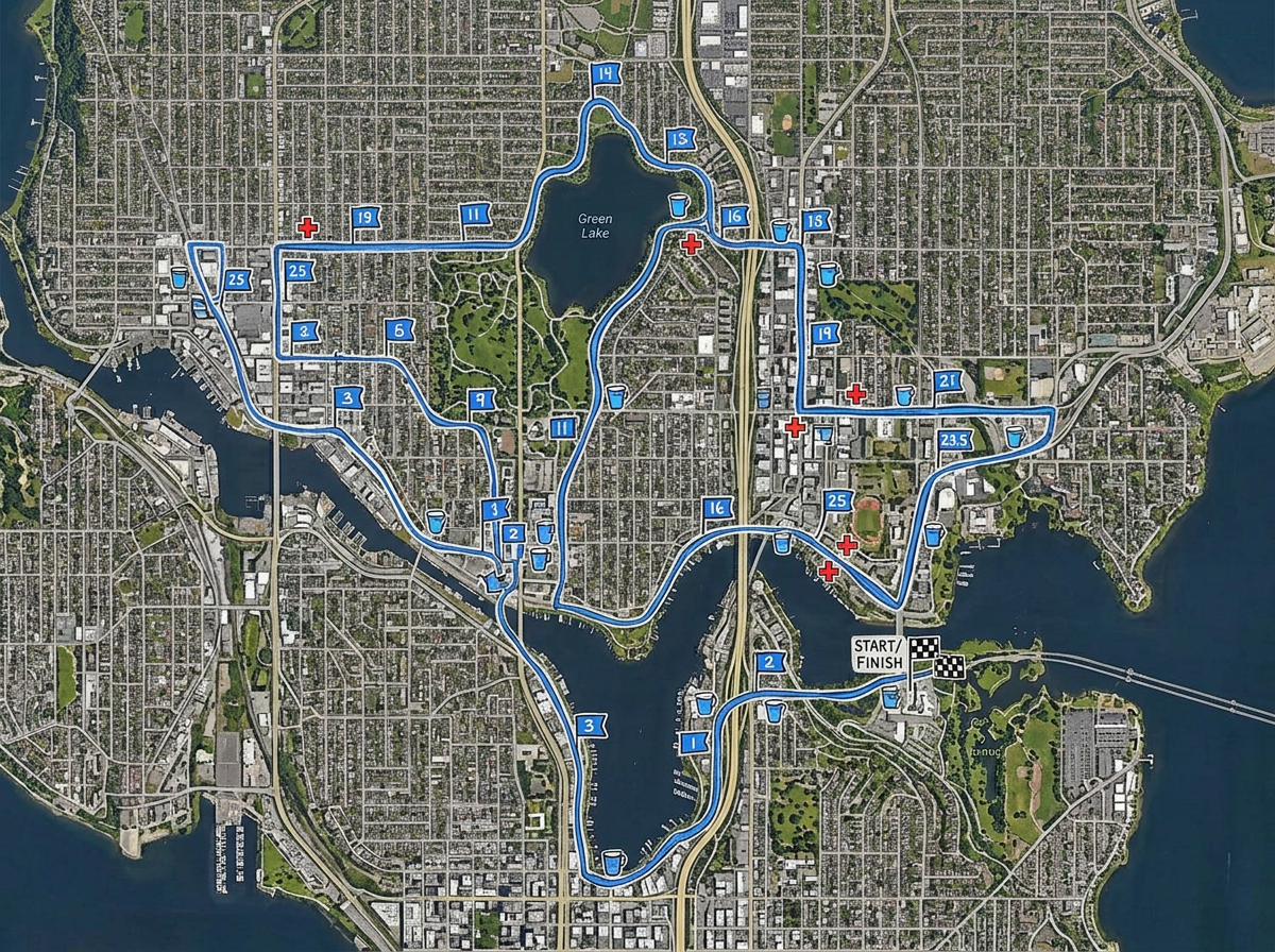
Draw a marathon, fun-run or cycling course with mile markers, water stations and medical tents. Then publish for runners.
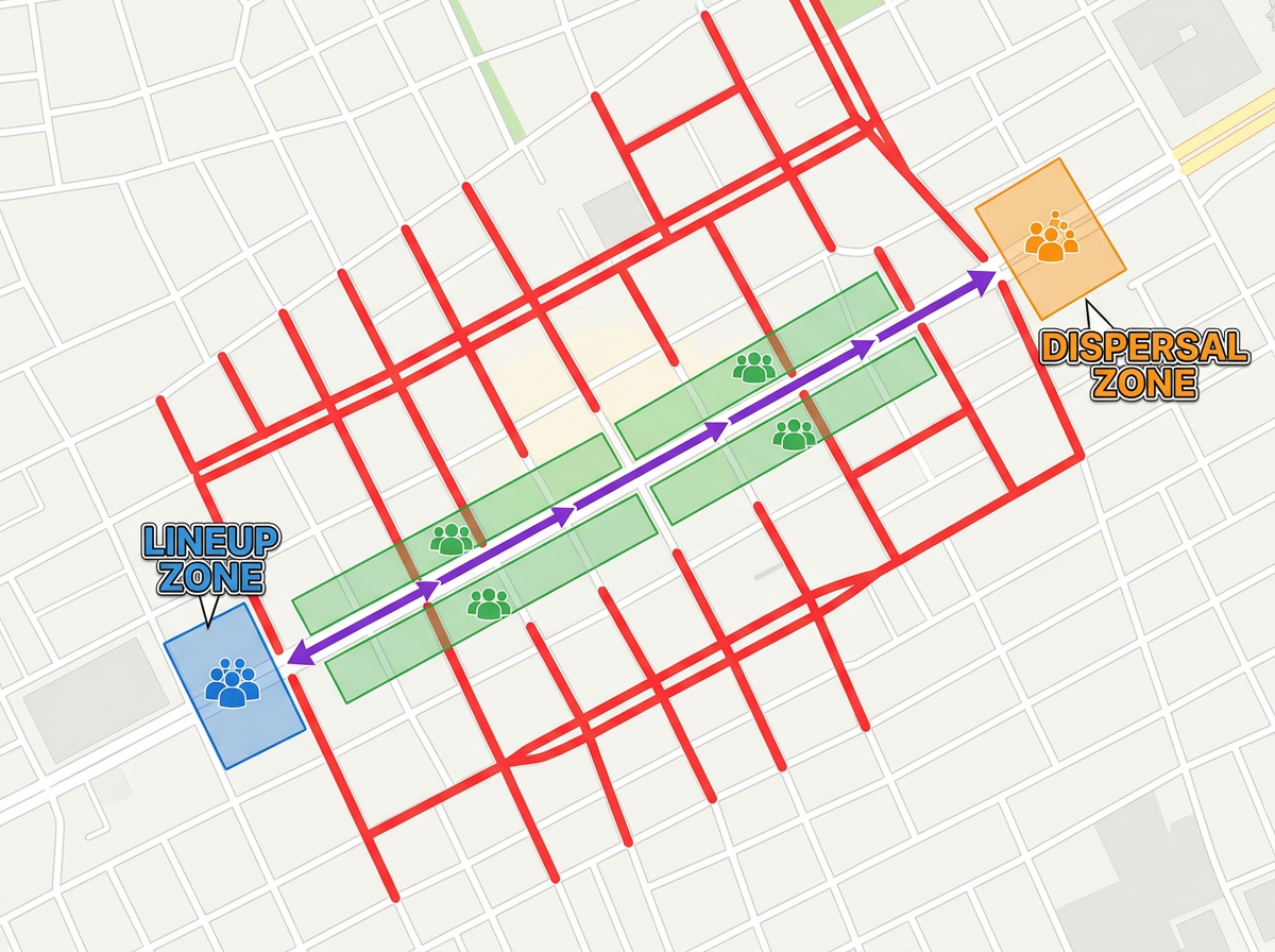
Map a parade route with road closures, viewing areas, lineup zones and dispersal points for the city permit packet.
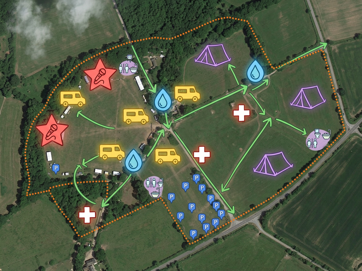
Publish a public-facing wayfinding map attendees can open on their phone. No app, no install.
Scribble AI
告訴Scribble AI您需要什麼。試試「在每個地點周圍繪製500m緩衝區」、「匯入此CSV並依狀態著色」或「測量從倉庫到每個停靠點的路線」。幾秒鐘就能完成。無需GIS訓練,您的團隊也能取得同一張可直接分享的地圖。
試用Scribble AI →★ ★ ★ ★ ★“Scribble Maps replaced the need for static screenshots and messy hand drawn maps. It helped with planning events, managing routes, and keeping everyone on the same page visually.”
★ ★ ★ ★“Workflows are smoother, especially for fieldwork, event planning, and team coordination.”
Yes. Build one master map with multiple layers. Share read-only links that toggle the layers you want each audience to see, or duplicate the map for fully separate versions.
Yes. Anyone with the link can open a map in their mobile browser. No app, no account, no friction.
Yes. Import GPX, KML, Shapefile or GeoJSON. The course drops directly onto the map and you can layer mile markers and water stations on top.
Yes. Generate an embed code and paste it into your event site. Updates appear automatically.