

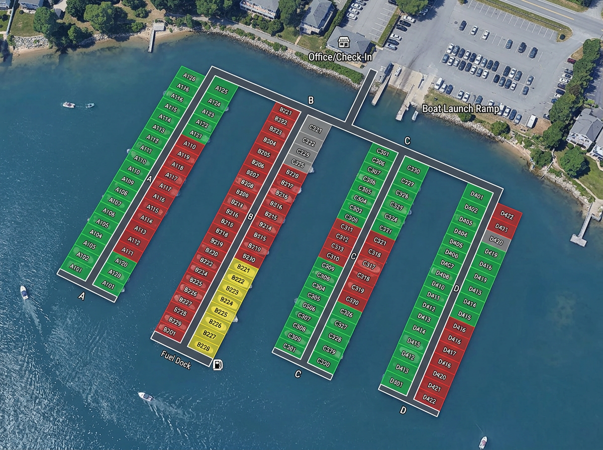
Marina layouts and slip plans
Number every slip on the satellite view, color by occupancy or boat class, and share with dock staff and incoming captains.

 English
 Español
 Français
 Deutsch
 Português
 日本語
 中文
 العربية
 한국어
 Italiano
 Русский
 Türkçe
 Nederlands
 Polski
 हिन्दी
 Dansk
 Čeština
 Română
 Ελληνικά
 Tiếng Việt
 Suomi
 Українська
 Indonesia
 Svenska
 Norsk bokmål
 Hrvatski
 Magyar
 Български
 中文(繁體)
 Slovenčina
 Srpski
 ไทย
 Eesti
 Català
 Lietuvių
 עברית
 Slovenščina
 فارسی
 Latviešu
 Azərbaycan
 Беларуская
 Melayu
 Bosanski
 ქართული
 Shqip
 Gaeilge
 Монгол
 ဗမာ
 O‘zbek
 اُردو
 Македонски
 ខ្មែរ
 Nynorsk
 বাংলা
 Galego
 Euskara
 Íslenska
 தமிழ்
 ລາວ
 ગુજરાતી
 Latina
 मराठी
 Қазақ тілі
 ਪੰਜਾਬੀ
 Afrikaans
 नेपाली
 አማርኛ
 తెలుగు
 ChiShona
 Cymraeg
 Føroyskt
 অসমীয়া
 Brezhoneg
 Esperanto
 Basa Jawa
 کٲشُر
 Ирон
 Sardu
Marina layouts, dive sites, fishing zones and charter routes, drawn fast and shared by link with crews, customers and partners.
 4.7 / 5 · G2上有 200 則評論
★ ★ ★ ★“I use it to map underwater SCUBA diving sites. It is very simple to use and saves time while making a graphically appealing map for customers.”
Drop moorings, dive sites and waypoints on real satellite imagery. Measure distances and bearings without a CAD program.
Share a route or site map with the captain by link. They open it on a phone or tablet. No app required.
Import GPX waypoint and track files from a chartplotter, layer them and export back out for any device.
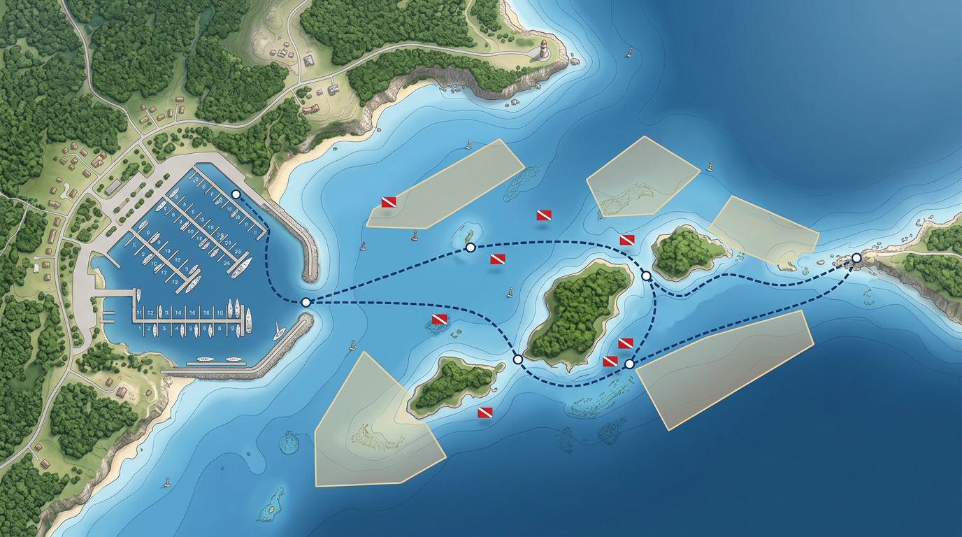
Number every slip on the satellite view, color by occupancy or boat class, and share with dock staff and incoming captains.
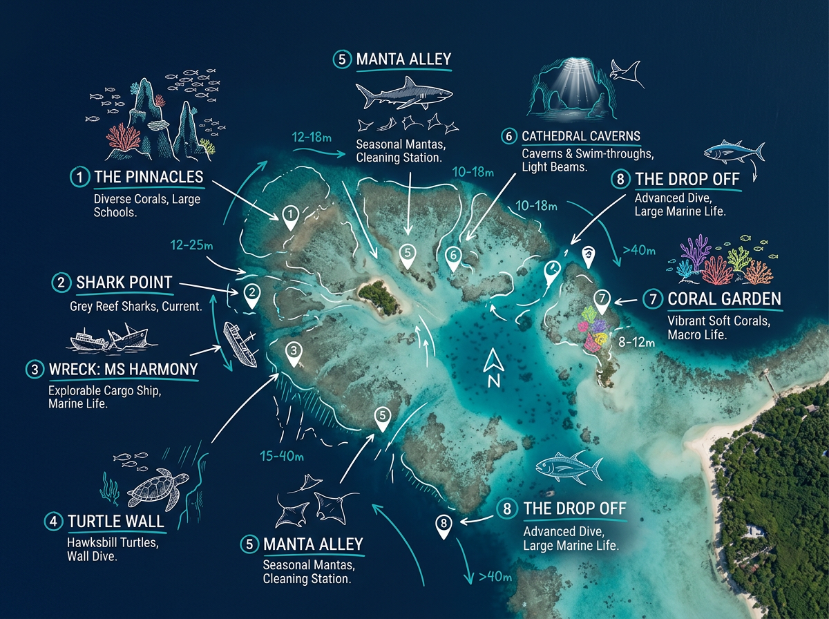
Plot every dive site with depth, hazard and feature notes. Share with customers as a clickable site catalog.
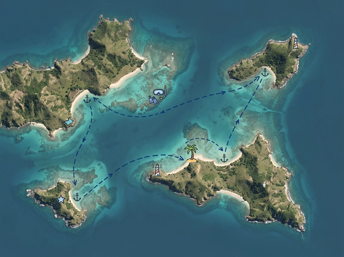
Draw a charter or sailing route with stops, anchorages and points of interest. Share with guests before departure.
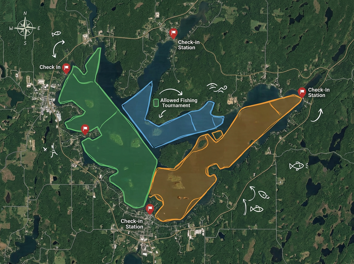
Map allowed zones, tournament boundaries and check-in points so every angler knows where they can fish.
Scribble AI
告訴Scribble AI您需要什麼。試試「在每個地點周圍繪製500m緩衝區」、「匯入此CSV並依狀態著色」或「測量從倉庫到每個停靠點的路線」。幾秒鐘就能完成。無需GIS訓練,您的團隊也能取得同一張可直接分享的地圖。
試用Scribble AI →★ ★ ★ ★“I use it to map underwater SCUBA diving sites. It is very simple to use and saves time while making a graphically appealing map for customers.”
★ ★ ★ ★“I appreciate Scribble Maps easy to use interface and flexibility, especially when it comes to graphics. The program has also been easy to integrate and implement and their customer service has been EXTREMELY responsive to my inquiries.”
Scribble Maps uses satellite, street, terrain and hybrid base maps. For coastal and marina work, many users find satellite imagery enough. You can overlay official chart imagery as an image layer if needed.
Yes. Import GPX, KML, Shapefile or GeoJSON. Tracks and waypoints drop directly onto the map.
Yes. Export any route as GPX or KML for use on most chartplotters and navigation apps.
Yes. Anyone with a sharing link can open it in any mobile browser. No app, no account.