

Tactical overlays with standard symbols
Build OPORD graphics with MIL-STD-2525D symbols. Mark friendly and hostile units, draw phase lines and objectives, and share for mission briefs.

 English
 Español
 Français
 Deutsch
 Português
 日本語
 中文
 العربية
 한국어
 Italiano
 Русский
 Türkçe
 Nederlands
 Polski
 हिन्दी
 Dansk
 Čeština
 Română
 Ελληνικά
 Tiếng Việt
 Suomi
 Українська
 Indonesia
 Svenska
 Norsk bokmål
 Hrvatski
 Magyar
 Български
 中文(繁體)
 Slovenčina
 Srpski
 ไทย
 Eesti
 Català
 Lietuvių
 עברית
 Slovenščina
 فارسی
 Latviešu
 Azərbaycan
 Беларуская
 Melayu
 Bosanski
 ქართული
 Shqip
 Gaeilge
 Монгол
 ဗမာ
 O‘zbek
 اُردو
 Македонски
 ខ្មែរ
 Nynorsk
 বাংলা
 Galego
 Euskara
 Íslenska
 தமிழ்
 ລາວ
 ગુજરાતી
 Latina
 मराठी
 Қазақ тілі
 ਪੰਜਾਬੀ
 Afrikaans
 नेपाली
 አማርኛ
 తెలుగు
 ChiShona
 Cymraeg
 Føroyskt
 অসমীয়া
 Brezhoneg
 Esperanto
 Basa Jawa
 کٲشُر
 Ирон
 Sardu
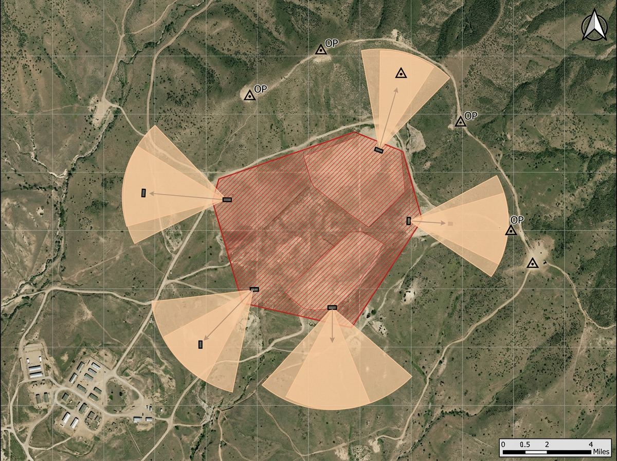
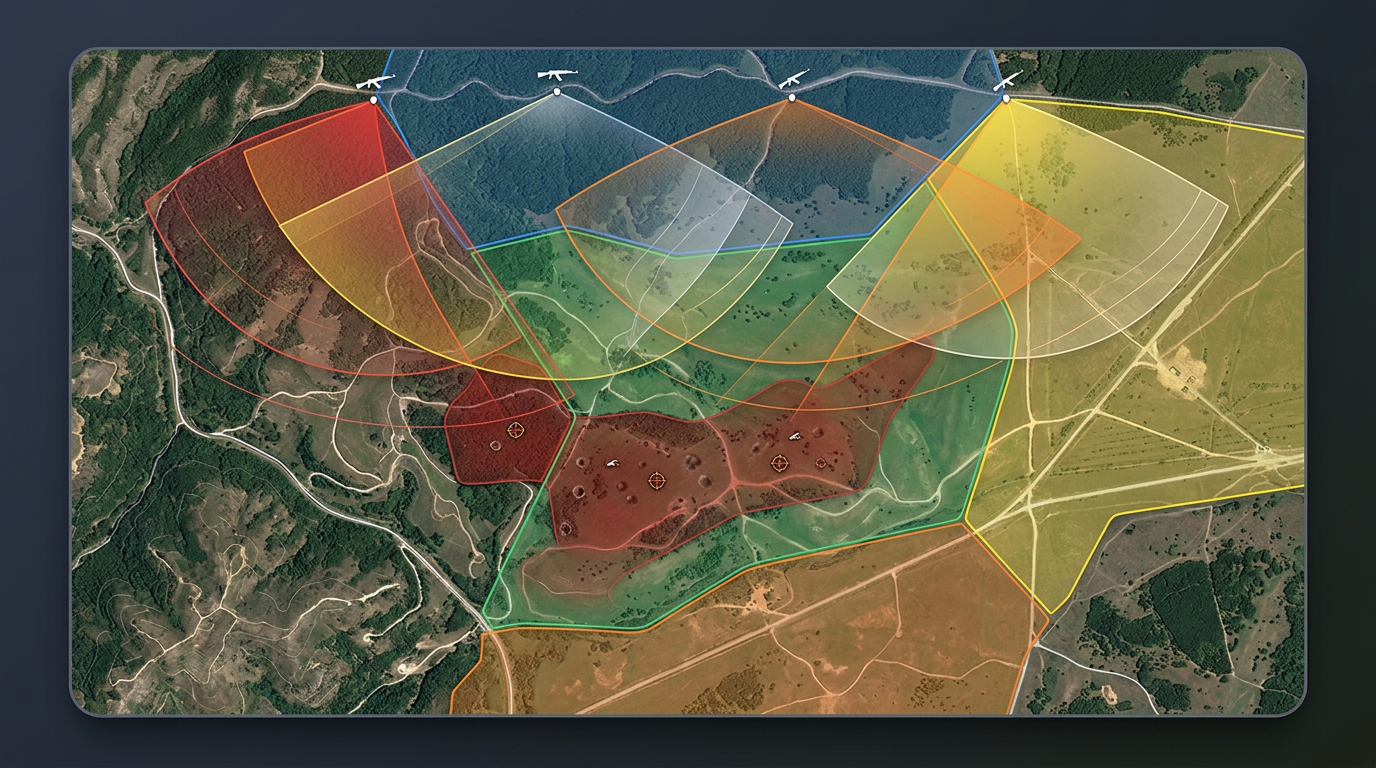
Drop standard military symbols on the map, draw control measures, and share by link. Range planning, exercise overlays, and tactical briefs in any browser.
 4.7 / 5 · G2上有 200 則評論
★ ★ ★ ★ ★“Scribble Maps is one of the only software available that lets you make a fully customizable map. I was able to create unique markers for different types of sites for guests to easily find what they're looking for.”
Drop MIL-STD-2525D and NATO APP-6 symbols on the map. Pick unit type, affiliation, and echelon. Draw phase lines, objectives, and control measures.
Share an exercise overlay or range plan with your team by link. They open it in a browser. No install, no account.
Import KML, Shapefile, GeoJSON or GPX. Layer training-area maps, route data and existing overlays without re-keying.
Build OPORD graphics with MIL-STD-2525D symbols. Mark friendly and hostile units, draw phase lines and objectives, and share for mission briefs.
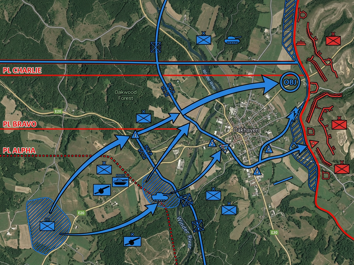
Run tabletop exercises with realistic military symbols. Position units, draw control measures, and walk through maneuvers step by step.
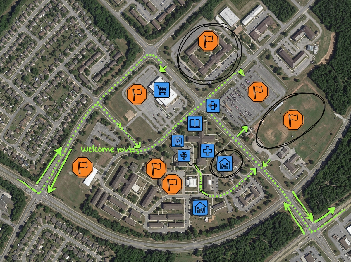
Map evacuation rallying points, sponsor neighborhoods, on-base resources and welcome routes for new arriving families.
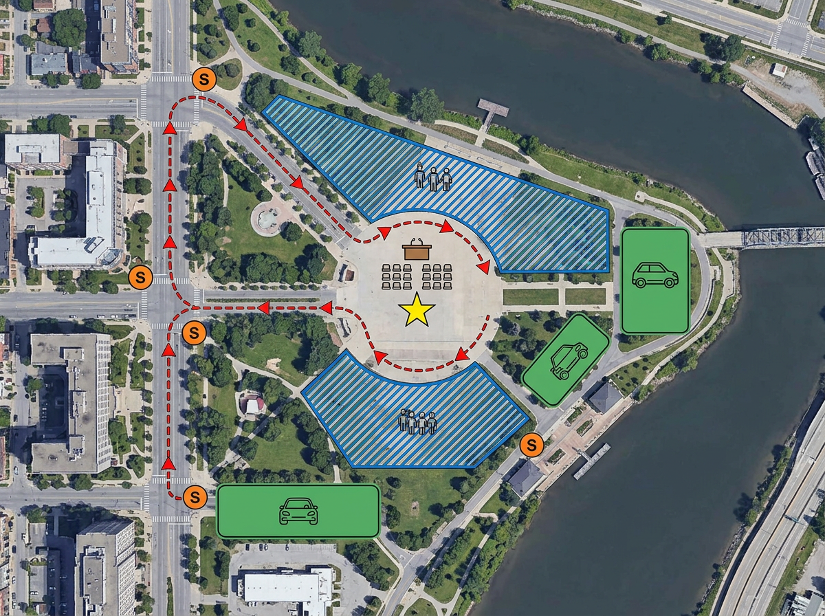
Map a parade route, ceremony footprint or VIP visit. Mark posts, gates, road closures and viewing areas on one map.
Scribble AI
告訴Scribble AI您需要什麼。試試「在每個地點周圍繪製500m緩衝區」、「匯入此CSV並依狀態著色」或「測量從倉庫到每個停靠點的路線」。幾秒鐘就能完成。無需GIS訓練,您的團隊也能取得同一張可直接分享的地圖。
試用Scribble AI →★ ★ ★ ★“Scribble Maps is one of the only software available that lets you make a fully customizable map. I was able to create unique markers for different types of sites for guests to easily find what they're looking for.”
★ ★ ★“I work in territory strategies and this is helping me lay out visuals in my work.”
Scribble Maps supports MIL-STD-2525D and NATO APP-6 symbology. Place symbols for land, sea, air, space, and subsurface units. Set affiliation, echelon, and status modifiers.
Scribble Maps is a commercial cloud product and is not authorized for classified data. Use it for unclassified planning, public affairs, family readiness and training overlays.
Yes. Scribble Maps supports SAML/OIDC/SCIM, activity and audit logs, and user management.
Yes. Import KML, Shapefile, GeoJSON, GPX or CSV. Layer over any base map and re-share.
Yes. Scribble Maps supports private maps, password protection and AES-256 encryption.