

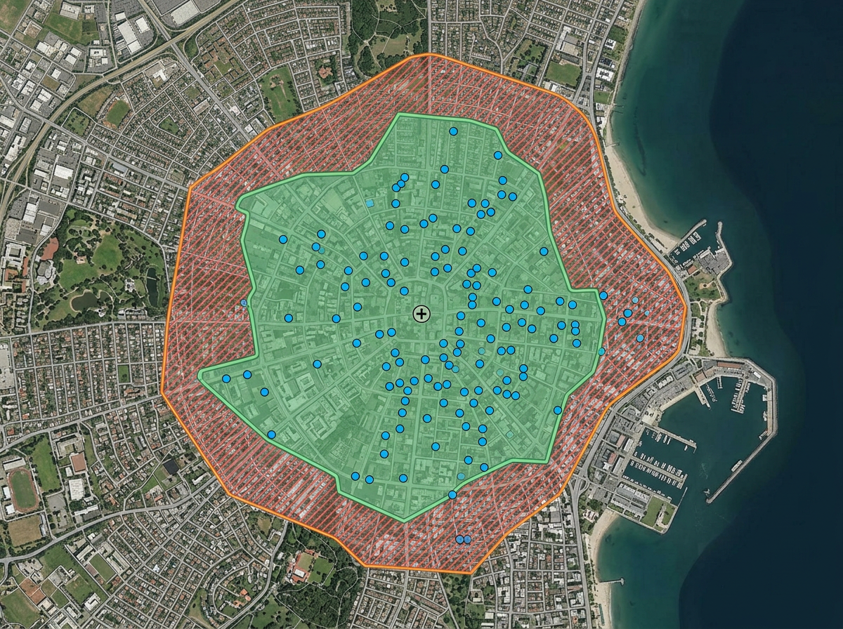
Clinic catchment and access planning
Draw the area your clinic serves, measure travel time and identify gaps in coverage for under-served neighborhoods.

 English
 Español
 Français
 Deutsch
 Português
 日本語
 中文
 العربية
 한국어
 Italiano
 Русский
 Türkçe
 Nederlands
 Polski
 हिन्दी
 Dansk
 Čeština
 Română
 Ελληνικά
 Tiếng Việt
 Suomi
 Українська
 Indonesia
 Svenska
 Norsk bokmål
 Hrvatski
 Magyar
 Български
 中文(繁體)
 Slovenčina
 Srpski
 ไทย
 Eesti
 Català
 Lietuvių
 עברית
 Slovenščina
 فارسی
 Latviešu
 Azərbaycan
 Беларуская
 Melayu
 Bosanski
 ქართული
 Shqip
 Gaeilge
 Монгол
 ဗမာ
 O‘zbek
 اُردو
 Македонски
 ខ្មែរ
 Nynorsk
 বাংলা
 Galego
 Euskara
 Íslenska
 தமிழ்
 ລາວ
 ગુજરાતી
 Latina
 मराठी
 Қазақ тілі
 ਪੰਜਾਬੀ
 Afrikaans
 नेपाली
 አማርኛ
 తెలుగు
 ChiShona
 Cymraeg
 Føroyskt
 অসমীয়া
 Brezhoneg
 Esperanto
 Basa Jawa
 کٲشُر
 Ирон
 Sardu
A simple, shareable map for clinic catchment areas, mobile outreach, vaccine clinics and community health surveys. Built for the teams who don't have a spatial epidemiology department.
 4.7 / 5 · G2上有 200 則評論
★ ★ ★ ★“We can see how many infirmaries are in an area and what sorts of patients they treat by charting their places on maps. The features of coordinating information and directives using symbols on the maps. I can mark the areas easily and adding the legends to inform what the symbols are for.”
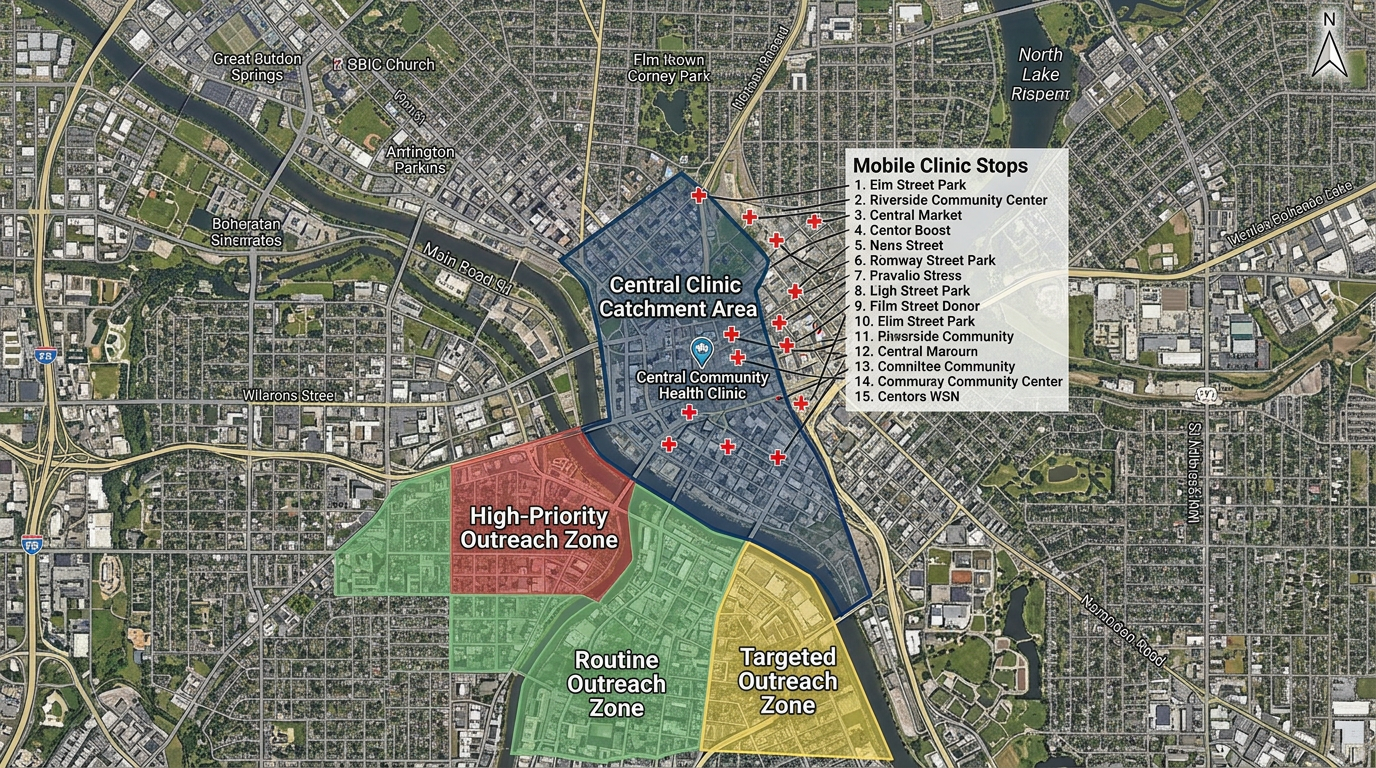
Draw catchment areas, travel-time isochrones and service zones directly on the map. No GIS analyst required.
Send a clickable map to mobile clinicians, outreach workers and community partners. They open it on a phone. No install.
Map a CSV of clinic sites, outreach stops or survey responses. Every row geocodes onto the map automatically.
Draw the area your clinic serves, measure travel time and identify gaps in coverage for under-served neighborhoods.
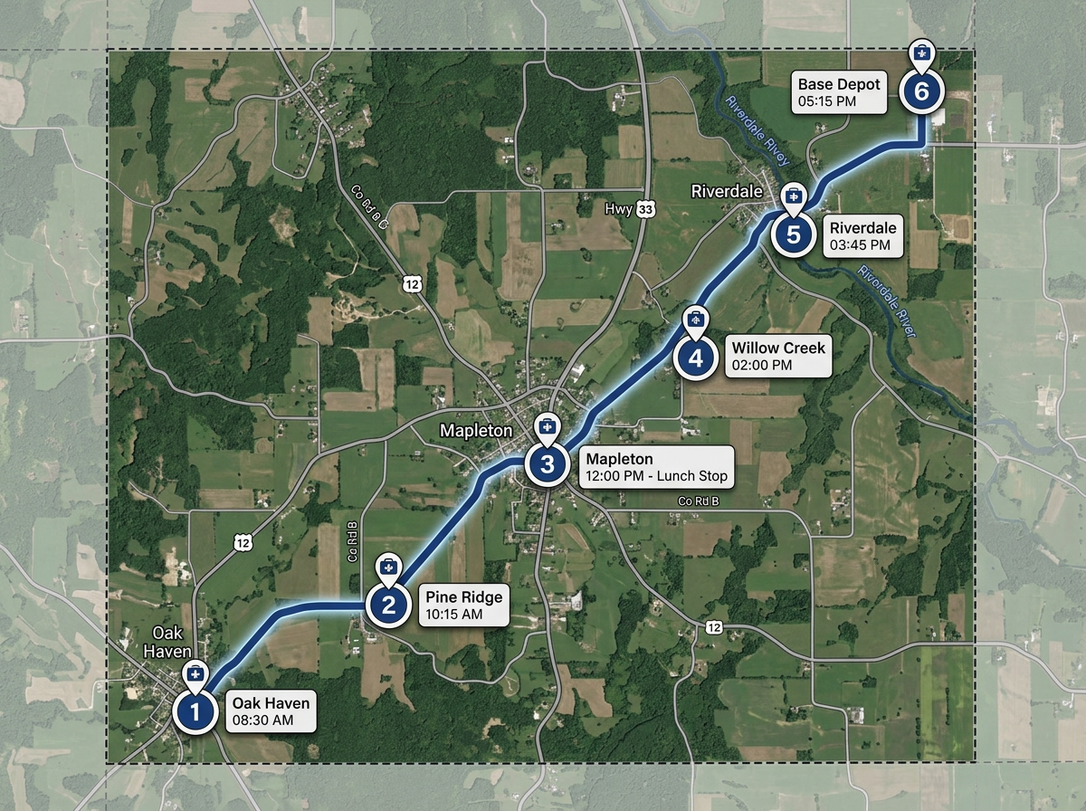
Map every stop on the mobile clinic or vaccine route with times, contacts and setup notes. Share with the crew by link.
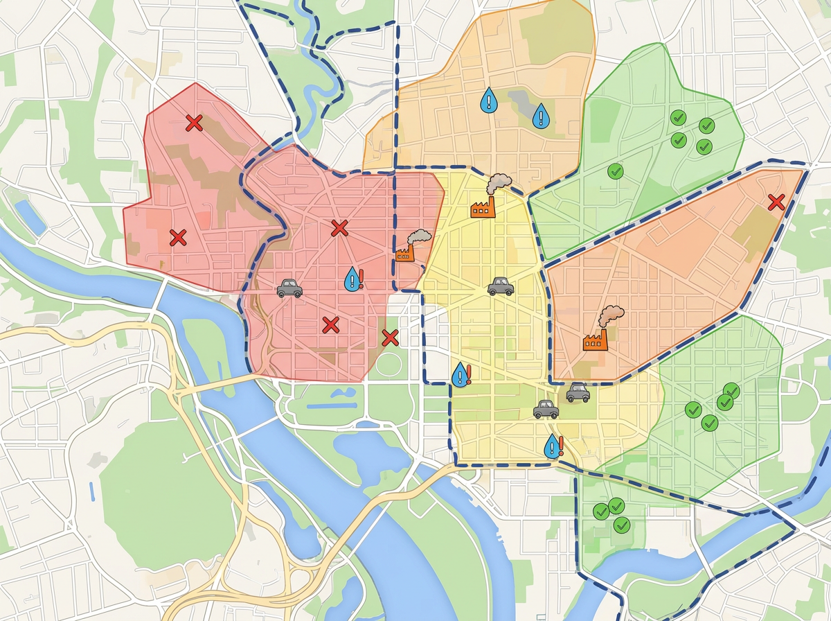
Plot survey responses, environmental hazards or resource locations. Turn field data into a map the team can brief on.
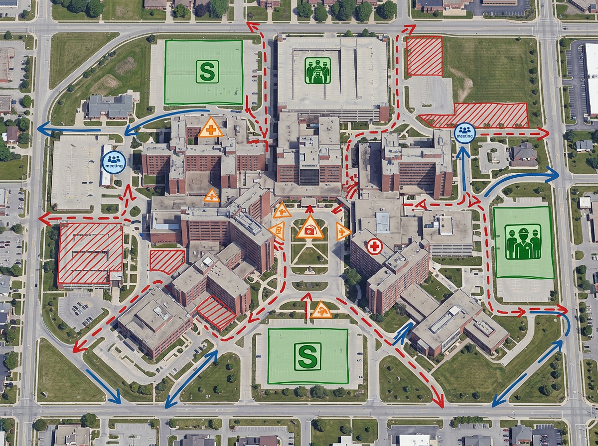
Map staging areas, triage points and evacuation routes for preparedness drills or live responses.
Scribble Sight
使用地點、人流量、Walkscore™、人口統計、空氣品質、花粉等資料,為 healthcare 找出最佳地點。並排比較候選地點,將直覺轉化為有資料佐證的決策。
試用Scribble Sight →Scribble AI
告訴Scribble AI您需要什麼。試試「在每個地點周圍繪製500m緩衝區」、「匯入此CSV並依狀態著色」或「測量從倉庫到每個停靠點的路線」。幾秒鐘就能完成。無需GIS訓練,您的團隊也能取得同一張可直接分享的地圖。
試用Scribble AI →★ ★ ★ ★“We can see how many infirmaries are in an area and what sorts of patients they treat by charting their places on maps.”
★ ★ ★ ★“Scribble Maps offers an intuitive and user-friendly interface, making it accessible for users with varying levels of mapping experience.”
Scribble Maps is not a HIPAA-covered platform. Do not store protected health information (PHI) in map labels or files. Use it for catchment planning, outreach logistics, clinic sites and de-identified data.
Yes. Scribble Maps supports travel-time isochrones. Drop a point, pick a travel time and the area is drawn automatically.
Yes. Paste from a spreadsheet or import a CSV. Every address geocodes onto the map in one pass.
Yes. Scribble Maps supports private maps, password protection and AES-256 encryption at rest.