

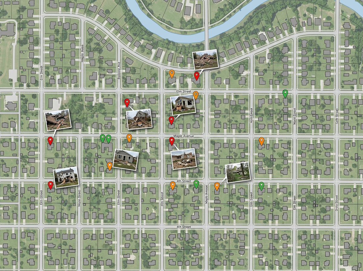
Damage assessment
Send teams into the field with a shared map. They drop pinned photos and severity ratings; you see the picture build in real time.

 English
 Español
 Français
 Deutsch
 Português
 日本語
 中文
 العربية
 한국어
 Italiano
 Русский
 Türkçe
 Nederlands
 Polski
 हिन्दी
 Dansk
 Čeština
 Română
 Ελληνικά
 Tiếng Việt
 Suomi
 Українська
 Indonesia
 Svenska
 Norsk bokmål
 Hrvatski
 Magyar
 Български
 中文(繁體)
 Slovenčina
 Srpski
 ไทย
 Eesti
 Català
 Lietuvių
 עברית
 Slovenščina
 فارسی
 Latviešu
 Azərbaycan
 Беларуская
 Melayu
 Bosanski
 ქართული
 Shqip
 Gaeilge
 Монгол
 ဗမာ
 O‘zbek
 اُردو
 Македонски
 ខ្មែរ
 Nynorsk
 বাংলা
 Galego
 Euskara
 Íslenska
 தமிழ்
 ລາວ
 ગુજરાતી
 Latina
 मराठी
 Қазақ тілі
 ਪੰਜਾਬੀ
 Afrikaans
 नेपाली
 አማርኛ
 తెలుగు
 ChiShona
 Cymraeg
 Føroyskt
 অসমীয়া
 Brezhoneg
 Esperanto
 Basa Jawa
 کٲشُر
 Ирон
 Sardu
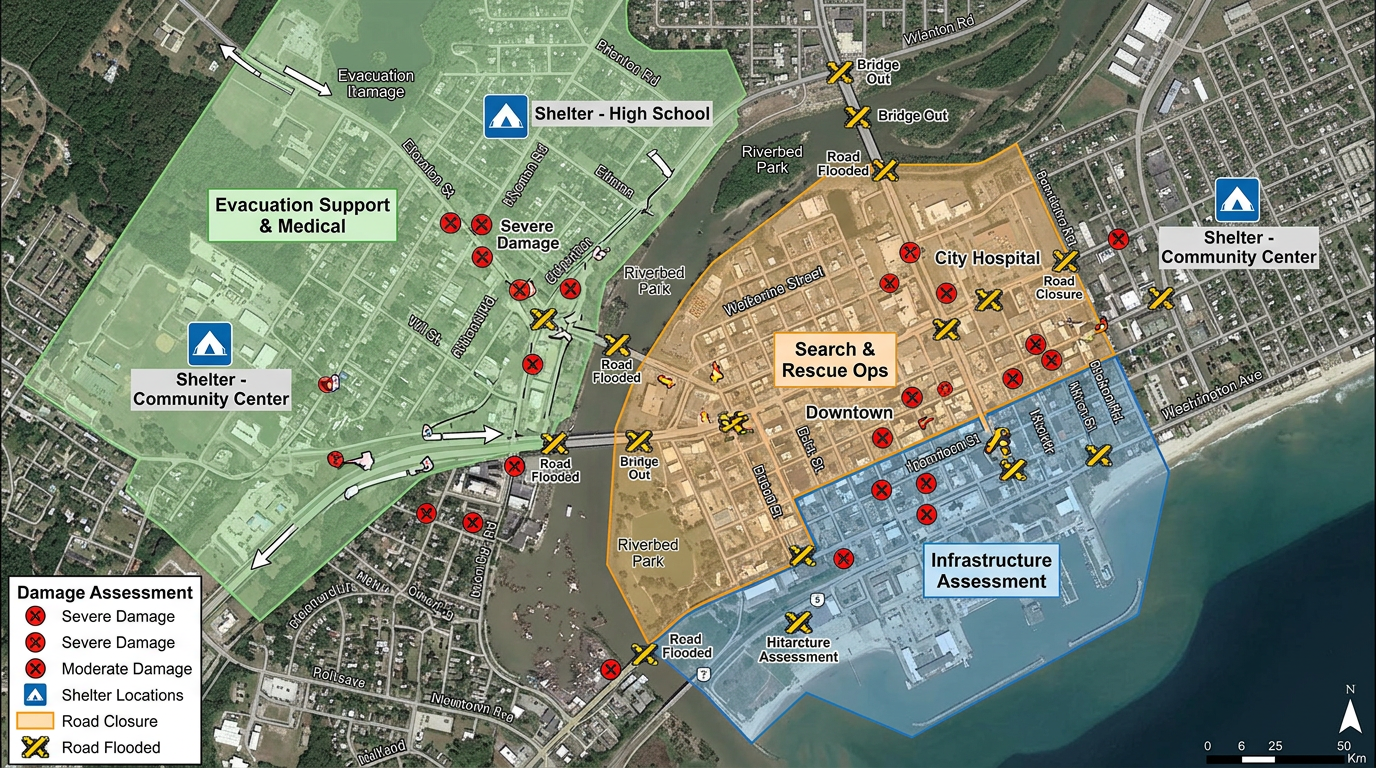
Damage assessments, shelter locations, supply caches, road closures and team assignments. Built fast and shared by link with mutual aid and partners.
 4.7 / 5 · G2上有 200 則評論
★ ★ ★ ★ ★“The support we've received from Scribble Maps has been amazing.”
Drop damage markers, draw closure zones and color-code team assignments on a satellite view as conditions change.
Send a link to volunteer teams, partner agencies and the press. They open it in a browser. No account, no install.
Import KML, Shapefile, GeoJSON, GPX or CSV. Drop weather feeds, hazard zones, volunteer rosters or shelter lists onto a single map.
Fire kit
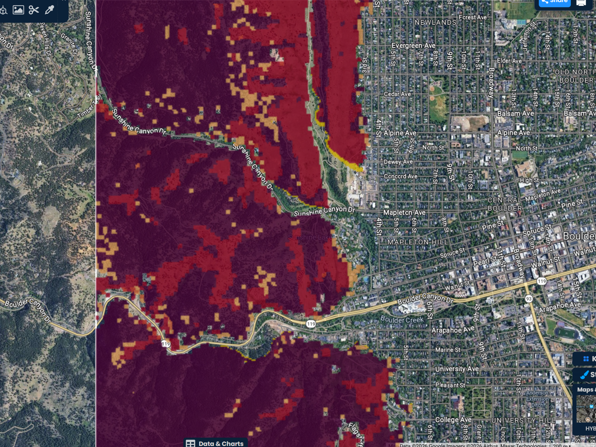
Draw the hills above a town and let a fire come in across the upwind edge. The Fire kit shows how far it could run and how fast, so you can plan routes, staging areas and messages before fire season.
Pro Business. 3 free fire runs on any account.
Send teams into the field with a shared map. They drop pinned photos and severity ratings; you see the picture build in real time.
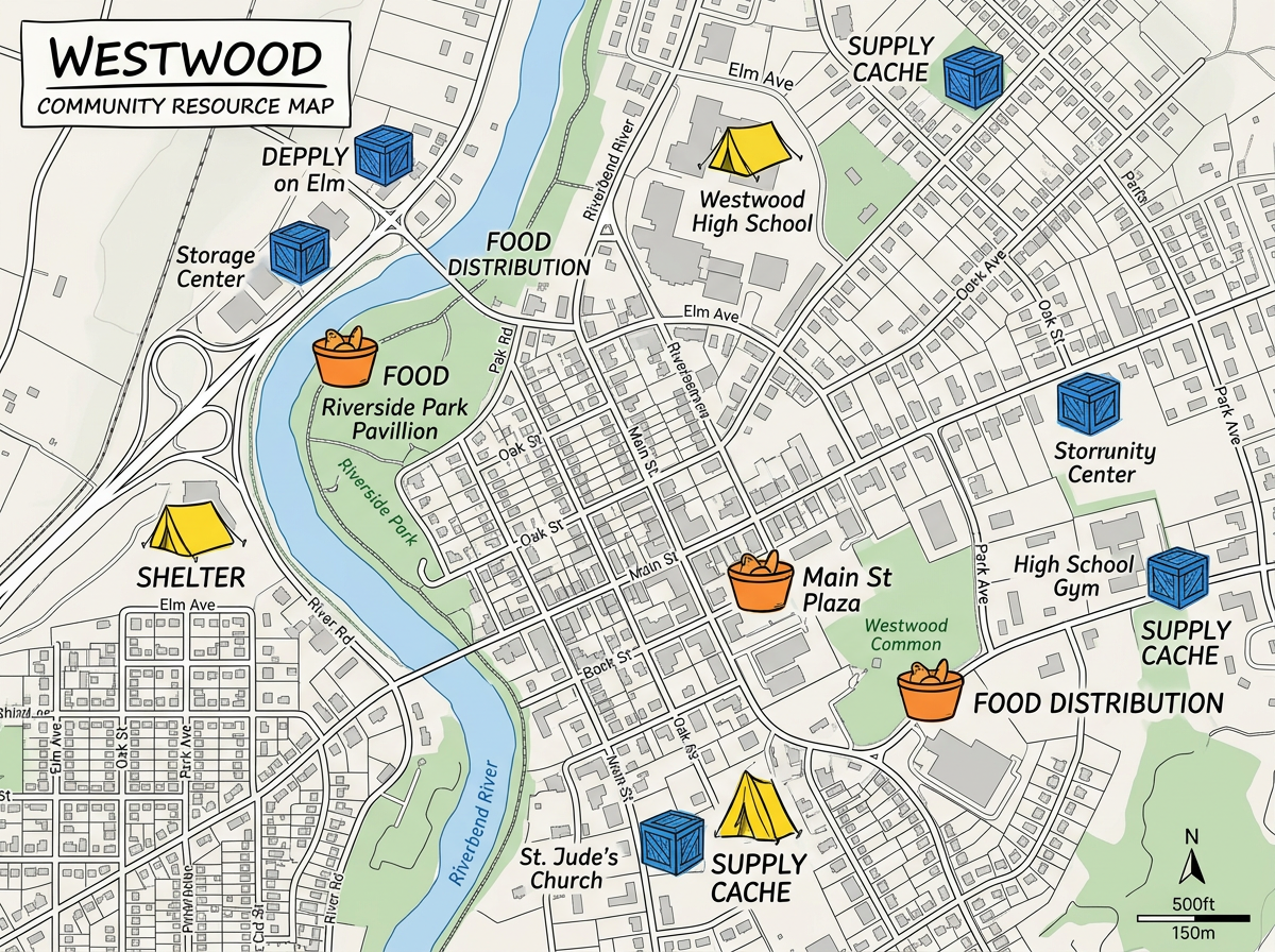
Map every open shelter, distribution point and supply cache and share a public link residents can use to find help.
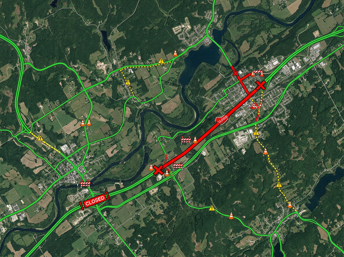
Mark closed roads, washed-out bridges and detours so responders and residents know what's passable.
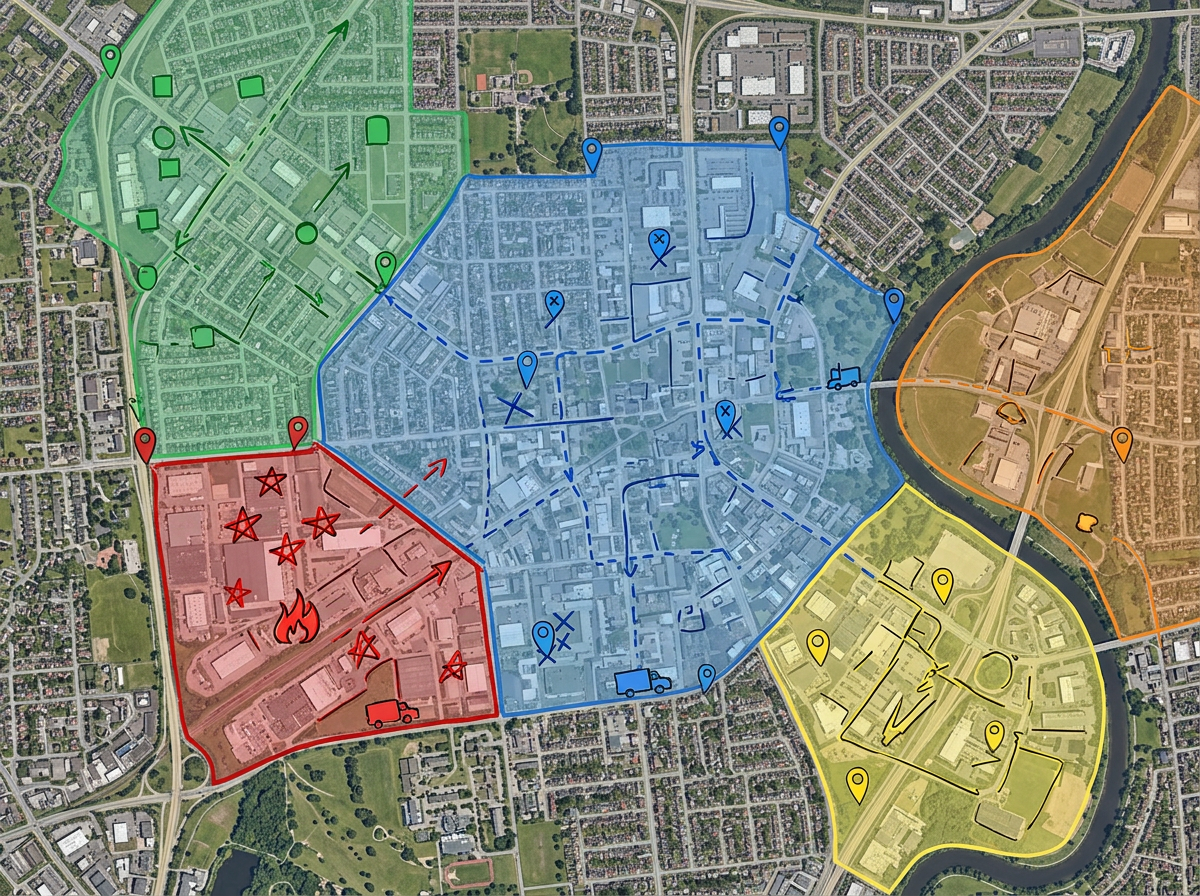
Divide an affected area into zones, color-code by team, and send each crew their own assignment map.
Scribble AI
告訴Scribble AI您需要什麼。試試「在每個地點周圍繪製500m緩衝區」、「匯入此CSV並依狀態著色」或「測量從倉庫到每個停靠點的路線」。幾秒鐘就能完成。無需GIS訓練,您的團隊也能取得同一張可直接分享的地圖。
試用Scribble AI →★ ★ ★ ★ ★“The support we've received from Scribble Maps has been amazing.”
★ ★ ★ ★ ★“Created travel maps for my guys very quick and with amazing details. I can print large sharp images of travel lines.”
Yes. Use Manage Users or a team to grant Admin, Editor or Viewer access. Multiple responders can edit the same map; if two people save changes at the same time, Scribble Maps prompts to merge their edits or overwrite.
Scribble Maps runs in any modern browser. Once a map is loaded, you can keep adding markers and notes on a weak connection. New map tiles will load when the link comes back.
Yes. Scribble Maps supports private maps, password protection and AES-256 encryption.
Yes. Create a separate read-only version with only the public-safe layers and share it widely while keeping the internal map private.