

Course maps and agronomy areas
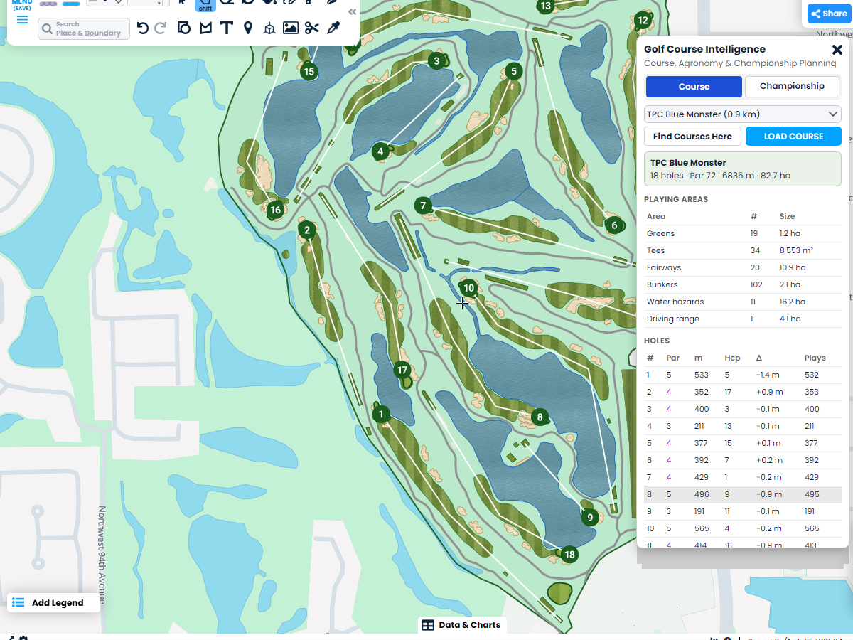
Load the course and get a table of playing areas: how many greens, tees, fairways and bunkers there are and how big they are. Plan mowing, topdressing and spray programs from real sizes, not guesses.

 English
 Español
 Français
 Deutsch
 Português
 日本語
 中文
 العربية
 한국어
 Italiano
 Русский
 Türkçe
 Nederlands
 Polski
 हिन्दी
 Dansk
 Čeština
 Română
 Ελληνικά
 Tiếng Việt
 Suomi
 Українська
 Indonesia
 Svenska
 Norsk bokmål
 Hrvatski
 Magyar
 Български
 中文(繁體)
 Slovenčina
 Srpski
 ไทย
 Eesti
 Català
 Lietuvių
 עברית
 Slovenščina
 فارسی
 Latviešu
 Azərbaycan
 Беларуская
 Melayu
 Bosanski
 ქართული
 Shqip
 Gaeilge
 Монгол
 ဗမာ
 O‘zbek
 اُردو
 Македонски
 ខ្មែរ
 Nynorsk
 বাংলা
 Galego
 Euskara
 Íslenska
 தமிழ்
 ລາວ
 ગુજરાતી
 Latina
 मराठी
 Қазақ тілі
 ਪੰਜਾਬੀ
 Afrikaans
 नेपाली
 አማርኛ
 తెలుగు
 ChiShona
 Cymraeg
 Føroyskt
 অসমীয়া
 Brezhoneg
 Esperanto
 Basa Jawa
 کٲشُر
 Ирон
 Sardu
Load any course and get every hole, green, fairway, bunker and cart path as shapes you can edit. Add yardages, elevation, acreage, soils and live course weather, then plan your next tournament on the same map.
 4.7 / 5 · G2上有 200 則評論

★ ★ ★ ★ ★“Scribble Maps replaced the need for static screenshots and messy hand drawn maps. It helped with planning events, managing routes, and keeping everyone on the same page visually.”
Pick a course and click Load course. Every hole, green, fairway, tee, bunker, water hazard and cart path appears in its own folder, ready to edit, restyle or print.
See the acres of greens, fairways and bunkers for seed, sand and chemical orders. Every hole shows par, length, handicap and elevation change from tee to green.
Share the course map with your crew, your board or tournament vendors. Everyone sees the same plan, on any phone or computer.
Load the course and get a table of playing areas: how many greens, tees, fairways and bunkers there are and how big they are. Plan mowing, topdressing and spray programs from real sizes, not guesses.
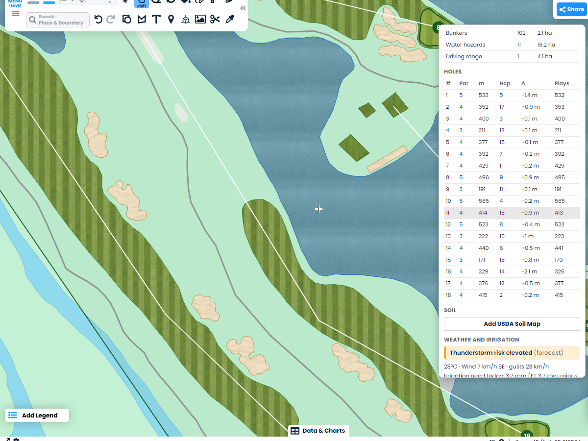
Each hole lists its par, length, handicap and how much it climbs or drops from tee to green, using 1 meter elevation data where it is available. Click a hole to zoom straight to it.
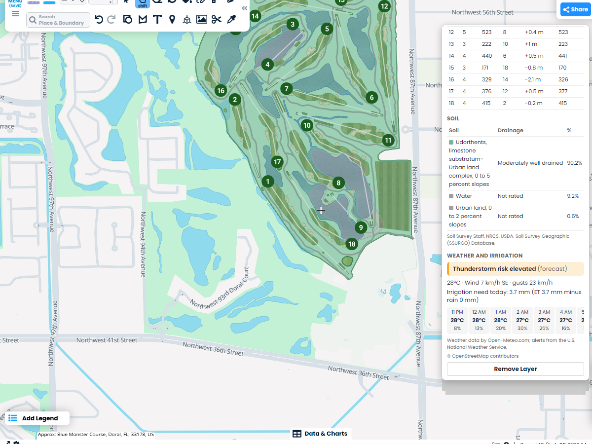
Add the USDA soil map, colored by how well each area drains. The weather card shows today's irrigation need, wind, an hour by hour forecast, thunderstorm risk from the forecast and National Weather Service alerts.
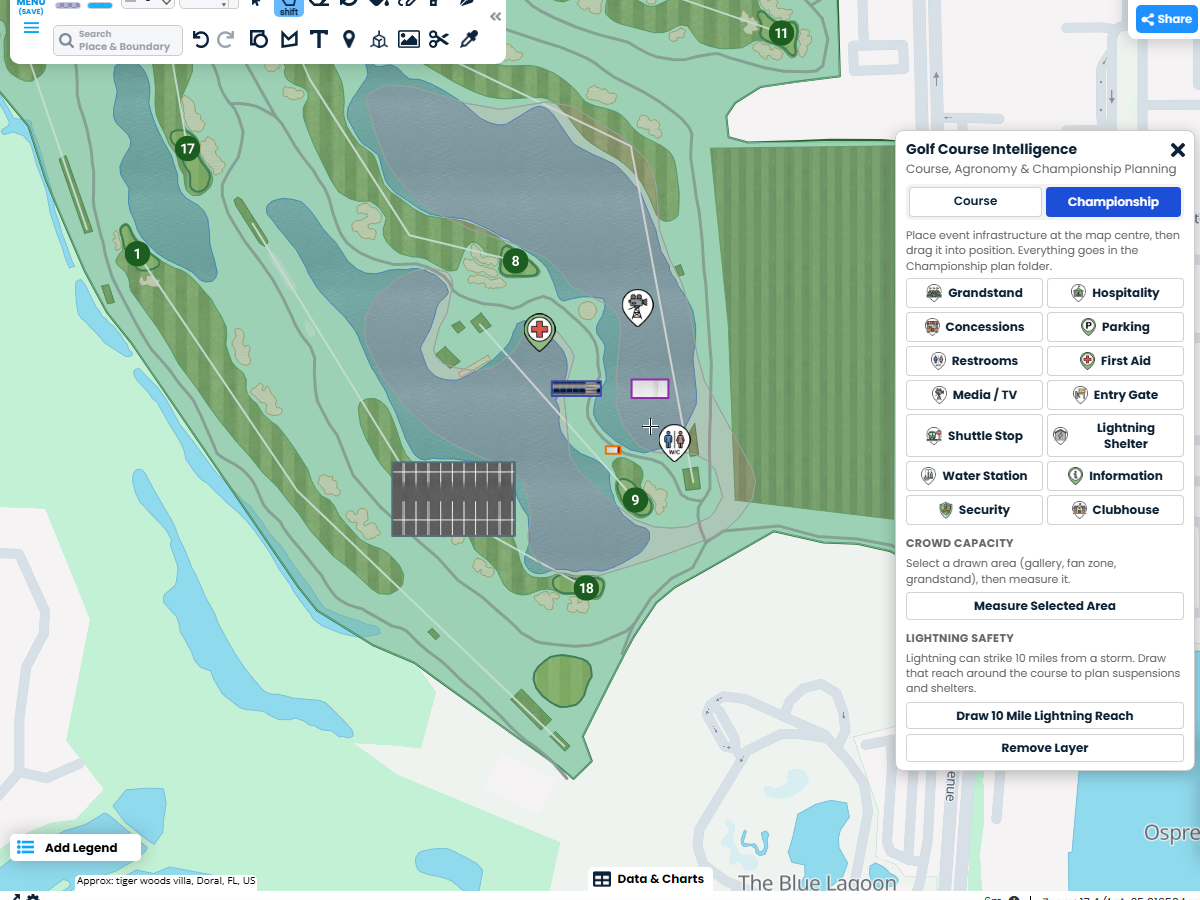
Place grandstands, hospitality tents, concessions and parking at real size, plus restrooms, first aid, gates and shuttle stops. Each kind goes in its own folder. Measure crowd capacity and draw the 10 mile lightning reach around the course.
Scribble AI
告訴Scribble AI您需要什麼。試試「在每個地點周圍繪製500m緩衝區」、「匯入此CSV並依狀態著色」或「測量從倉庫到每個停靠點的路線」。幾秒鐘就能完成。無需GIS訓練,您的團隊也能取得同一張可直接分享的地圖。
試用Scribble AI →★ ★ ★ ★ ★“Scribble Maps replaced the need for static screenshots and messy hand drawn maps. It helped with planning events, managing routes, and keeping everyone on the same page visually.”
★ ★ ★ ★ ★“I can highlight areas, buildings, etc and measure for jobs that may be out of town, or even out of state.”
Any course mapped in OpenStreetMap. Most well-known courses are mapped in detail. Some only have an outline, and the panel tells you what is missing so you can draw it yourself.
Yes. Open Maps & Data, go to Kits and click Example on Golf Course Intelligence. The example opens over Trump National Doral in Miami, and every tool works there. You need a free account to sign in.
Golf Course Intelligence is part of Pro Business. It works on every golf course mapped in OpenStreetMap.
From our own elevation data, which uses 1 meter USGS 3DEP data across most of the United States and lower resolution data elsewhere.
No. The thunderstorm risk comes from the weather forecast, and the National Weather Service alerts are official warnings. Use the 10 mile lightning reach ring to plan when to stop play.
Yes. Everything is a normal shape in your map. Move, reshape, restyle or delete anything, add your own notes, and it all saves with your map.