

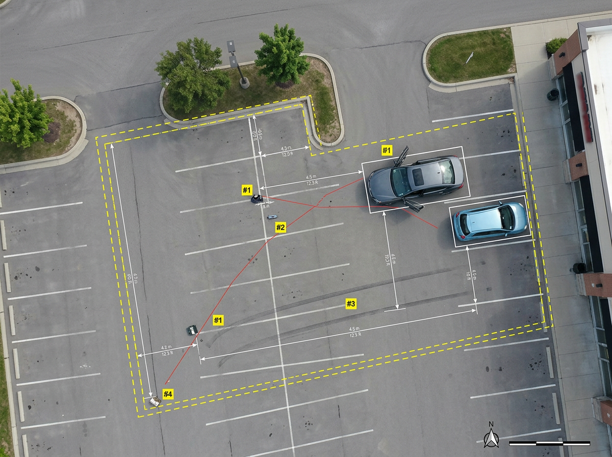
Scene diagrams and evidence
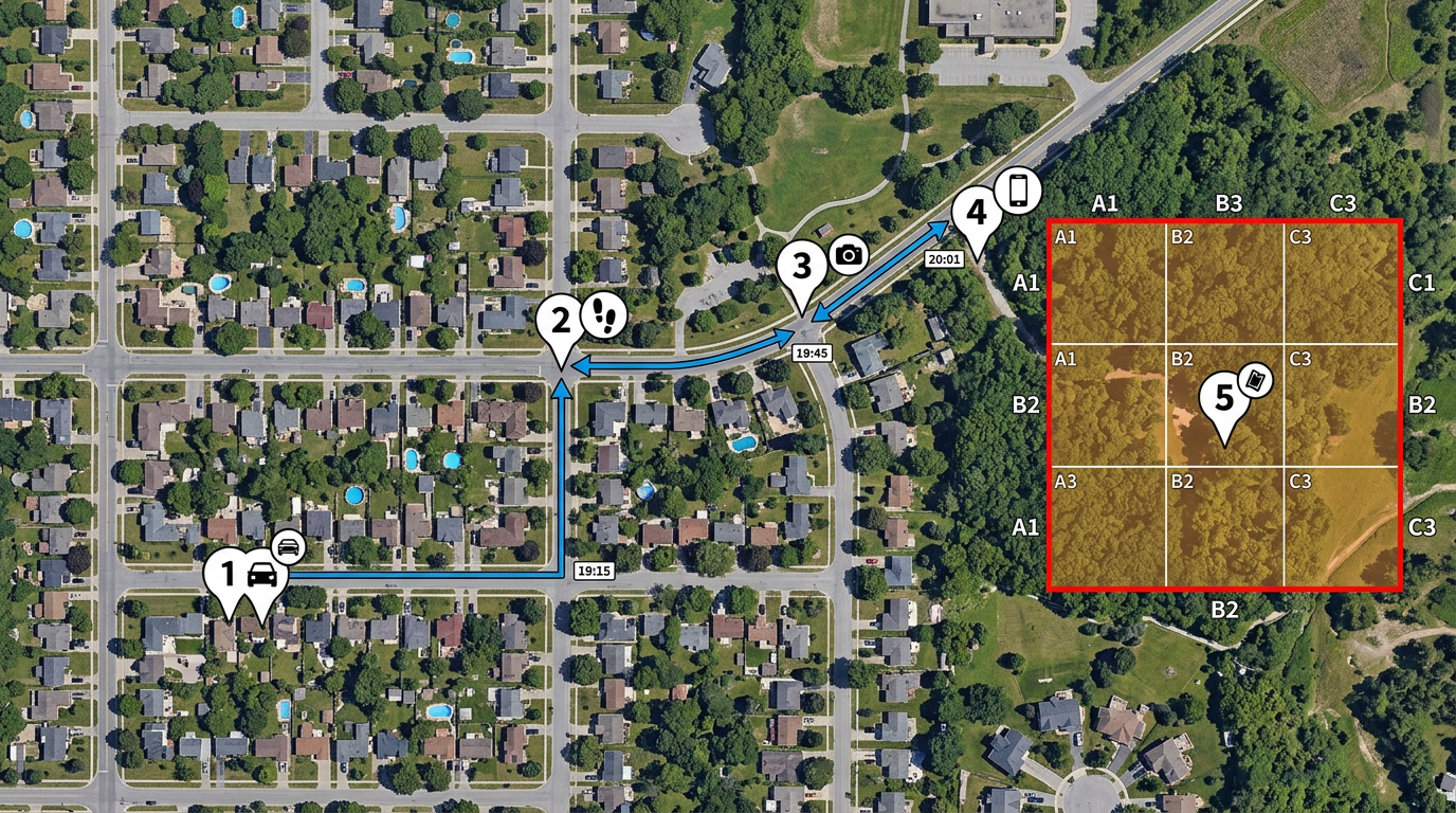
Place numbered evidence markers, vehicles and points of impact on a satellite view. Measure distances for the case file and the courtroom.

 English
 Español
 Français
 Deutsch
 Português
 日本語
 中文
 العربية
 한국어
 Italiano
 Русский
 Türkçe
 Nederlands
 Polski
 हिन्दी
 Dansk
 Čeština
 Română
 Ελληνικά
 Tiếng Việt
 Suomi
 Українська
 Indonesia
 Svenska
 Norsk bokmål
 Hrvatski
 Magyar
 Български
 中文(繁體)
 Slovenčina
 Srpski
 ไทย
 Eesti
 Català
 Lietuvių
 עברית
 Slovenščina
 فارسی
 Latviešu
 Azərbaycan
 Беларуская
 Melayu
 Bosanski
 ქართული
 Shqip
 Gaeilge
 Монгол
 ဗမာ
 O‘zbek
 اُردو
 Македонски
 ខ្មែរ
 Nynorsk
 বাংলা
 Galego
 Euskara
 Íslenska
 தமிழ்
 ລາວ
 ગુજરાતી
 Latina
 मराठी
 Қазақ тілі
 ਪੰਜਾਬੀ
 Afrikaans
 नेपाली
 አማርኛ
 తెలుగు
 ChiShona
 Cymraeg
 Føroyskt
 অসমীয়া
 Brezhoneg
 Esperanto
 Basa Jawa
 کٲشُر
 Ирон
 Sardu
Draw scene diagrams, plan search grids, trace timelines and build court exhibits in minutes. Share one link with your team, prosecutors and partner agencies.
 4.7 / 5 · G2上有 200 則評論
★ ★ ★ ★ ★“As a trial lawyer, I often need to show the jury a map of the scene or a route. Scribble Maps is far superior to other tools, like Google Maps, for making maps for presentations.”
Place evidence, vehicles and entry points on a satellite view. Measure distances and angles without a CAD license or a GIS expert.
Share the case map with partners, prosecutors or outside counsel. They open it in any browser. No install and no account. Turn off the link any time.
Import KML, Shapefile, GeoJSON or CSV. Add call records, ALPR hits, canvass data or old aerial photos on the case map.
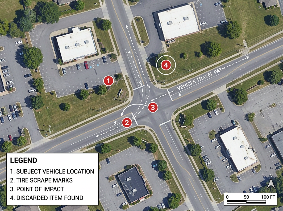
Place numbered evidence markers, vehicles and points of impact on a satellite view. Measure distances for the case file and the courtroom.
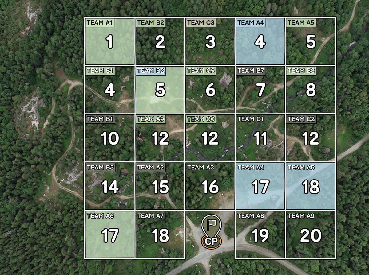
Draw grid sectors for a wooded or city search. Give each team a zone. Share a view-only map so every searcher knows the boundary.
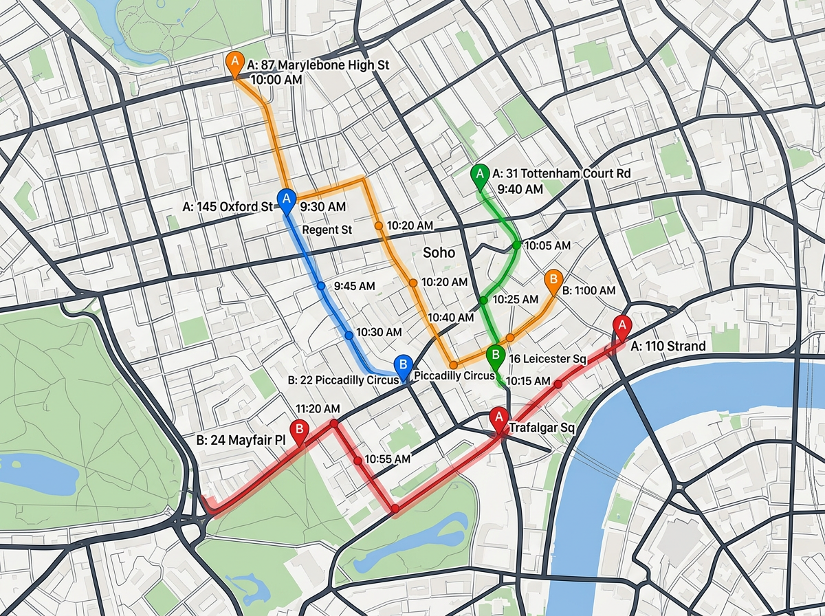
Trace suspect, victim and witness movements with time-stamped markers across several locations. Add call records or ALPR hits to tell the story on one map.
Export a clean labeled map as PDF or PNG for trial, grand jury or a case briefing. Show the scene, the route or the search area with measurements the jury can trust.
Scribble AI
告訴Scribble AI您需要什麼。試試「在每個地點周圍繪製500m緩衝區」、「匯入此CSV並依狀態著色」或「測量從倉庫到每個停靠點的路線」。幾秒鐘就能完成。無需GIS訓練,您的團隊也能取得同一張可直接分享的地圖。
試用Scribble AI →★ ★ ★ ★ ★“As a trial lawyer, I often need to show the jury a map of the scene or a route. Scribble Maps is far superior to other tools, like Google Maps, for making maps for presentations.”
★ ★ ★ ★ ★“The support we've received from Scribble Maps has been amazing.”
Yes. Scribble Maps supports private maps, password protection and AES-256 encryption. You can turn off a share link any time.
Yes. You can measure distance, area and angles right on the satellite view. Export a labeled map for the case file or the courtroom.
No. Anyone with the share link can open the map in a browser. No install and no account needed.
Yes. Import KML, Shapefile, GeoJSON, GPX or CSV. Add the data on any base map and share again.
Yes. Scribble Maps supports SAML, OIDC and SCIM, plus activity and audit logs and user management.