

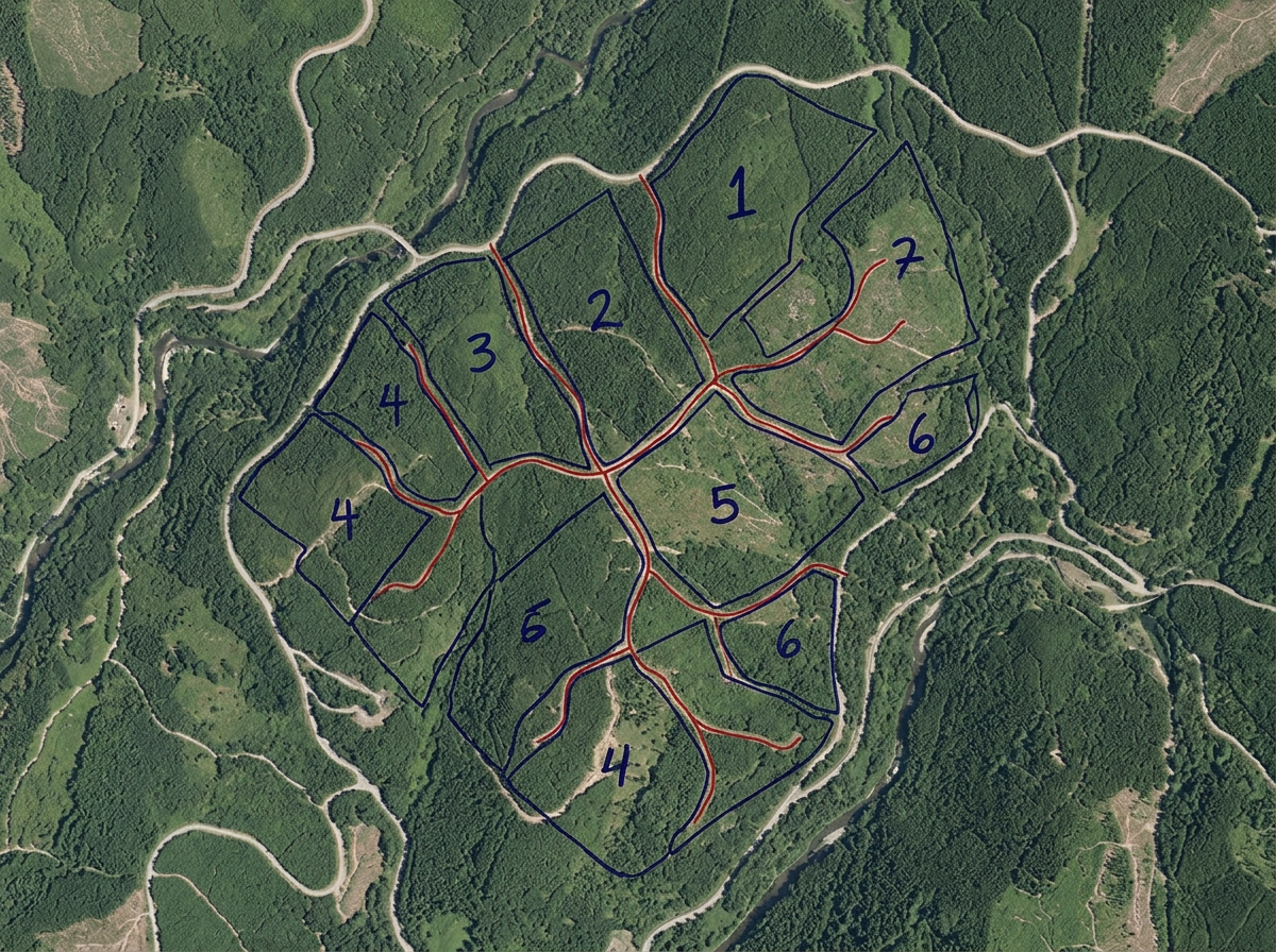
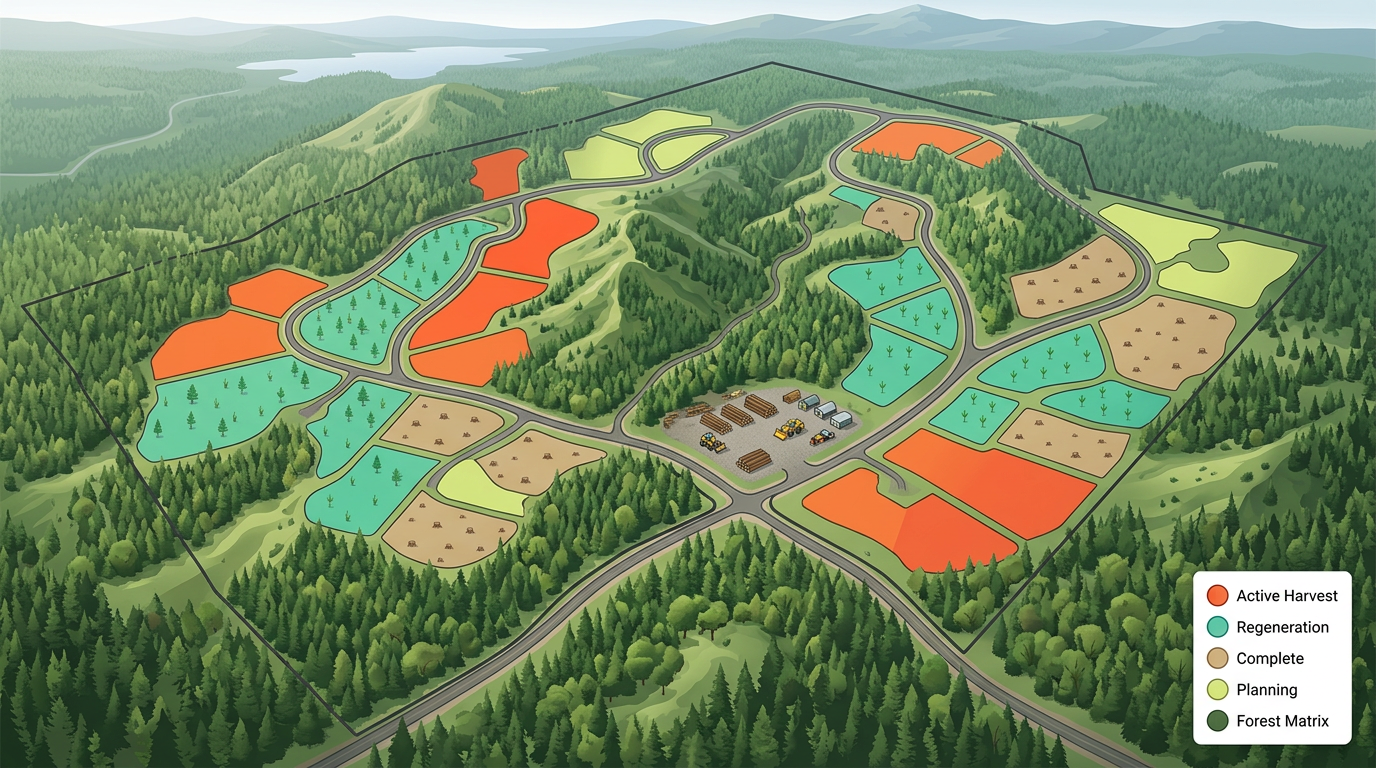
Cut block and harvest plans
Draw cut block boundaries, mark phase order and brief loggers and haulers with a clickable map.

 English
 Español
 Français
 Deutsch
 Português
 日本語
 中文
 العربية
 한국어
 Italiano
 Русский
 Türkçe
 Nederlands
 Polski
 हिन्दी
 Dansk
 Čeština
 Română
 Ελληνικά
 Tiếng Việt
 Suomi
 Українська
 Indonesia
 Svenska
 Norsk bokmål
 Hrvatski
 Magyar
 Български
 中文(繁體)
 Slovenčina
 Srpski
 ไทย
 Eesti
 Català
 Lietuvių
 עברית
 Slovenščina
 فارسی
 Latviešu
 Azərbaycan
 Беларуская
 Melayu
 Bosanski
 ქართული
 Shqip
 Gaeilge
 Монгол
 ဗမာ
 O‘zbek
 اُردو
 Македонски
 ខ្មែរ
 Nynorsk
 বাংলা
 Galego
 Euskara
 Íslenska
 தமிழ்
 ລາວ
 ગુજરાતી
 Latina
 मराठी
 Қазақ тілі
 ਪੰਜਾਬੀ
 Afrikaans
 नेपाली
 አማርኛ
 తెలుగు
 ChiShona
 Cymraeg
 Føroyskt
 অসমীয়া
 Brezhoneg
 Esperanto
 Basa Jawa
 کٲشُر
 Ирон
 Sardu
Sketch cut blocks, mark stand boundaries, plan haul roads and brief contractors, built for foresters, woodlot owners, log haulers and consulting foresters.
 4.7 / 5 · G2上有 200 則評論
★ ★ ★ ★ ★“The thing I like most about Scribble is how easy it is to use. I also love how I can create any maps from scratch. A lot of the maps that I have created are not geo referenced. This has been very helpful to me when I have been creating these farm maps.”
Sketch cut blocks, stand boundaries, riparian buffers and access roads on satellite imagery. No GIS training required.
Send the cut block map and haul plan to the logger or hauler. They open it on a phone. No app, no install.
Import KML, Shapefile, GeoJSON or GPX of stands, roads and inventory data. Layer it all on one shared map.
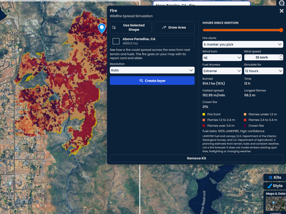
Fire kit
Draw a block or a whole forest and the Fire kit shows how a wildfire could spread through it, from the fuels on the ground and in the canopy. Compare a dry day with an extreme one to see where crown fire would take over.
Pro Business. 3 free fire runs on any account.
Draw cut block boundaries, mark phase order and brief loggers and haulers with a clickable map.
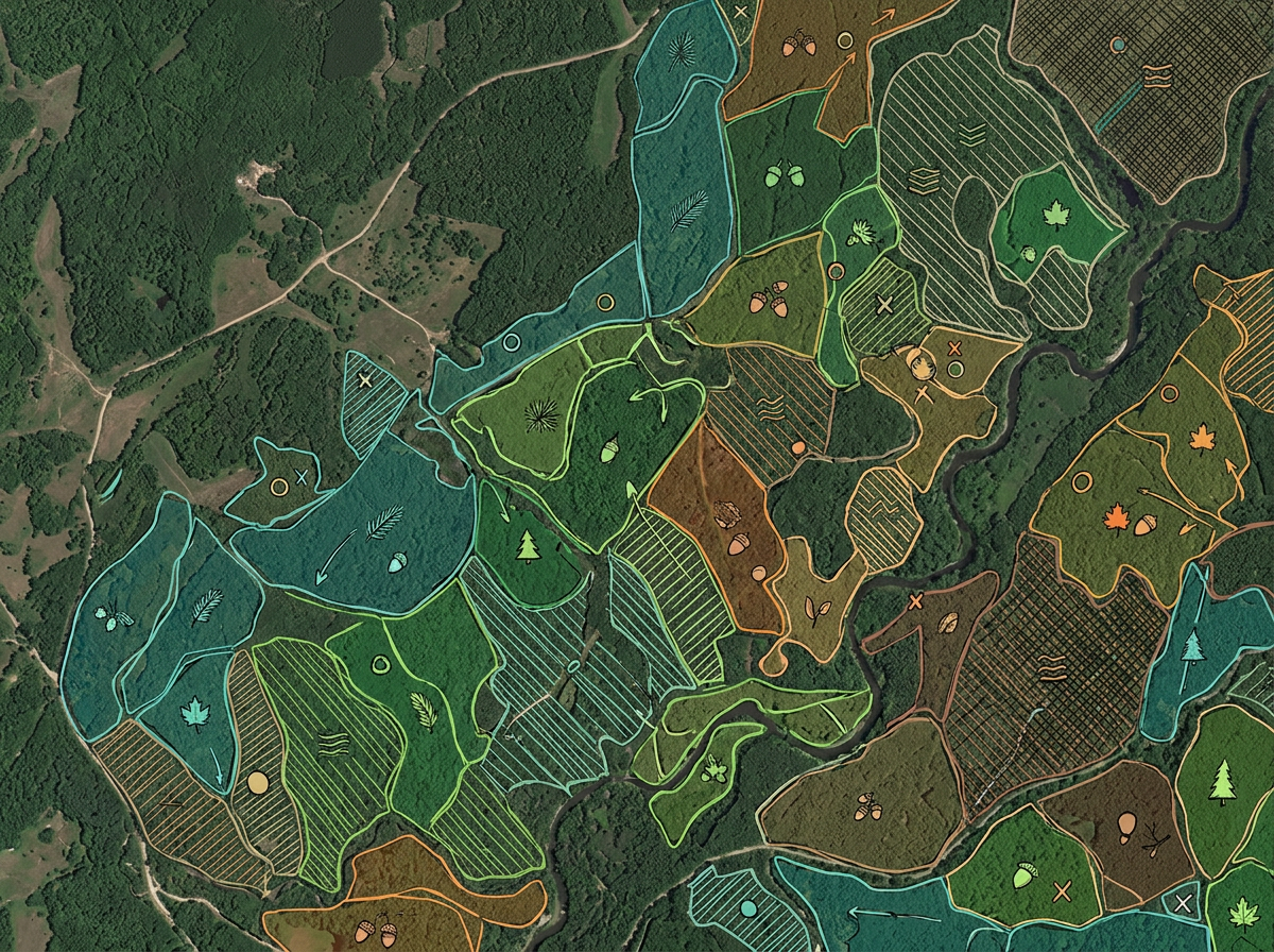
Sketch stands by species, age class and treatment for the management plan and contractor briefings.
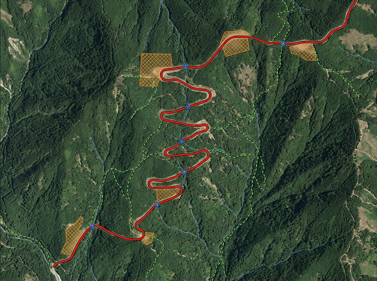
Plan haul roads, landings, switchbacks and water crossings on terrain or satellite for engineering and permit reviews.
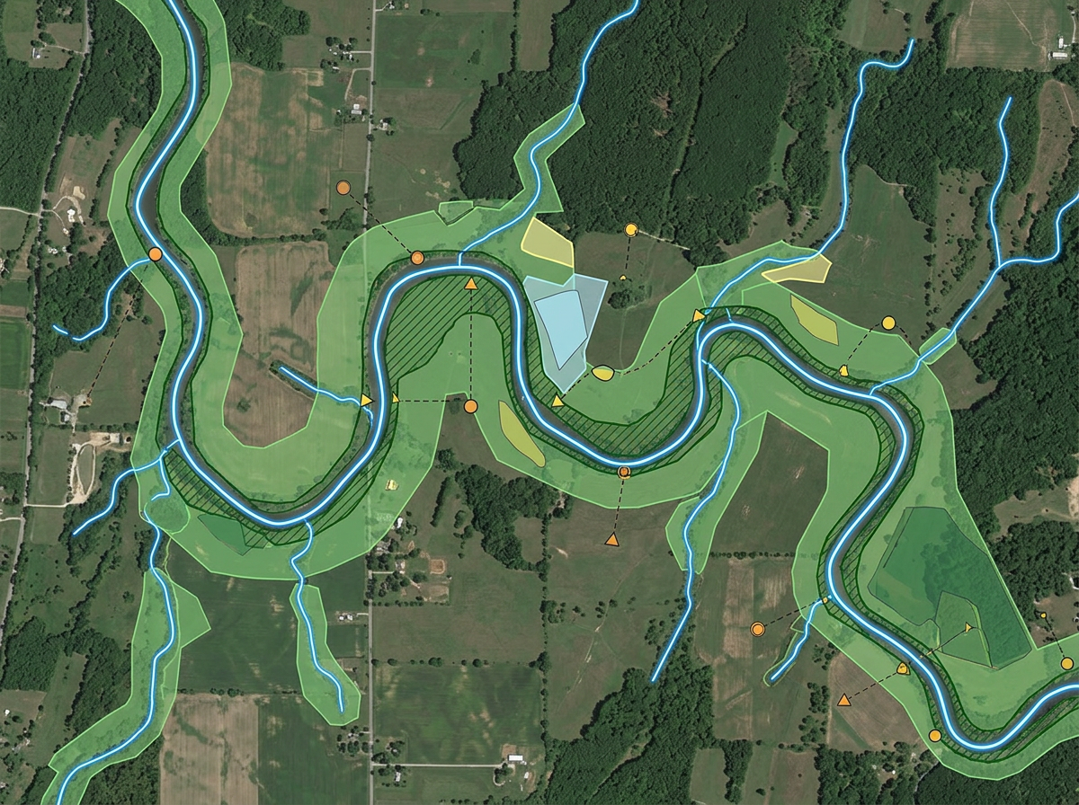
Draw riparian buffers, leave strips and wildlife corridors for permit packets and stakeholder meetings.
Scribble AI
告訴Scribble AI您需要什麼。試試「在每個地點周圍繪製500m緩衝區」、「匯入此CSV並依狀態著色」或「測量從倉庫到每個停靠點的路線」。幾秒鐘就能完成。無需GIS訓練,您的團隊也能取得同一張可直接分享的地圖。
試用Scribble AI →★ ★ ★ ★“The thing I like most about Scribble is how easy it is to use. I also love how I can create any maps from scratch.”
★ ★ ★ ★ ★“I can highlight areas, buildings, etc and measure for jobs that may be out of town, or even out of state.”
Yes. Import KML, Shapefile, GeoJSON or GPX. Existing stands and inventory data drop directly onto the map.
Yes. Click Share, copy the link and text it to the contractor. They open it on a phone. No app, no install.
Yes. Sketch the stream line, set a buffer distance and the buffer polygon is drawn for you.
Yes. Export any map to PDF, PNG, KML or GeoJSON for inclusion in permit and management packets.
Yes. Enter a U.S. Public Land Survey System (PLSS) legal description in search to preview and add the matching BLM reference boundary. This is available with Pro Business and is for mapping reference only, not a legal survey.