

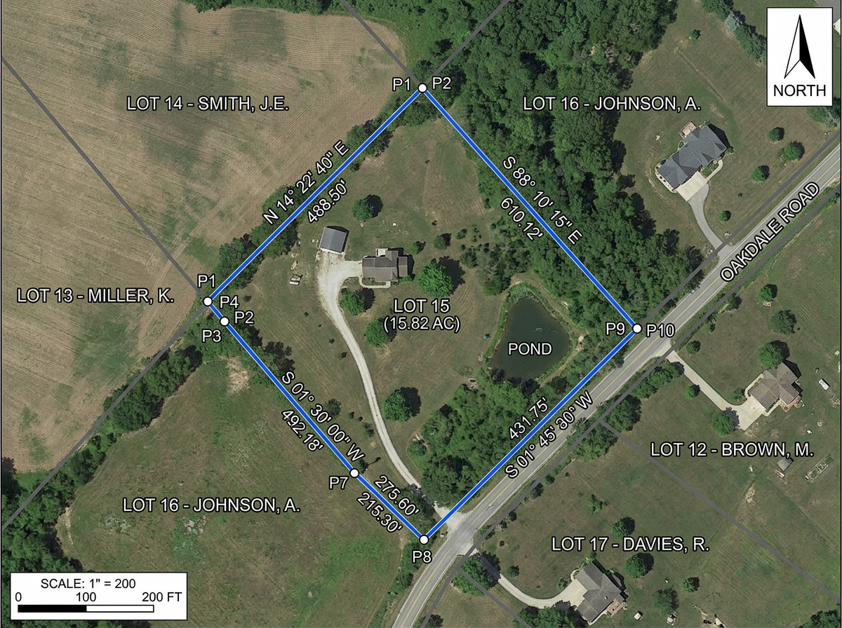
Plat sketches and exhibits
Build plat sketches, property exhibits and boundary diagrams for proposals, client meetings and council packets.

 English
 Español
 Français
 Deutsch
 Português
 日本語
 中文
 العربية
 한국어
 Italiano
 Русский
 Türkçe
 Nederlands
 Polski
 हिन्दी
 Dansk
 Čeština
 Română
 Ελληνικά
 Tiếng Việt
 Suomi
 Українська
 Indonesia
 Svenska
 Norsk bokmål
 Hrvatski
 Magyar
 Български
 中文(繁體)
 Slovenčina
 Srpski
 ไทย
 Eesti
 Català
 Lietuvių
 עברית
 Slovenščina
 فارسی
 Latviešu
 Azərbaycan
 Беларуская
 Melayu
 Bosanski
 ქართული
 Shqip
 Gaeilge
 Монгол
 ဗမာ
 O‘zbek
 اُردو
 Македонски
 ខ្មែរ
 Nynorsk
 বাংলা
 Galego
 Euskara
 Íslenska
 தமிழ்
 ລາວ
 ગુજરાતી
 Latina
 मराठी
 Қазақ тілі
 ਪੰਜਾਬੀ
 Afrikaans
 नेपाली
 አማርኛ
 తెలుగు
 ChiShona
 Cymraeg
 Føroyskt
 অসমীয়া
 Brezhoneg
 Esperanto
 Basa Jawa
 کٲشُر
 Ирон
 Sardu
Build plat sketches, pre-survey recon maps, utility red-lines and client exhibits in any browser. Import KML and Shapefiles, export DXF, and share by link with anyone.
 4.7 / 5 · G2上有 200 則評論
★ ★ ★ ★ ★“Scribble is the most intuitive mapping software I've found.”
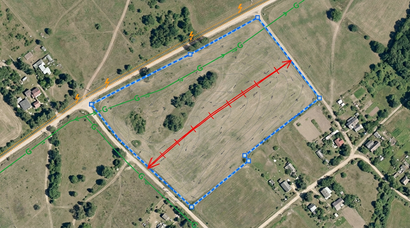
Draw parcel boundaries, easements, setbacks and utility lines over satellite imagery. No CAD license, no drafting program.
Click Share and text the link to the crew. They open the recon map on a phone or tablet. No app, no install.
Import KML, Shapefile, GeoJSON, DXF and CSV. Export to DXF, KML or PDF for the CAD station or the client packet.
Build plat sketches, property exhibits and boundary diagrams for proposals, client meetings and council packets.
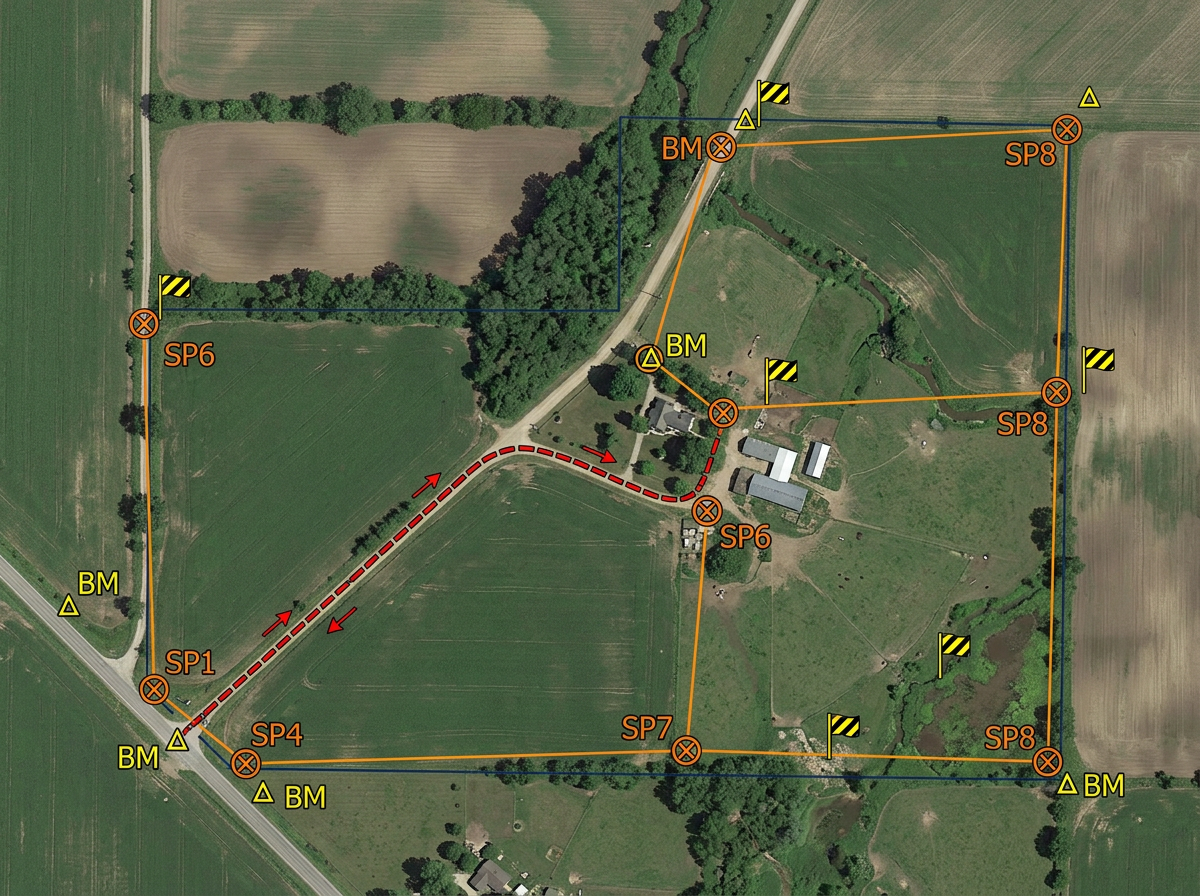
Plan the survey before the crew rolls: mark access routes, setup points, hazards and known benchmarks on a shared map.
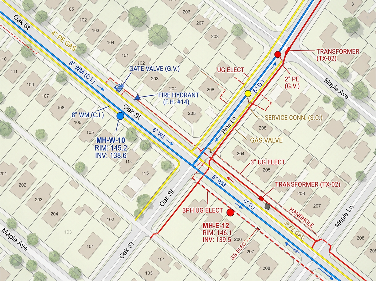
Sketch known or suspected utility lines, manholes and hydrants on a red-line exhibit for design and safety briefings.
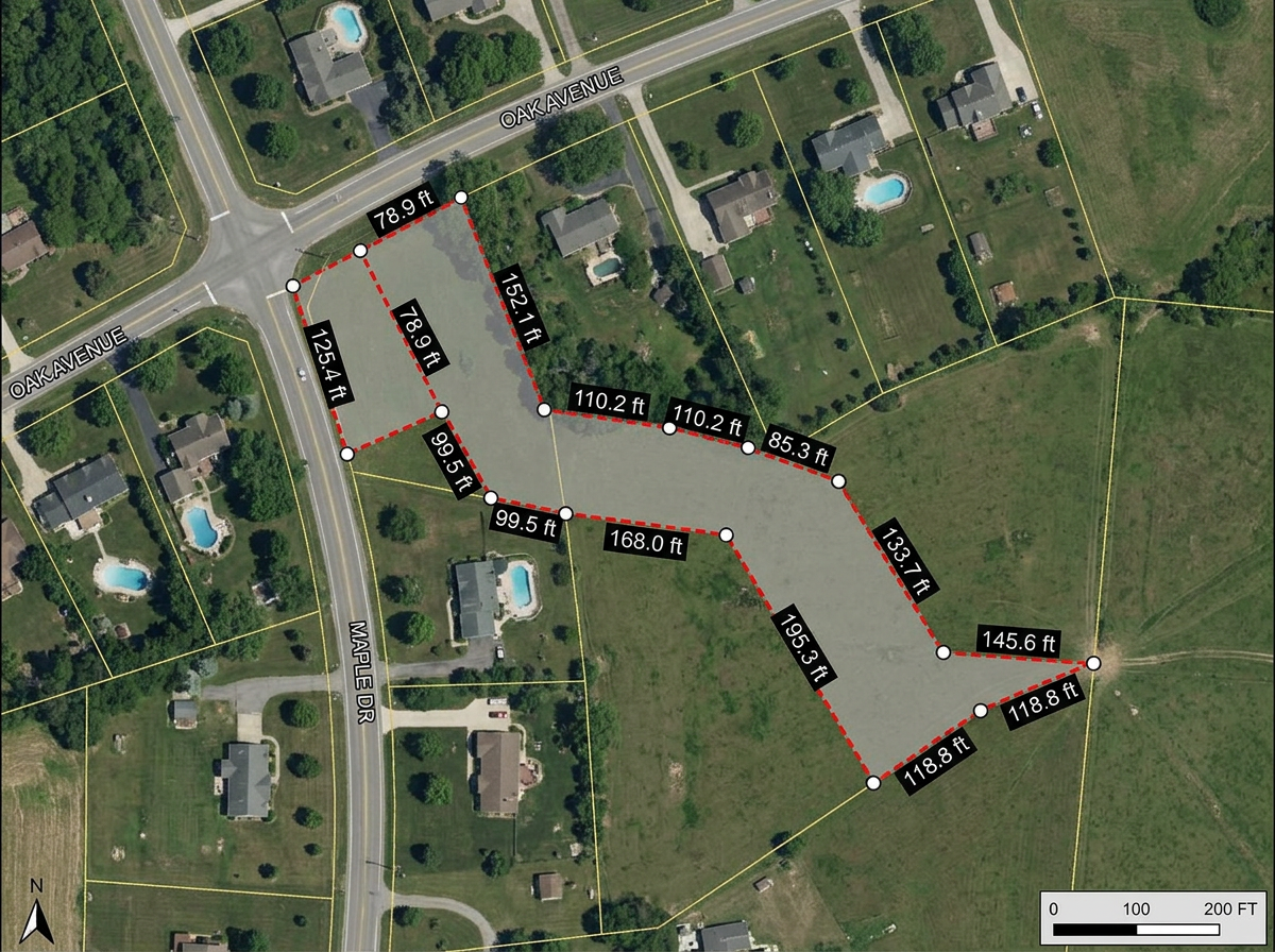
Build easement and right-of-way exhibits for attorneys, title work and landowner meetings.
Scribble AI
告訴Scribble AI您需要什麼。試試「在每個地點周圍繪製500m緩衝區」、「匯入此CSV並依狀態著色」或「測量從倉庫到每個停靠點的路線」。幾秒鐘就能完成。無需GIS訓練,您的團隊也能取得同一張可直接分享的地圖。
試用Scribble AI →★ ★ ★ ★ ★“Scribble is the most intuitive mapping software I've found.”
★ ★ ★ ★“Exceptional mapping tool for land surveying. The interface is clean and the layers and tools make even complex survey workflows manageable.”
Yes. Export any map to DXF, KML or GeoJSON for use in AutoCAD, Civil 3D or any CAD package that accepts these formats.
Yes. Import KML, Shapefile, GeoJSON, DXF or GPX. Layer existing work onto satellite imagery and annotate from there.
No. Scribble Maps is for sketches, exhibits, field reconnaissance and shareable client maps. It works alongside Civil 3D and AutoCAD for the everyday tasks that don't need a full CAD package.
Yes. Click Share and send the link. Clients open it in any browser. No install, no account.
Yes. Enter a U.S. Public Land Survey System (PLSS) legal description in search to preview and add the matching BLM reference boundary. This is available with Pro Business and is for mapping reference only, not a legal survey.
Yes. Turn on Traffic Intelligence and click any US road to see its AADT, weekday traffic, peak hour volume, and reliability grade. Measured roads show the year of the DOT count. Available on Pro Business.