

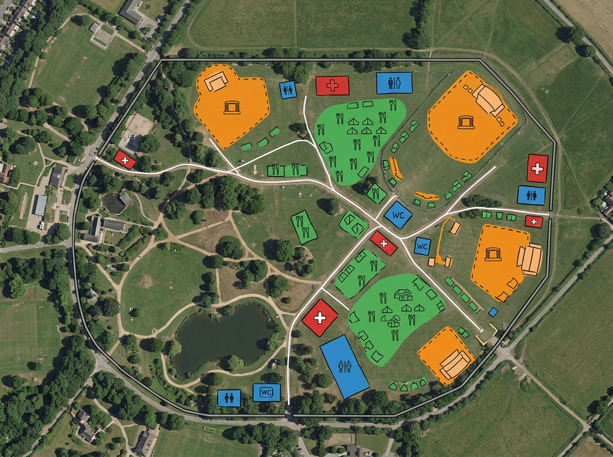
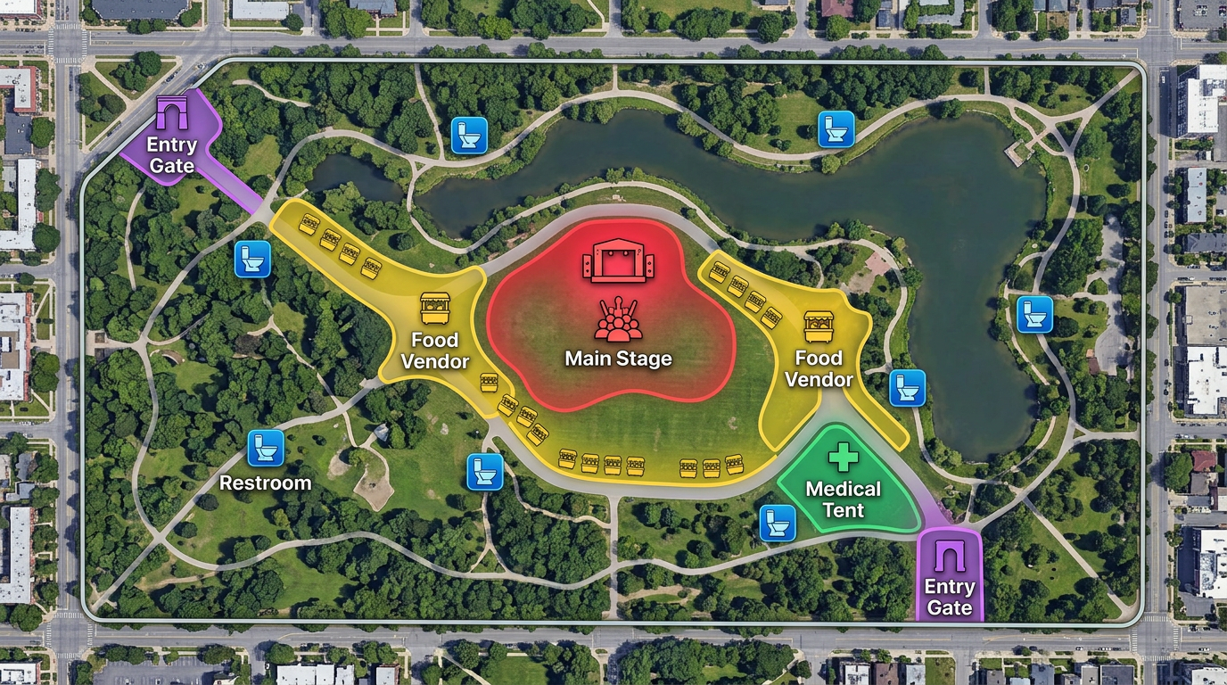
Festival and venue plans
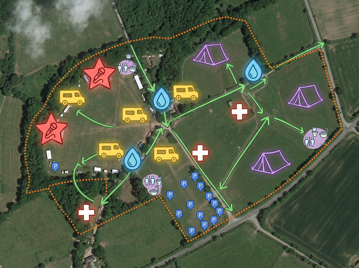
Lay out stages, food vendors, restrooms, first-aid stations, info booths and entry gates on a shared site map.
Festival footprints, marathon courses, parade routes and venue plans. Layer it all and share with vendors, security, medical and the public.
 4.7 / 5 · 200 reviews on G2
★ ★ ★ ★ ★“Scribble Maps replaced the need for static screenshots and messy hand drawn maps. It helped with planning events, managing routes, and keeping everyone on the same page visually.”
Drop stages, vendors, restrooms, medical tents and gates directly on satellite imagery. No design tool required.
Share a public-facing version with attendees and a private version with security, vendors and medical. Both are one click away.
Import vendor lists, course GPX files or city permits. Toggle layers to brief any stakeholder on what they need.
Lay out stages, food vendors, restrooms, first-aid stations, info booths and entry gates on a shared site map.
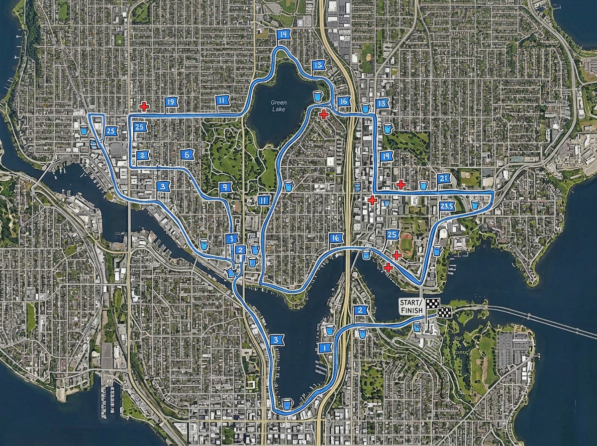
Draw a marathon, fun-run or cycling course with mile markers, water stations and medical tents. Then publish for runners.
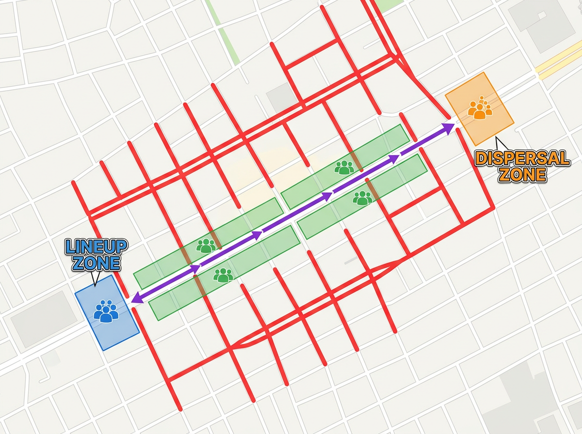
Map a parade route with road closures, viewing areas, lineup zones and dispersal points for the city permit packet.
Publish a public-facing wayfinding map attendees can open on their phone. No app, no install.
Scribble AI
Tell Scribble AI what you need. Try “draw a 500m buffer around every site,” “import this CSV and color by status,” or “measure the route from the depot to each stop.” It does it in seconds. No GIS training needed, and your team gets the same map, ready to share.
Try Scribble AI →★ ★ ★ ★ ★“Scribble Maps replaced the need for static screenshots and messy hand drawn maps. It helped with planning events, managing routes, and keeping everyone on the same page visually.”
★ ★ ★ ★“Workflows are smoother, especially for fieldwork, event planning, and team coordination.”
Yes. Build one master map with multiple layers. Share read-only links that toggle the layers you want each audience to see, or duplicate the map for fully separate versions.
Yes. Anyone with the link can open a map in their mobile browser. No app, no account, no friction.
Yes. Import GPX, KML, Shapefile or GeoJSON. The course drops directly onto the map and you can layer mile markers and water stations on top.
Yes. Generate an embed code and paste it into your event site. Updates appear automatically.