


Property listings
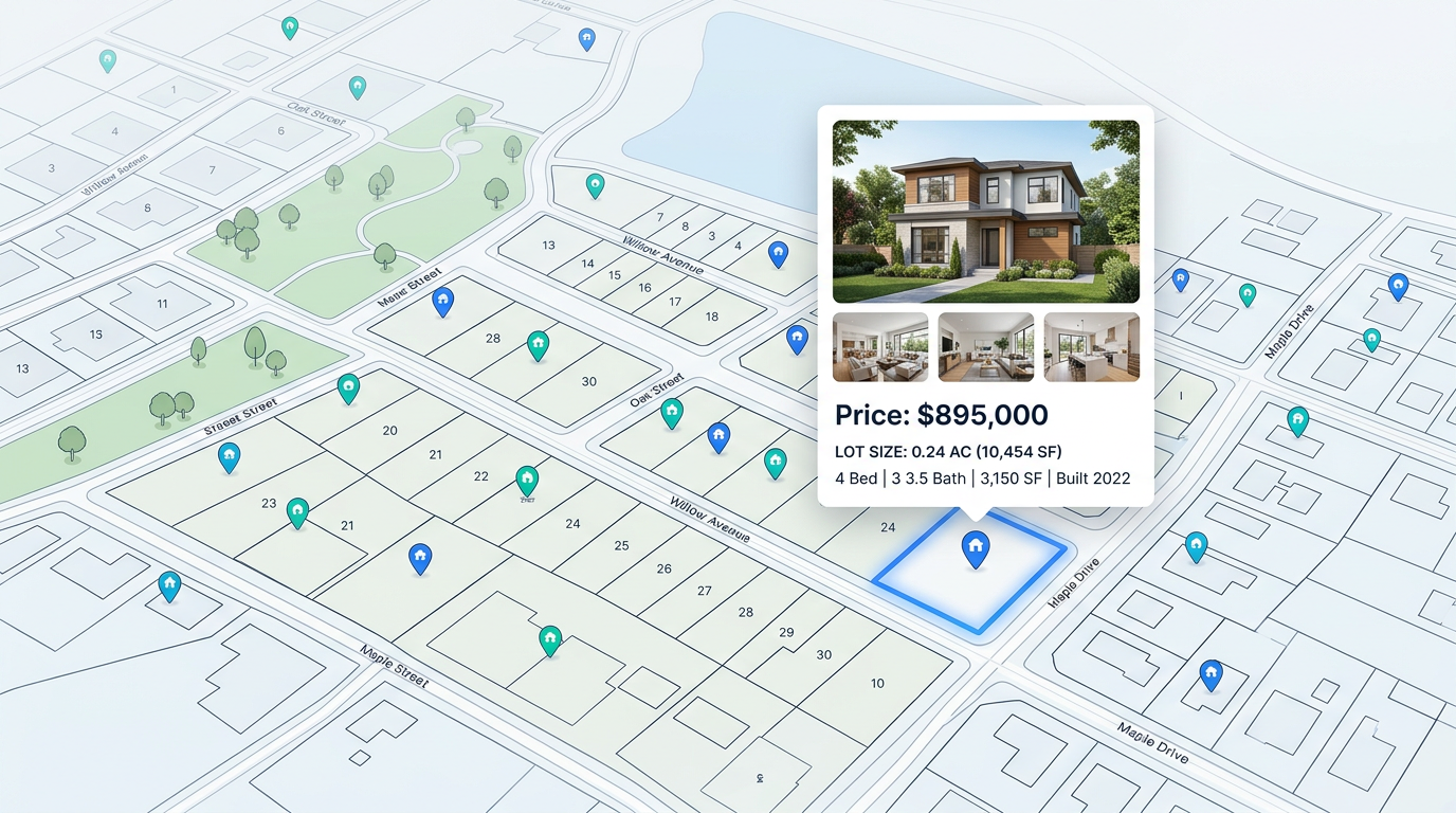
Pin every listing on one map. Color by status, price band, or agent. Send the map to a buyer and they tour the inventory at their own pace.

 English
 Español
 Français
 Deutsch
 Português
 日本語
 中文
 العربية
 한국어
 Italiano
 Русский
 Türkçe
 Nederlands
 Polski
 हिन्दी
 Dansk
 Čeština
 Română
 Ελληνικά
 Tiếng Việt
 Suomi
 Українська
 Indonesia
 Svenska
 Norsk bokmål
 Hrvatski
 Magyar
 Български
 中文(繁體)
 Slovenčina
 Srpski
 ไทย
 Eesti
 Català
 Lietuvių
 עברית
 Slovenščina
 فارسی
 Latviešu
 Azərbaycan
 Беларуская
 Melayu
 Bosanski
 ქართული
 Shqip
 Gaeilge
 Монгол
 ဗမာ
 O‘zbek
 اُردو
 Македонски
 ខ្មែរ
 Nynorsk
 বাংলা
 Galego
 Euskara
 Íslenska
 தமிழ்
 ລາວ
 ગુજરાતી
 Latina
 मराठी
 Қазақ тілі
 ਪੰਜਾਬੀ
 Afrikaans
 नेपाली
 አማርኛ
 తెలుగు
 ChiShona
 Cymraeg
 Føroyskt
 অসমীয়া
 Brezhoneg
 Esperanto
 Basa Jawa
 کٲشُر
 Ирон
 Sardu
Pin every listing, draw lot lines, and stack ownership, zoning, or HOA layers. Share an interactive map clients can pan, zoom, and click on any phone.
★ ★ ★ ★ ★“This software has made it super easy to create a customizable map to share with our clients to map out our next territories.”
Trace parcels, draw lot lines, and mark boundary corners. Use satellite, street, or terrain base maps and switch any time without losing your work.
Import a listing list and every row becomes a pin with photos, price, and details. Color by status so active, pending, and sold stand out at a glance.
Send a single link. Clients pan, zoom, and tap any property to see photos, price, and notes. No app to install and no sign up needed.
Pin every listing on one map. Color by status, price band, or agent. Send the map to a buyer and they tour the inventory at their own pace.

Trace parcels, mark corners, and draw lot lines. Layer in zoning or wetlands. Share a clean map with the buyer, the city, or the surveyor.
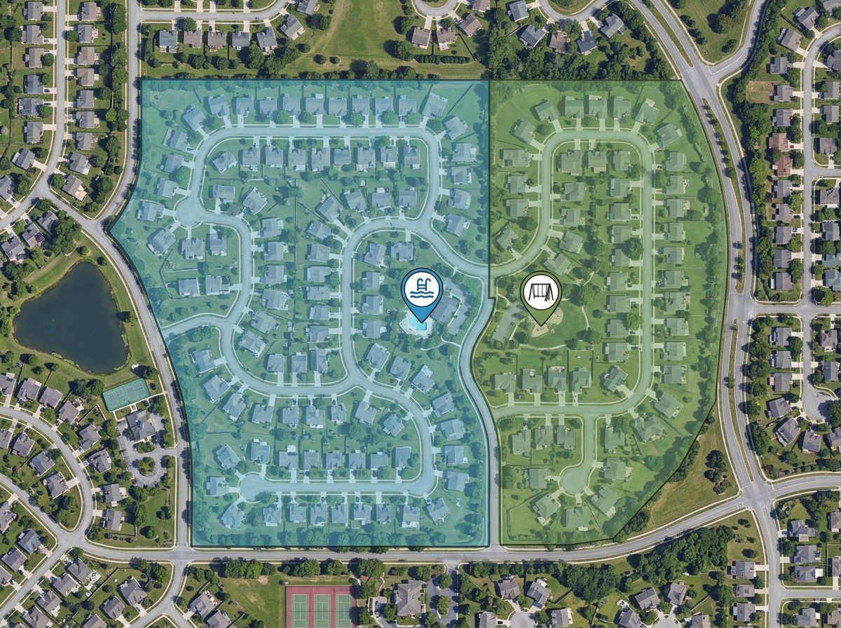
Map every HOA, neighborhood, or service area. Layer in amenities, dues zones, or board contacts. Share with members or new owners.
Scribble AI
告訴Scribble AI您需要什麼。試試「在每個地點周圍繪製500m緩衝區」、「匯入此CSV並依狀態著色」或「測量從倉庫到每個停靠點的路線」。幾秒鐘就能完成。無需GIS訓練,您的團隊也能取得同一張可直接分享的地圖。
試用Scribble AI →Property mapping means pinning properties and drawing parcels, lot lines, or boundaries on a map. You can share the map with clients, owners, or your team in a single link.
Yes. Trace parcels by hand on top of satellite or street base maps. Mark corners and label parcels with any details you need.
Yes. Bring in a CSV or Excel file from your listing system. Every row turns into a pin with the address, photos, and any details from the file.
Yes. Send a link and clients open it in any phone or laptop browser. They can pan, zoom, and tap any pin without signing up.
Yes. Enter a U.S. Public Land Survey System (PLSS) legal description in search to preview and add the matching BLM reference boundary. This is available with Pro Business and is for mapping reference only, not a legal survey.
Yes. With Traffic Intelligence on, click the road next to any US property to see its AADT, peak hour, and hourly traffic. Measured roads show the year of the DOT count. Available on Pro Business.