

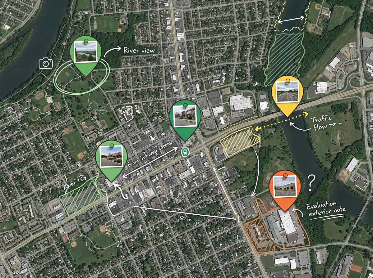
Location scouting
Plot every candidate spot a scout finds, attach photos and notes, score by sun direction, access and noise, then walk producers through the top three on one shareable map.

 English
 Español
 Français
 Deutsch
 Português
 日本語
 中文
 العربية
 한국어
 Italiano
 Русский
 Türkçe
 Nederlands
 Polski
 हिन्दी
 Dansk
 Čeština
 Română
 Ελληνικά
 Tiếng Việt
 Suomi
 Українська
 Indonesia
 Svenska
 Norsk bokmål
 Hrvatski
 Magyar
 Български
 中文(繁體)
 Slovenčina
 Srpski
 ไทย
 Eesti
 Català
 Lietuvių
 עברית
 Slovenščina
 فارسی
 Latviešu
 Azərbaycan
 Беларуская
 Melayu
 Bosanski
 ქართული
 Shqip
 Gaeilge
 Монгол
 ဗမာ
 O‘zbek
 اُردو
 Македонски
 ខ្មែរ
 Nynorsk
 বাংলা
 Galego
 Euskara
 Íslenska
 தமிழ்
 ລາວ
 ગુજરાતી
 Latina
 मराठी
 Қазақ тілі
 ਪੰਜਾਬੀ
 Afrikaans
 नेपाली
 አማርኛ
 తెలుగు
 ChiShona
 Cymraeg
 Føroyskt
 অসমীয়া
 Brezhoneg
 Esperanto
 Basa Jawa
 کٲشُر
 Ирон
 Sardu
Drop pins on candidate locations, draw the unit move, mark base camp, parking and the closure perimeter, then share a link the whole crew can open.
 4.7 / 5 · G2上有 200 則評論
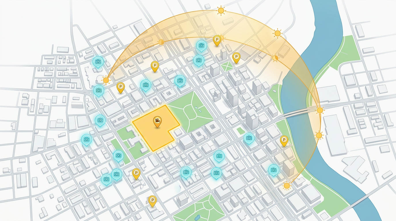
Drop pins on every candidate location, attach reference photos and shot notes, and mark the angles you want, all without opening a GIS tool.
Share a private link with the producer, AD, locations and the rest of the crew. They open it on a phone in any browser. No app, no account.
Import a CSV of candidate locations, KML from a scouting trip or a GeoJSON of permitted zones. Style every pin by status, day or unit.
Plot every candidate spot a scout finds, attach photos and notes, score by sun direction, access and noise, then walk producers through the top three on one shareable map.
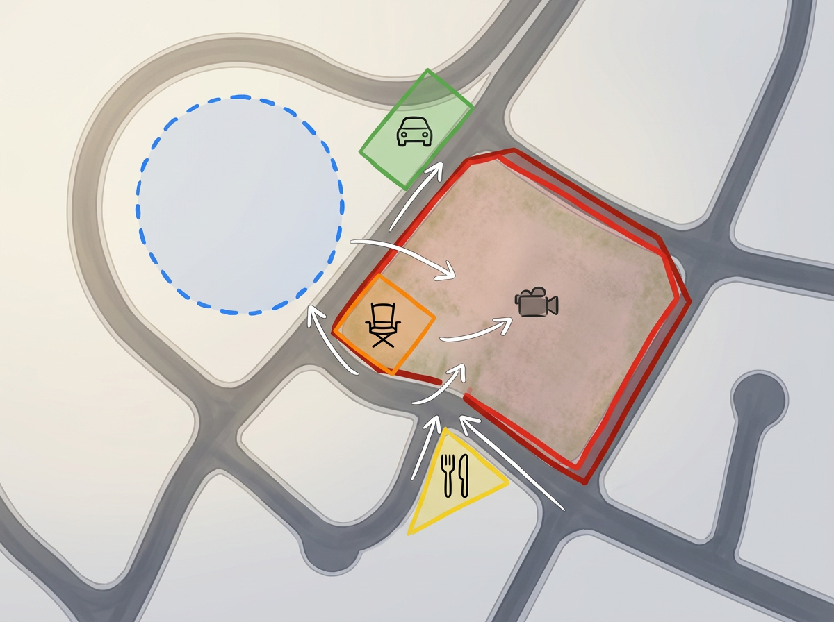
Mark base camp, crew parking, holding, catering, the closure perimeter and camera positions on a single map every department can pull up on set.
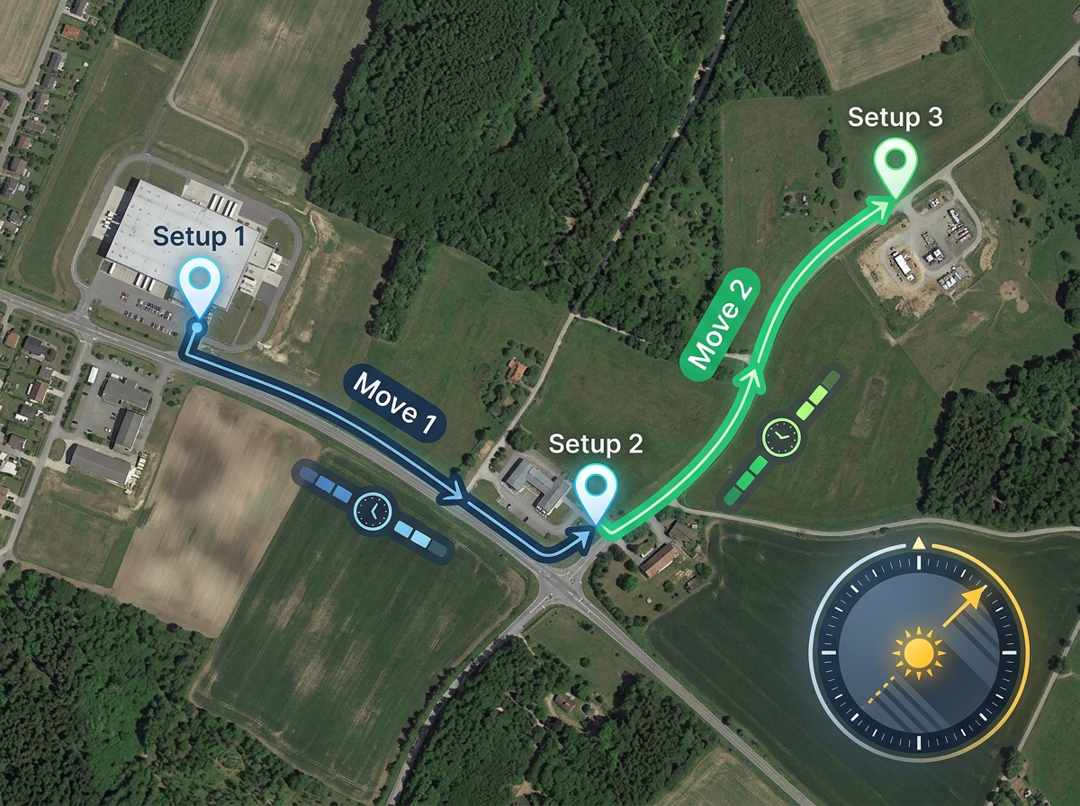
Draw the route from base camp to each setup, measure travel time and walk distance, and plan the day so the gaffer doesn't lose the light.
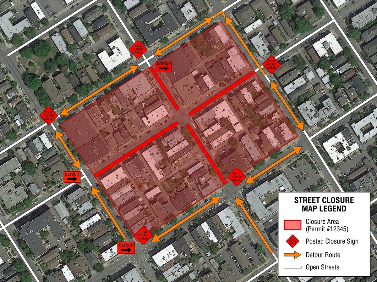
Outline the closure footprint, mark posted signage and detour routes, and hand a clean PDF to the city for the permit application.
Scribble Sight
使用地點、人流量、Walkscore™、人口統計、空氣品質、花粉等資料,為 film production 找出最佳地點。並排比較候選地點,將直覺轉化為有資料佐證的決策。
試用Scribble Sight →Scribble AI
告訴Scribble AI您需要什麼。試試「在每個地點周圍繪製500m緩衝區」、「匯入此CSV並依狀態著色」或「測量從倉庫到每個停靠點的路線」。幾秒鐘就能完成。無需GIS訓練,您的團隊也能取得同一張可直接分享的地圖。
試用Scribble AI →It complements one. Keep your library wherever it lives today and use Scribble Maps to share, plan and brief on the locations you've already shortlisted.
Yes. Share a link, set view-only or edit permissions, and revoke at any time. The recipient opens it in any browser. No install, no signup.
Yes. Import CSV, KML, GeoJSON, GPX or Shapefile, then style markers by any column like status, day, unit or department.
Free to start. Paid options add private maps, larger uploads and admin controls. See the pricing page for details.