

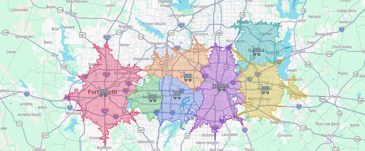
Retail trade areas
See which customers each store reaches first by car, then add demographics to compare the people inside every trade area.

 English
 Español
 Français
 Deutsch
 Português
 日本語
 中文
 العربية
 한국어
 Italiano
 Русский
 Türkçe
 Nederlands
 Polski
 हिन्दी
 Dansk
 Čeština
 Română
 Ελληνικά
 Tiếng Việt
 Suomi
 Українська
 Indonesia
 Svenska
 Norsk bokmål
 Hrvatski
 Magyar
 Български
 中文(繁體)
 Slovenčina
 Srpski
 ไทย
 Eesti
 Català
 Lietuvių
 עברית
 Slovenščina
 فارسی
 Latviešu
 Azərbaycan
 Беларуская
 Melayu
 Bosanski
 ქართული
 Shqip
 Gaeilge
 Монгол
 ဗမာ
 O‘zbek
 اُردو
 Македонски
 ខ្មែរ
 Nynorsk
 বাংলা
 Galego
 Euskara
 Íslenska
 தமிழ்
 ລາວ
 ગુજરાતી
 Latina
 मराठी
 Қазақ тілі
 ਪੰਜਾਬੀ
 Afrikaans
 नेपाली
 አማርኛ
 తెలుగు
 ChiShona
 Cymraeg
 Føroyskt
 অসমীয়া
 Brezhoneg
 Esperanto
 Basa Jawa
 کٲشُر
 Ирон
 Sardu
 සිංහල
 Татар
 ትግርኛ
 Türkmen dili
 Malti
 ಕನ್ನಡ
 Lëtzebuergesch
 Te reo Māori
 Davvisámegiella
 ꆈꌠꁱꂷ
Split the map between your stores, schools, depots or clinics by how fast each one reaches every street, by car, bike or on foot. No overlapping circles and no straight-line guesses.
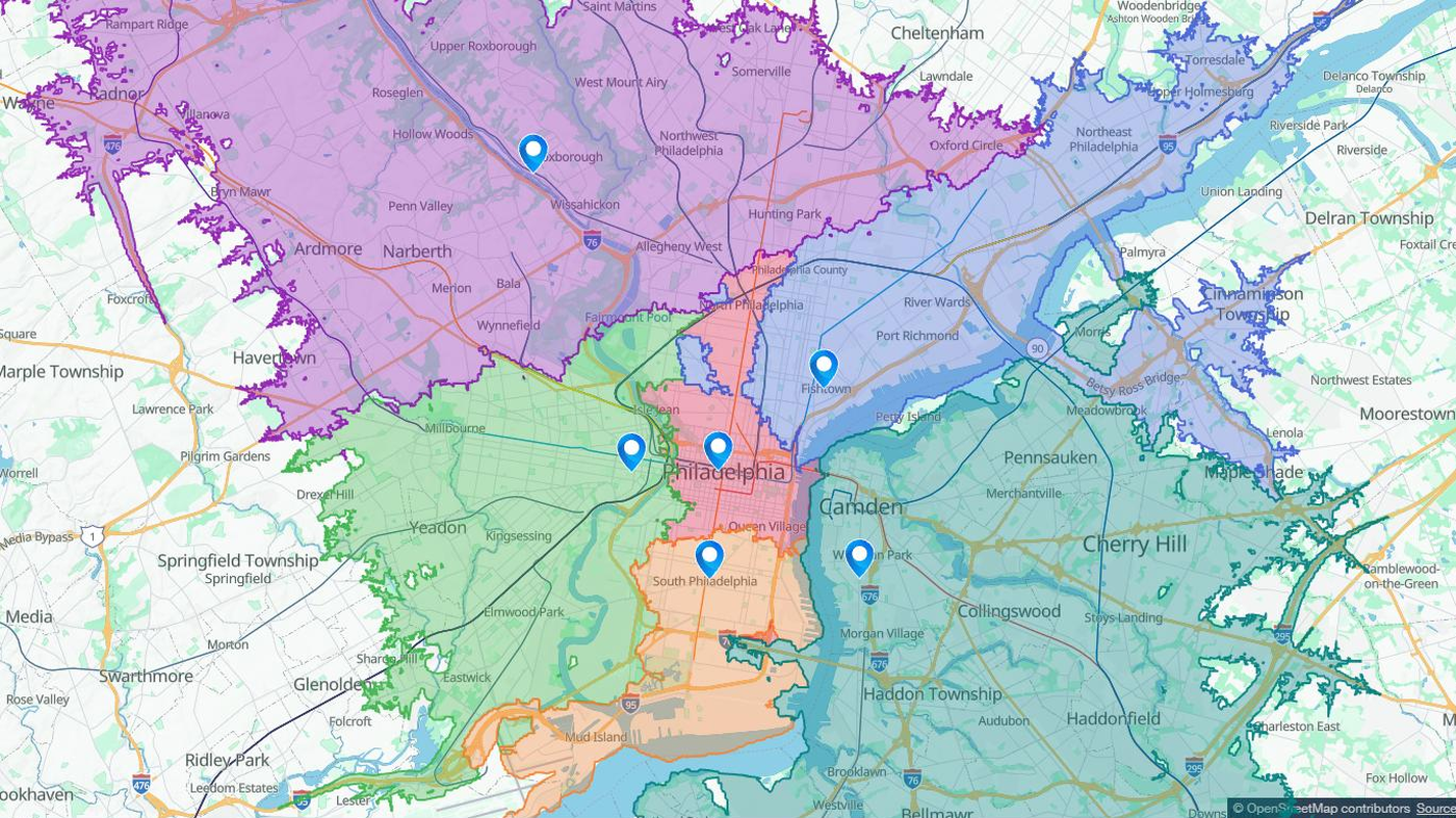
Each place goes to the site that can reach it first on the road network. Rivers, highways and one-way streets are taken into account, so a store across the river no longer claims your block.
Areas never overlap and neighbours share one exact border. A road both sites reach at the same moment is split where they meet.
Every area keeps its site name, time limit, size in square kilometres and the kilometres of road it covers. Filter, chart or export them with the rest of your data.
See which customers each store reaches first by car, then add demographics to compare the people inside every trade area.
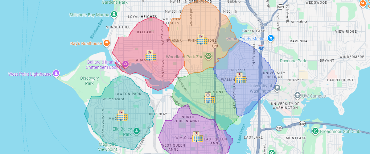
Draw walking or driving catchments for every school from the real street network, then share the map with families.
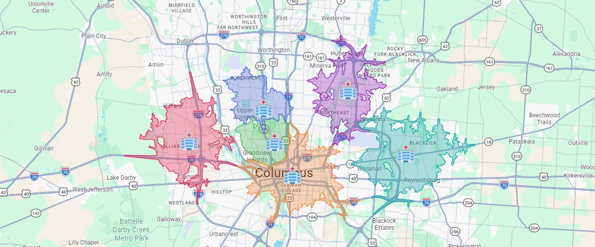
Find which station, clinic or hospital reaches each street first, and spot the places no site reaches within your time limit.
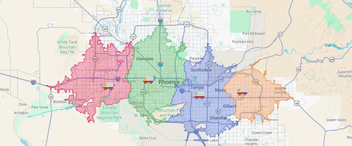
Give each depot the streets it reaches fastest, so drivers do not cross each other's routes.
Scribble AI
Tell Scribble AI what you need. Try “draw a 500m buffer around every site,” “import this CSV and color by status,” or “measure the route from the depot to each stop.” It does it in seconds. No GIS training needed, and your team gets the same map, ready to share.
Try Scribble AI →How the common methods behave when you map which site serves each place.
| Network Voronoi (travel time) | Straight-line Voronoi | Radius circles | Drive-time rings | |
|---|---|---|---|---|
| Follows the road network | Yes | No | No | Yes |
| Each place belongs to exactly one site | Yes | Yes | No Circles overlap | No Rings from nearby sites overlap |
| Neighbouring areas share one border | Yes | Yes | No | No |
| Accounts for rivers, highways and one-way streets | Yes | No | No | Yes |
| Leaves out places no site reaches in time | Yes | No | No | Yes |
In Scribble Maps, network Voronoi works with up to 100 sites and up to 60 minutes of travel, by car, bike or on foot, on Pro Business. Straight-line Voronoi works on every plan.
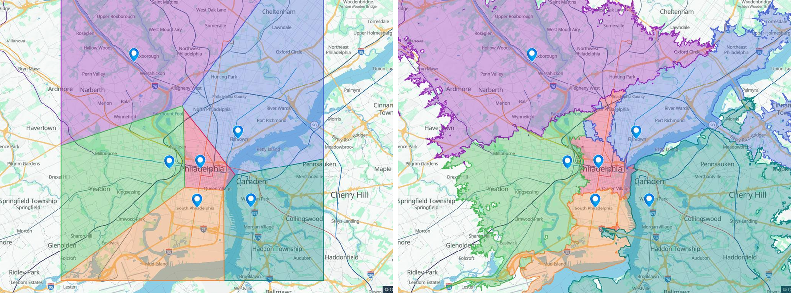
A catchment area is the part of the map a site serves: the customers a store draws from, the homes a school serves or the streets a fire station covers. Each place belongs to the site that is closest to it.
A Voronoi diagram splits a map between sites so every place goes to its closest site. Network Voronoi measures closest by travel time on the real road network instead of a straight line, so the areas follow roads, bridges and one-way streets.
Radius circles and drive-time rings overlap, so a street can belong to several sites at once. Network Voronoi gives every street to exactly one site, the one that reaches it first, and neighbouring areas share one clean border. How to create service areas
Up to 100 sites in one run, with a travel time limit of up to 60 minutes by car, bike or on foot.
Travel time catchment areas need Pro Business. Straight-line Voronoi areas work on every plan.
Yes. Ask something like "split this map into 15 minute drive time areas for my stores" and Scribble AI opens the Service Areas tool and tells you what to pick.