

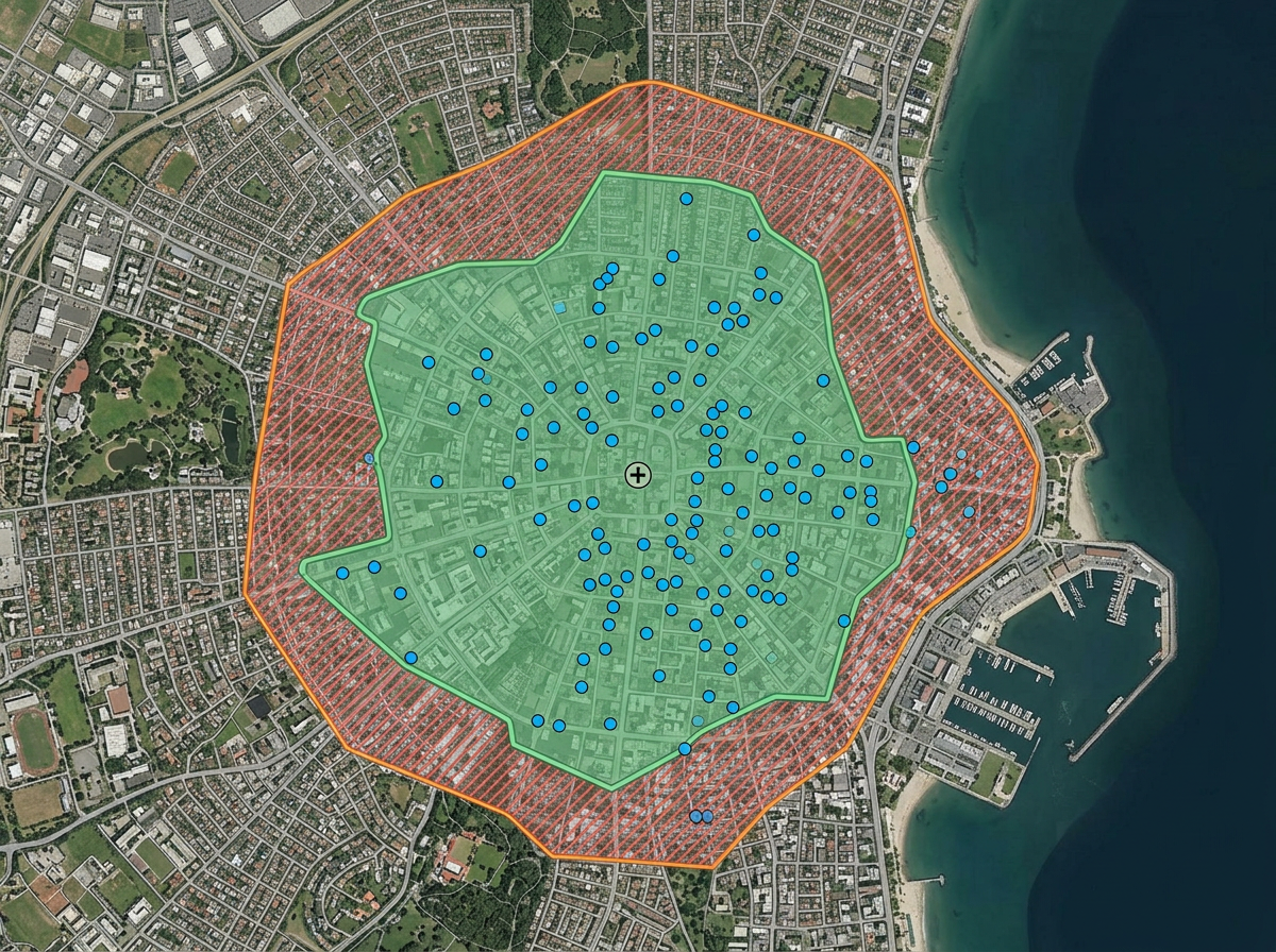
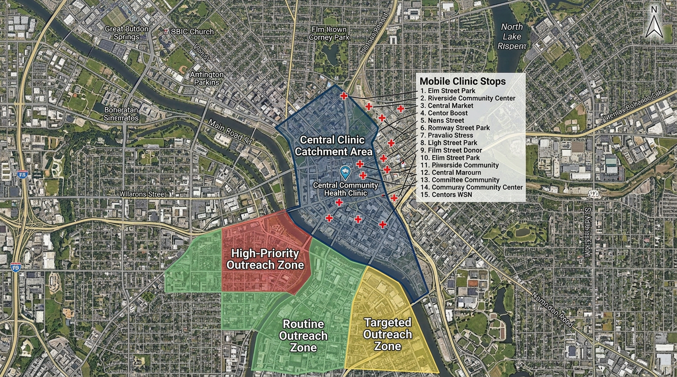
Clinic catchment and access planning
Draw the area your clinic serves, measure travel time and identify gaps in coverage for under-served neighborhoods.
A simple, shareable map for clinic catchment areas, mobile outreach, vaccine clinics and community health surveys. Built for the teams who don't have a spatial epidemiology department.
 4.7 / 5 · 200 reviews on G2
★ ★ ★ ★“We can see how many infirmaries are in an area and what sorts of patients they treat by charting their places on maps. The features of coordinating information and directives using symbols on the maps. I can mark the areas easily and adding the legends to inform what the symbols are for.”
Draw catchment areas, travel-time isochrones and service zones directly on the map. No GIS analyst required.
Send a clickable map to mobile clinicians, outreach workers and community partners. They open it on a phone. No install.
Map a CSV of clinic sites, outreach stops or survey responses. Every row geocodes onto the map automatically.
Draw the area your clinic serves, measure travel time and identify gaps in coverage for under-served neighborhoods.
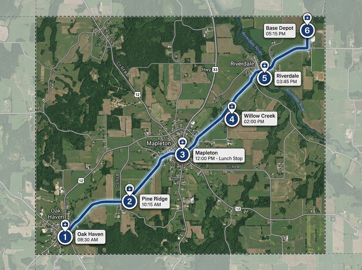
Map every stop on the mobile clinic or vaccine route with times, contacts and setup notes. Share with the crew by link.
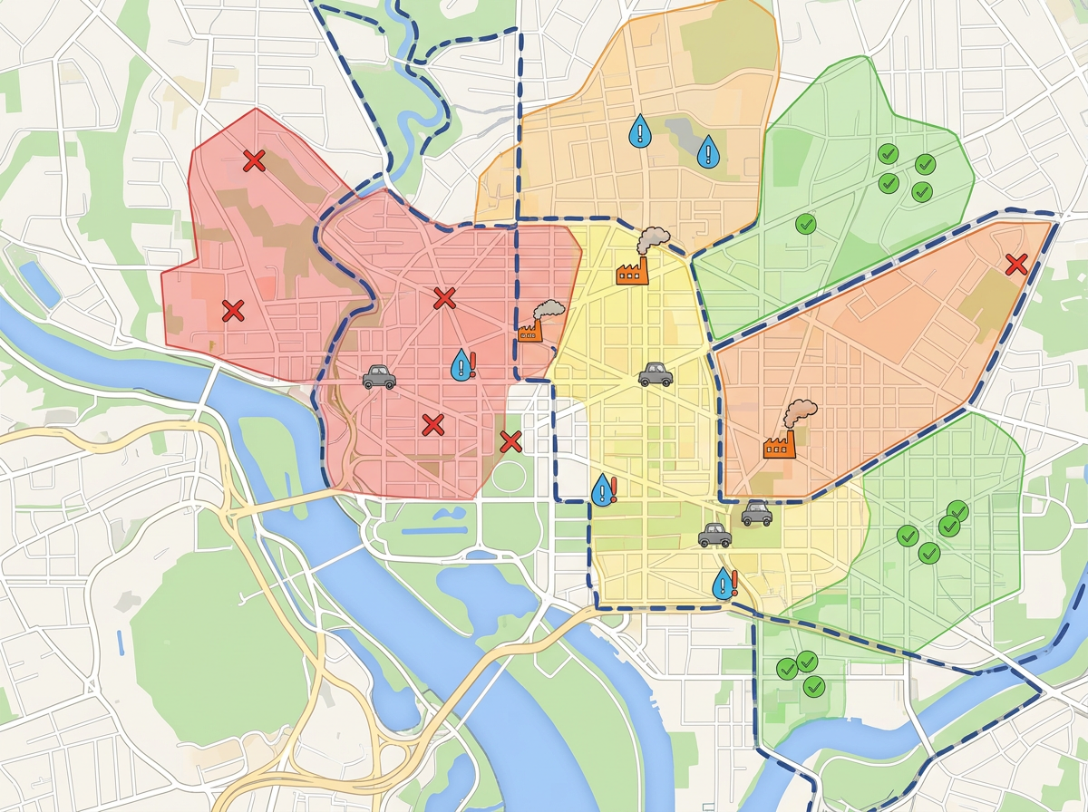
Plot survey responses, environmental hazards or resource locations. Turn field data into a map the team can brief on.
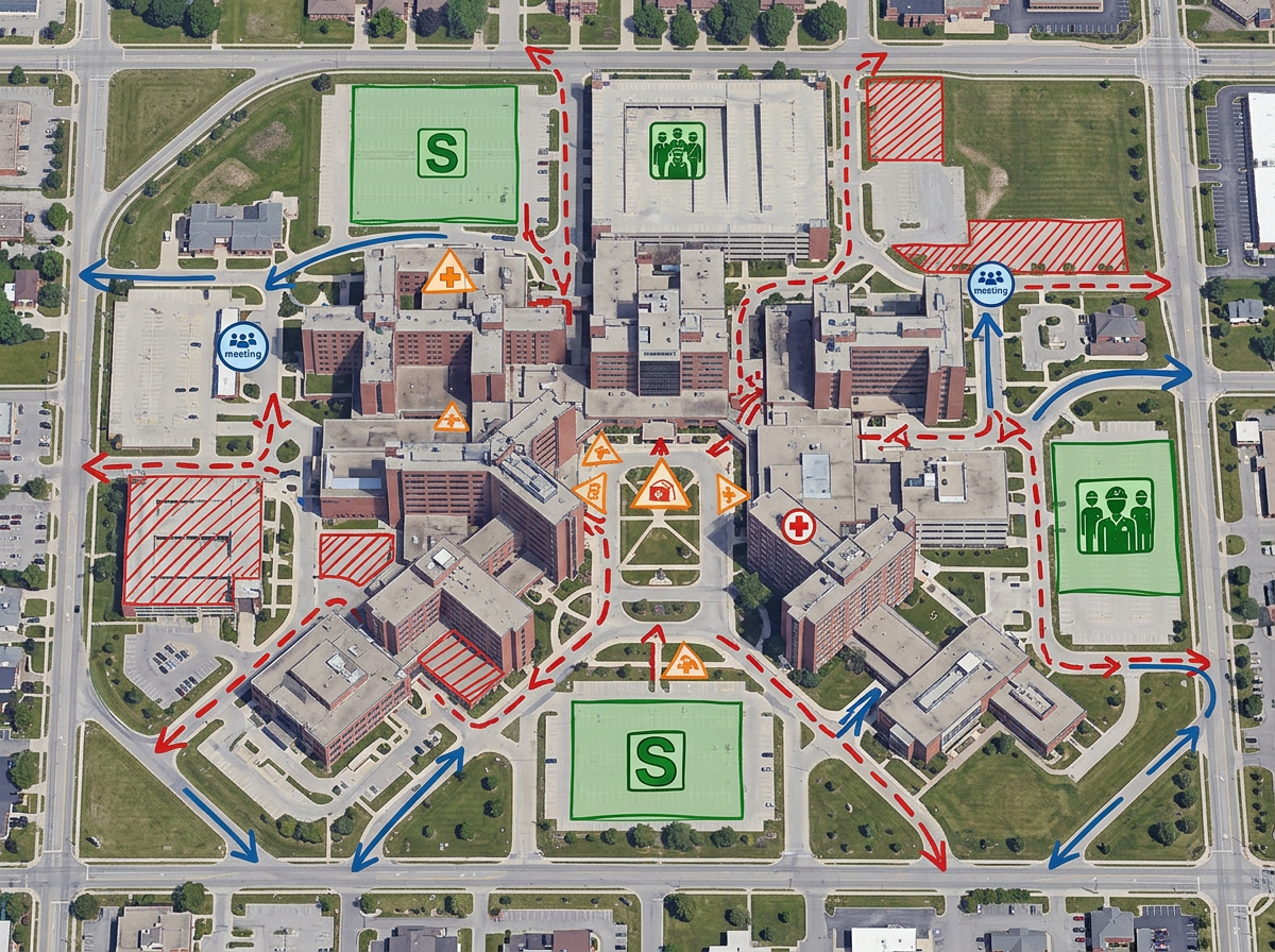
Map staging areas, triage points and evacuation routes for preparedness drills or live responses.
Scribble Sight
Find the best locations for healthcare using Places, foot-traffic, Walkscore™, demographics, air quality, pollen and more. Compare candidates side by side and turn instinct into a data-backed decision.
Try Scribble Sight →Scribble AI
Tell Scribble AI what you need. Try “draw a 500m buffer around every site,” “import this CSV and color by status,” or “measure the route from the depot to each stop.” It does it in seconds. No GIS training needed, and your team gets the same map, ready to share.
Try Scribble AI →★ ★ ★ ★“We can see how many infirmaries are in an area and what sorts of patients they treat by charting their places on maps.”
★ ★ ★ ★“Scribble Maps offers an intuitive and user-friendly interface, making it accessible for users with varying levels of mapping experience.”
Scribble Maps is not a HIPAA-covered platform. Do not store protected health information (PHI) in map labels or files. Use it for catchment planning, outreach logistics, clinic sites and de-identified data.
Yes. Scribble Maps supports travel-time isochrones. Drop a point, pick a travel time and the area is drawn automatically.
Yes. Paste from a spreadsheet or import a CSV. Every address geocodes onto the map in one pass.
Yes. Scribble Maps supports private maps, password protection and AES-256 encryption at rest.