

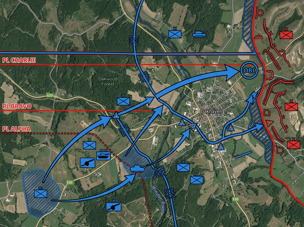
Tactical overlays with standard symbols
Build OPORD graphics with MIL-STD-2525D symbols. Mark friendly and hostile units, draw phase lines and objectives, and share for mission briefs.
Drop standard military symbols on the map, draw control measures, and share by link. Range planning, exercise overlays, and tactical briefs in any browser.
 4.7 / 5 · 200 reviews on G2
★ ★ ★ ★ ★“Scribble Maps is one of the only software available that lets you make a fully customizable map. I was able to create unique markers for different types of sites for guests to easily find what they're looking for.”
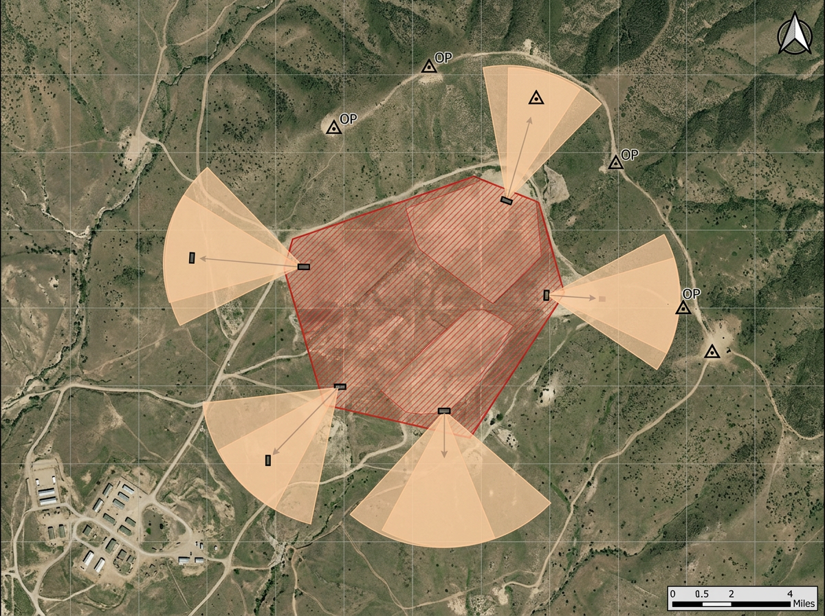
Drop MIL-STD-2525D and NATO APP-6 symbols on the map. Pick unit type, affiliation, and echelon. Draw phase lines, objectives, and control measures.
Share an exercise overlay or range plan with your team by link. They open it in a browser. No install, no account.
Import KML, Shapefile, GeoJSON or GPX. Layer training-area maps, route data and existing overlays without re-keying.
Build OPORD graphics with MIL-STD-2525D symbols. Mark friendly and hostile units, draw phase lines and objectives, and share for mission briefs.
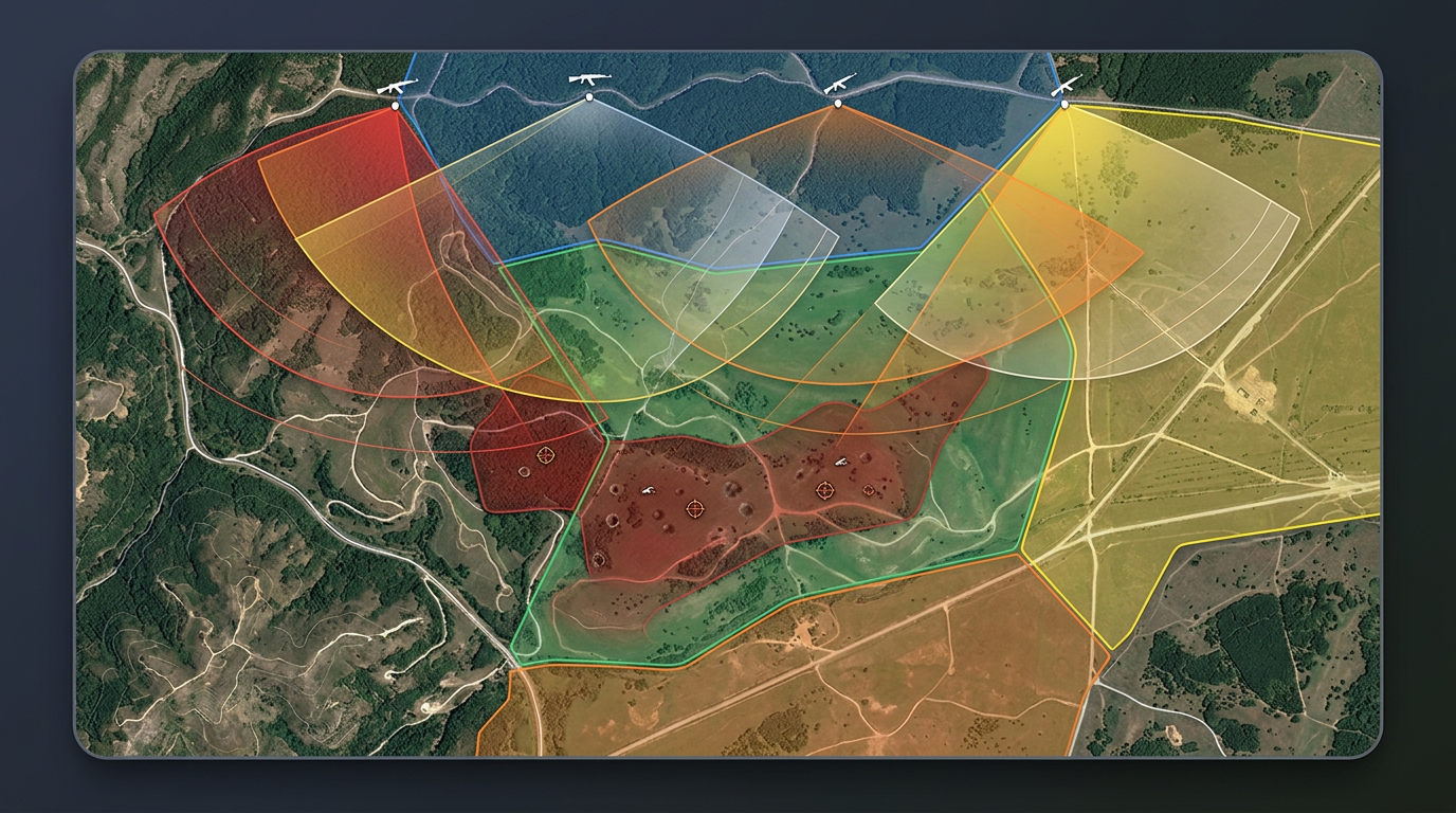
Run tabletop exercises with realistic military symbols. Position units, draw control measures, and walk through maneuvers step by step.
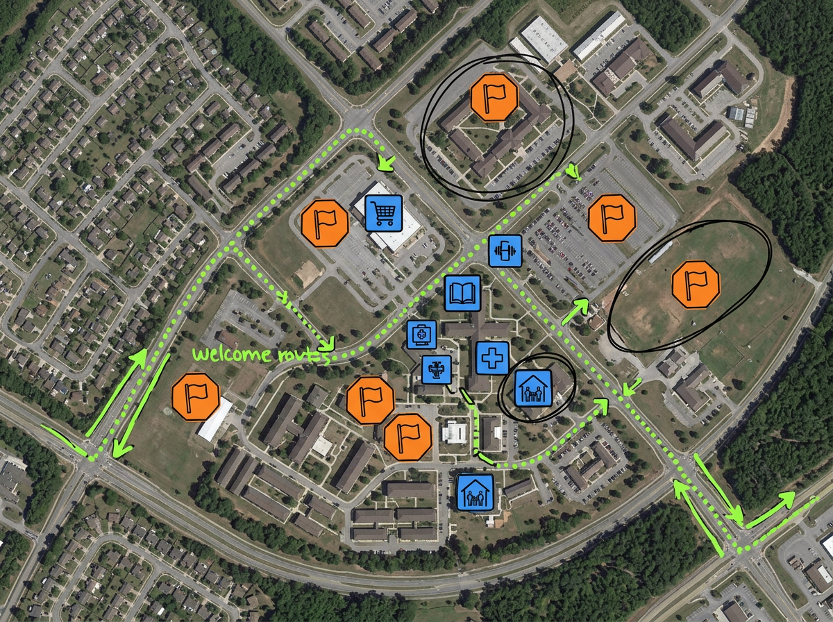
Map evacuation rallying points, sponsor neighborhoods, on-base resources and welcome routes for new arriving families.
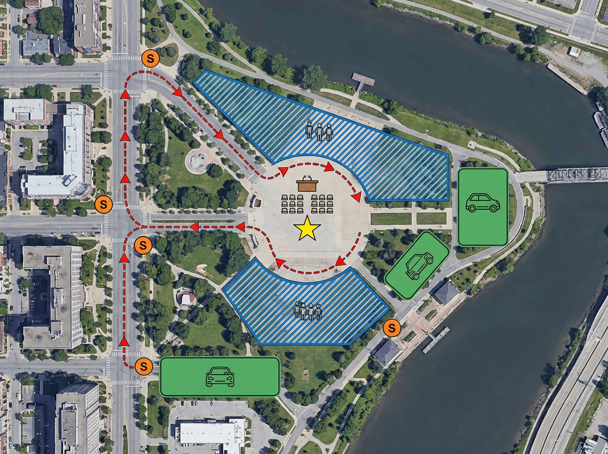
Map a parade route, ceremony footprint or VIP visit. Mark posts, gates, road closures and viewing areas on one map.
Scribble AI
Tell Scribble AI what you need. Try “draw a 500m buffer around every site,” “import this CSV and color by status,” or “measure the route from the depot to each stop.” It does it in seconds. No GIS training needed, and your team gets the same map, ready to share.
Try Scribble AI →★ ★ ★ ★“Scribble Maps is one of the only software available that lets you make a fully customizable map. I was able to create unique markers for different types of sites for guests to easily find what they're looking for.”
★ ★ ★“I work in territory strategies and this is helping me lay out visuals in my work.”
Scribble Maps supports MIL-STD-2525D and NATO APP-6 symbology. Place symbols for land, sea, air, space, and subsurface units. Set affiliation, echelon, and status modifiers.
Scribble Maps is a commercial cloud product and is not authorized for classified data. Use it for unclassified planning, public affairs, family readiness and training overlays.
Yes. Scribble Maps supports SAML/OIDC/SCIM, activity and audit logs, and user management.
Yes. Import KML, Shapefile, GeoJSON, GPX or CSV. Layer over any base map and re-share.
Yes. Scribble Maps supports private maps, password protection and AES-256 encryption.