

Cycling routes and club rides
Plot a club ride route, color by category and share the day's plan with members. Embed on the club site for the calendar.
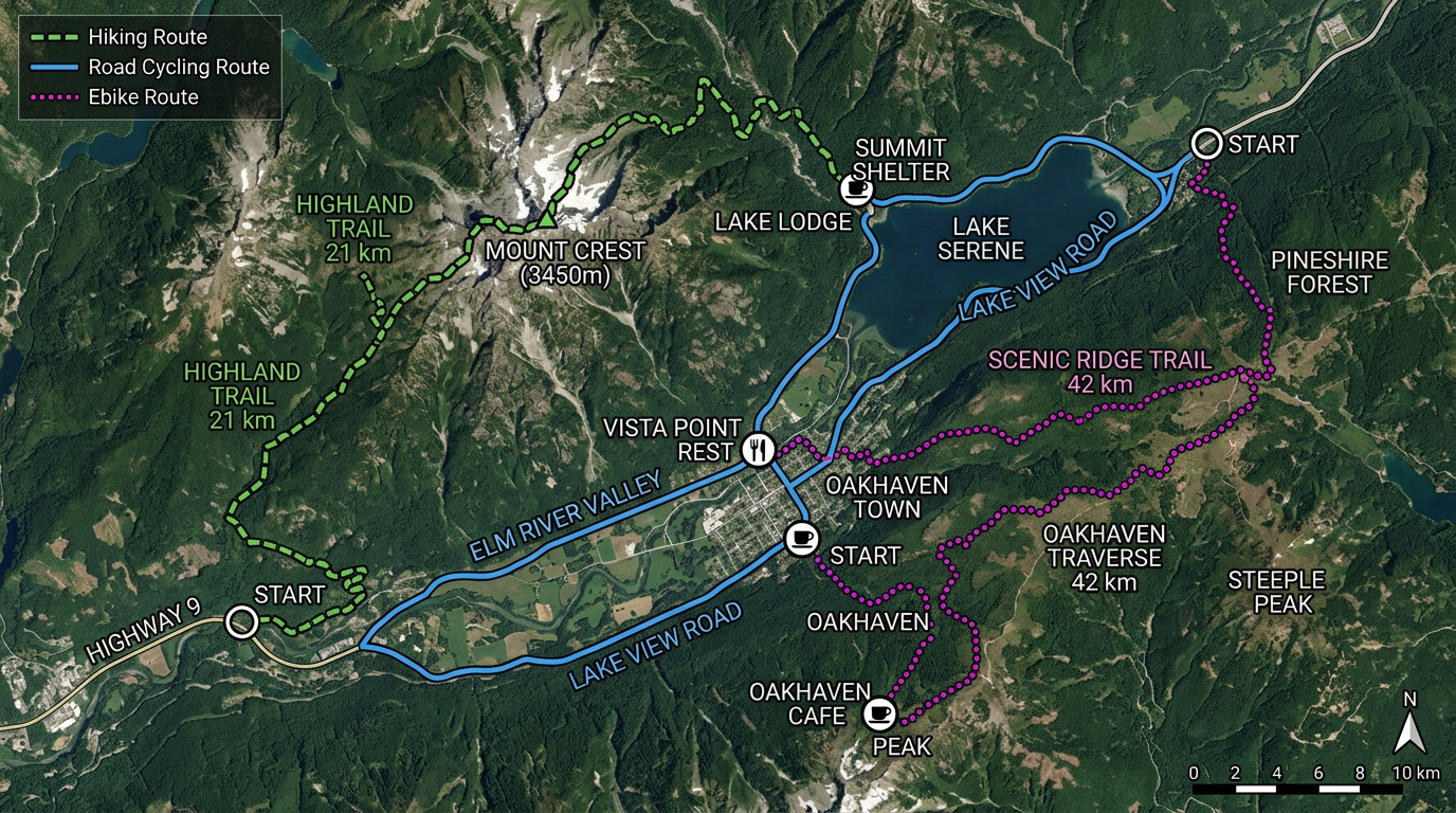
Plot cycling routes, hiking trails, race courses and club rides on real satellite imagery. Free for individuals and clubs, shareable on any phone.
 4.7 / 5 · 200 reviews on G2
★ ★ ★ ★ ★“Back in the day with paper maps, I always enjoyed marking places I'd explored on bike or on foot with a highlighter pen. I'd never found a similar system for online maps till I found this site. I now have maps with whatever background I fancy overlaid with all my explorations. One colour for hikes. One colour for Classic Bike Rides and another for my Ebike rides.”
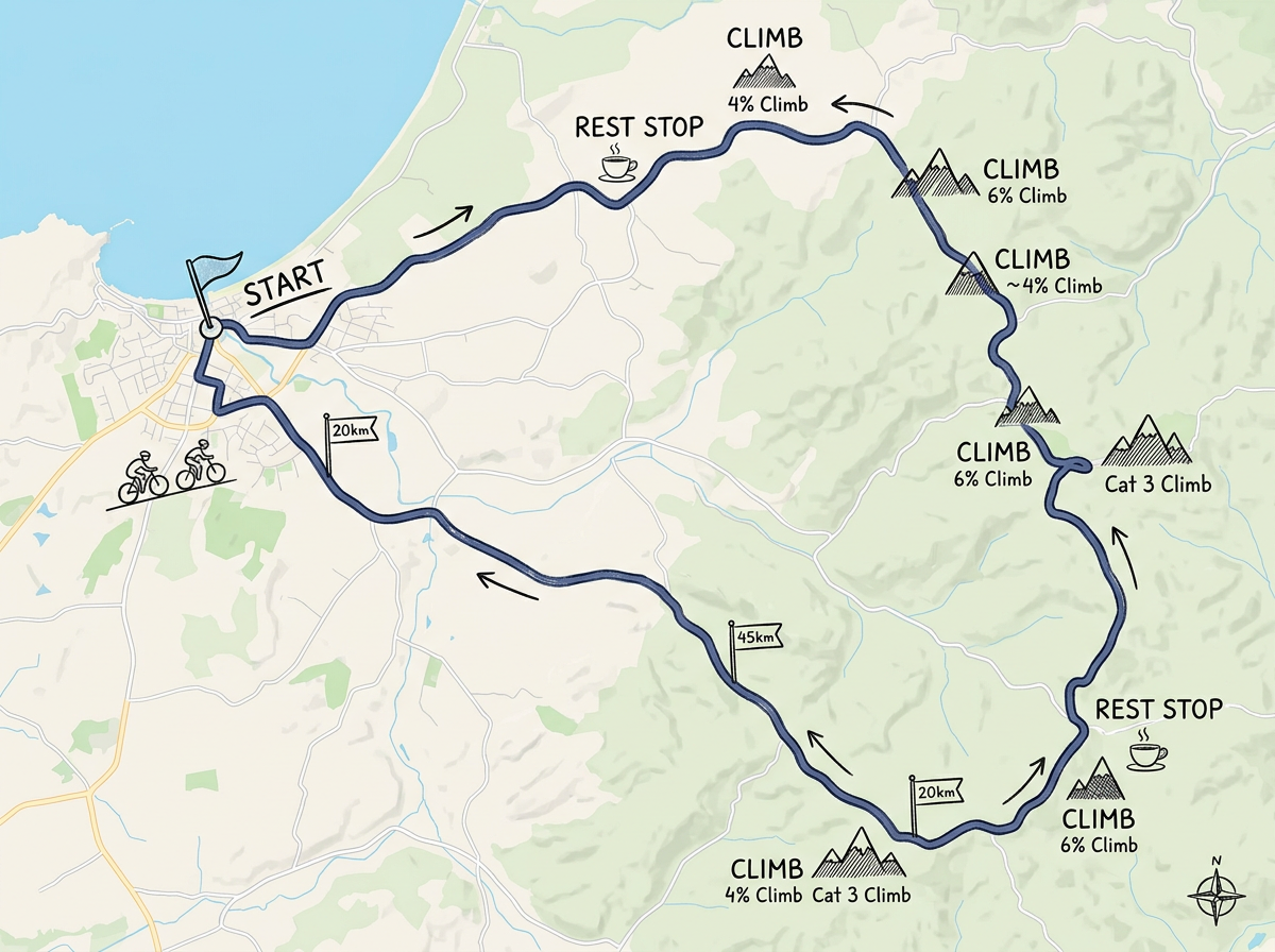
Plot a route on satellite or terrain, color it by ride type and drop markers at rest stops, climbs or sights. No app to install.
Click Share and post the link in the club chat. Members open it on a phone or tablet. No app, no install.
Import GPX or KML tracks from Strava, Komoot, Garmin or your phone. Layer rides on one map and export back out for any device.
Plot a club ride route, color by category and share the day's plan with members. Embed on the club site for the calendar.
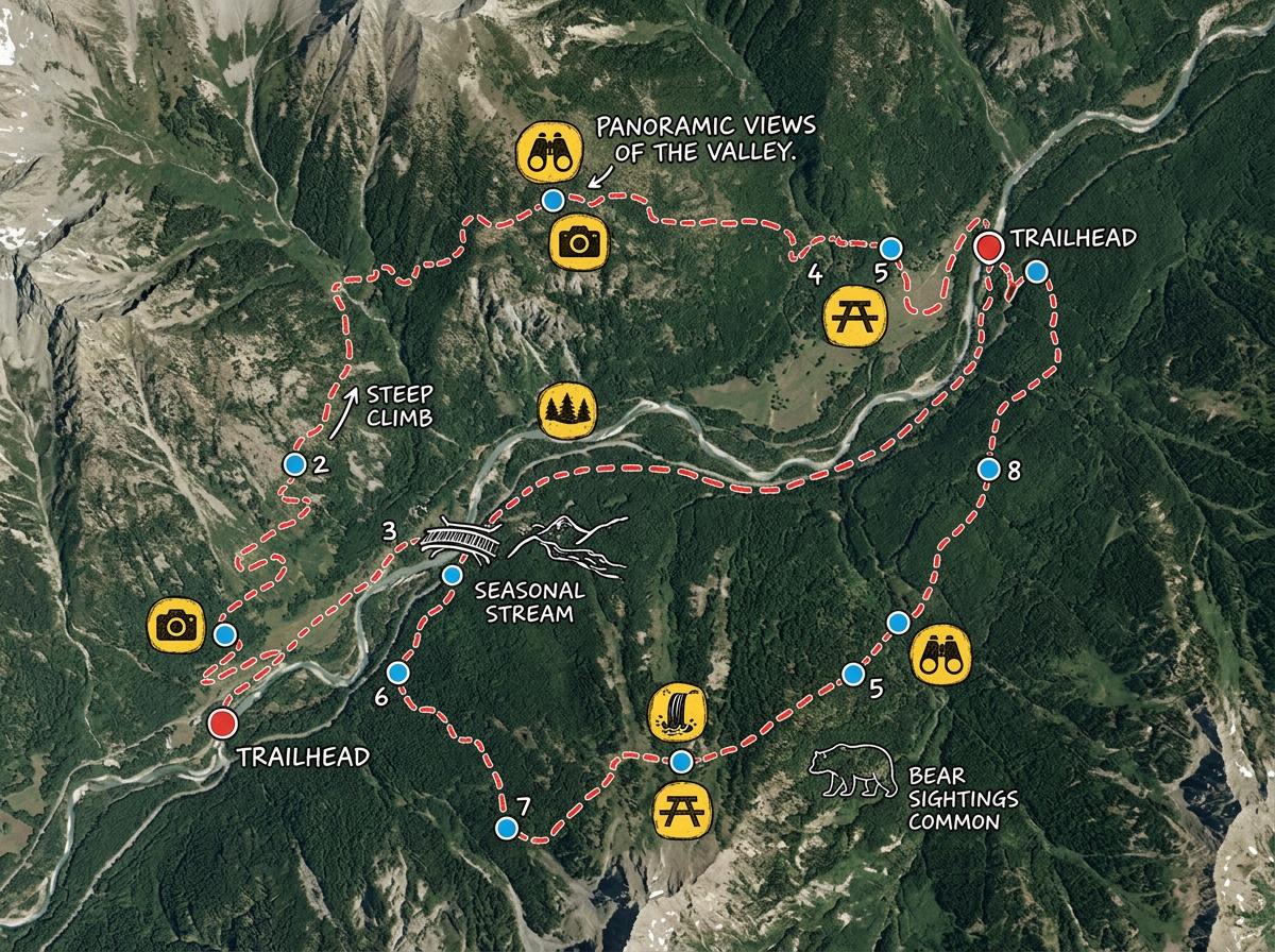
Map a hike with waypoints, photos and notes. Share with hiking partners and the local trail group.
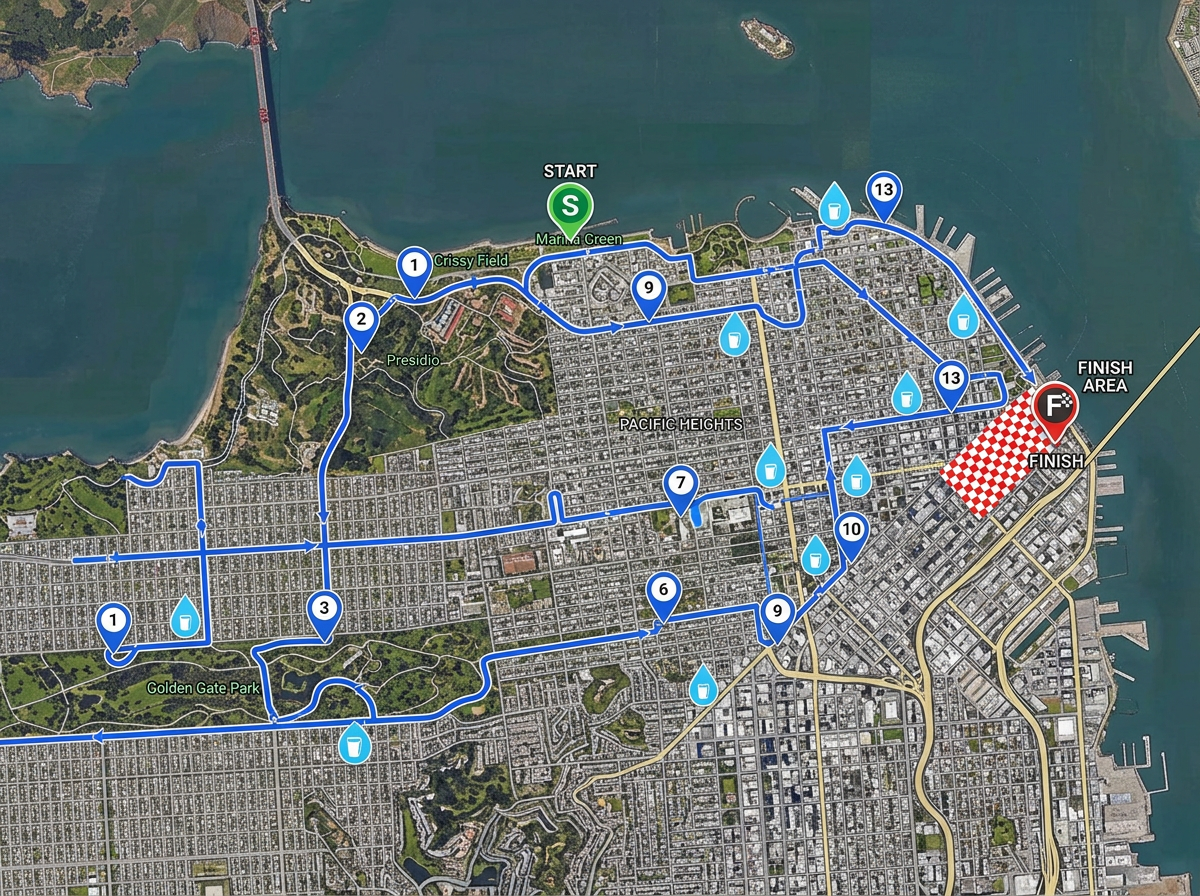
Draw a race course with mile markers, water stops and finish line for amateur runs, rides and triathlons.
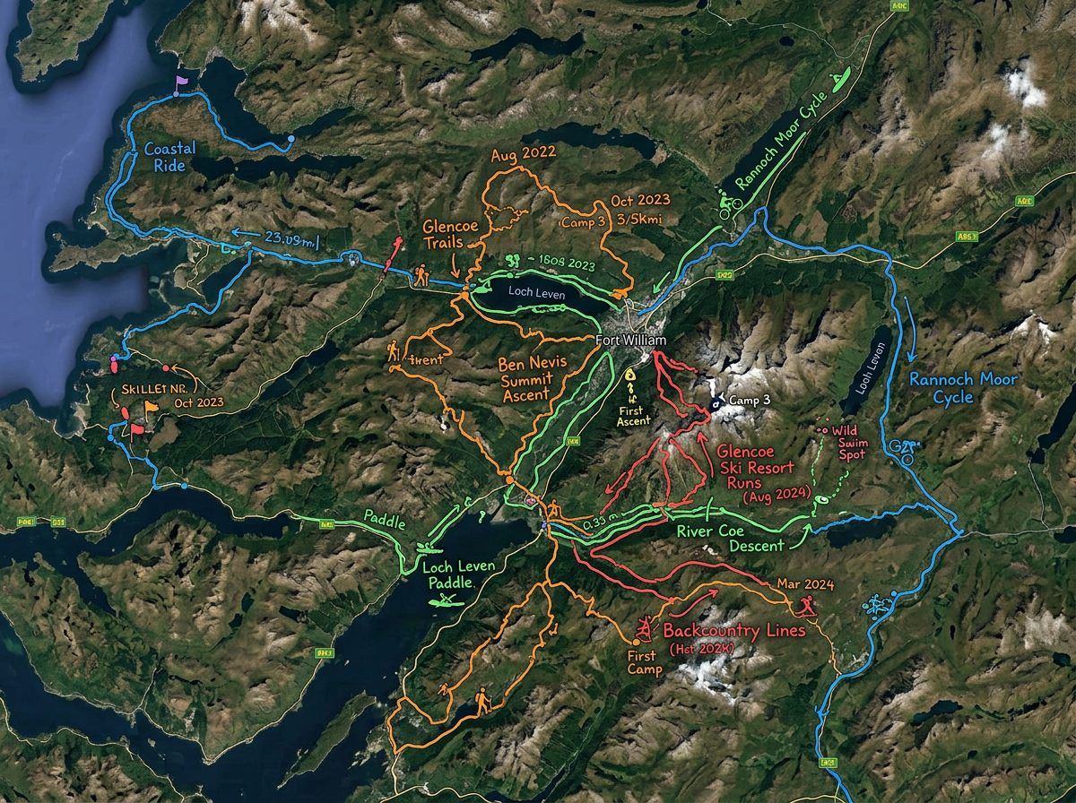
Build a personal exploration log with all your past hikes, rides and trips on one map you can share with friends.
Scribble AI
Tell Scribble AI what you need. Try “draw a 500m buffer around every site,” “import this CSV and color by status,” or “measure the route from the depot to each stop.” It does it in seconds. No GIS training needed, and your team gets the same map, ready to share.
Try Scribble AI →★ ★ ★ ★ ★“Back in the day with paper maps, I always enjoyed marking places I'd explored on bike or on foot with a highlighter pen. I'd never found a similar system for online maps till I found this site. One colour for hikes. One colour for Classic Bike Rides and another for my Ebike rides.”
★ ★ ★ ★ ★“It is completely customizable to suite the needs of all sorts of mapping projects. The maps are typically accurate and it's actually fun to use!”
Yes. Scribble Maps is free for individuals and clubs. See the pricing page for larger imports and advanced tools.
Yes. Import GPX, KML, Shapefile or GeoJSON. Tracks and waypoints drop directly onto the map and you can layer multiple rides.
Yes. Export any route as GPX or KML for use on Garmin, Wahoo and most cycling computers.
Yes. Click Share, copy the link and post it in the club chat. Members open it on a phone. No install.