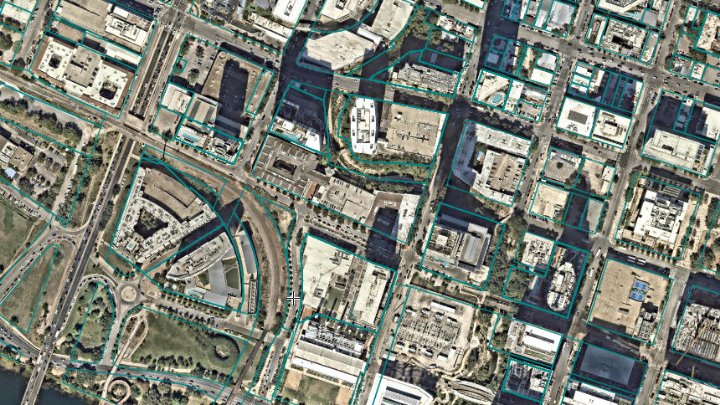
Property lines (parcels)
Nationwide US parcel boundaries with parcel numbers (APNs) and ownership details, on any map.

 English
 Español
 Français
 Deutsch
 Português
 日本語
 中文
 العربية
 한국어
 Italiano
 Русский
 Türkçe
 Nederlands
 Polski
 हिन्दी
 Dansk
 Čeština
 Română
 Ελληνικά
 Tiếng Việt
 Suomi
 Українська
 Indonesia
 Svenska
 Norsk bokmål
 Hrvatski
 Magyar
 Български
 中文(繁體)
 Slovenčina
 Srpski
 ไทย
 Eesti
 Català
 Lietuvių
 עברית
 Slovenščina
 فارسی
 Latviešu
 Azərbaycan
 Беларуская
 Melayu
 Bosanski
 ქართული
 Shqip
 Gaeilge
 Монгол
 ဗမာ
 O‘zbek
 اُردو
 Македонски
 ខ្មែរ
 Nynorsk
 বাংলা
 Galego
 Euskara
 Íslenska
 தமிழ்
 ລາວ
 ગુજરાતી
 Latina
 मराठी
 Қазақ тілі
 ਪੰਜਾਬੀ
 Afrikaans
 नेपाली
 አማርኛ
 తెలుగు
 ChiShona
 Cymraeg
 Føroyskt
 অসমীয়া
 Brezhoneg
 Esperanto
 Basa Jawa
 کٲشُر
 Ирон
 Sardu
 සිංහල
 Татар
 ትግርኛ
 Türkmen dili
 Malti
 ಕನ್ನಡ
 Lëtzebuergesch
 Te reo Māori
 Davvisámegiella
 ꆈꌠꁱꂷ
Scribble Maps is an easy interactive map maker for teams. We have been building it since 2009, with no outside investors, paid for by our customers. Here is how that compares with other mapping tools.
We checked 16 web map makers that teams use to create and share maps. The right column shows the range across them.
| Scribble Maps | Other mapping tools | |
|---|---|---|
| Making maps since | 2009 17 years and counting | 2005 to 2021 13 of the 16 launched after 2009 |
| Outside investors | None No outside funding, and cash-flow positive | None to $280 million in one round 7 of the 16 are venture-backed, from $1 million seed rounds up |
| Price for 3 people to share private maps | $42 a month Three Pro Basic accounts at $14 each, billed yearly | $15 to $216 a month Across the 9 tools that publish a plan for 3 editors |
| Map views | Unlimited on paid plans Every base map except Google's, which has its own limit | Capped or billed per view at many tools From 5,000 views a month on one entry plan, to $5 per 1,000 map loads after the first 50,000 on another |
| File formats you can export | More than 30 Including GeoJSON, TopoJSON, KML, GPX, CSV, Excel, Shapefile, DXF, DGN, GeoPackage, GeoParquet, FlatGeobuf, PMTiles, MBTiles, MapInfo, GML, SQLite, vector tiles, PDF and PNG. GIS and CAD formats need a Pro plan. | 3 to 7 Among the 5 tools whose help pages list their export formats |
| Single sign-on (SAML) | Free SAML, OIDC and SCIM on our free Enterprise plan | Enterprise plan or not offered 12 of 15 tools put SAML on an enterprise plan or do not offer it |
Based on 16 web map makers' own pricing, product and company pages and public funding records, checked on November 9, 2026. Google My Maps is left out of the single sign-on count because it uses Google accounts. Details change, so check with each company.
Drop pins, draw shapes and add labels in your browser. Most people make their first map in under ten minutes, with no GIS training.
Add property lines, traffic counts, demographics, soils, flood zones and wildfire layers with one click.
Export to more than 30 standard file formats, from KML, GeoJSON and Shapefile to DXF, GeoPackage and PMTiles, so your work is never locked in.
Send a public, private or password-protected link, or embed the live map on your website. Paid plans include unlimited map views.
Ask Scribble AI in plain English, or use Scribble Maps from Claude, ChatGPT or Gemini.
Scribble Maps is built on user interface technology we invented in-house. A patent for it is pending.
The editor and website speak 88 languages, so your whole team can work in their own.
Nationwide US parcel boundaries with parcel numbers (APNs) and ownership details, on any map.
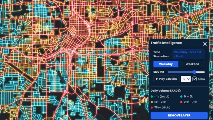
Annual average daily traffic (AADT), hourly peaks and count stations for roads across North America.
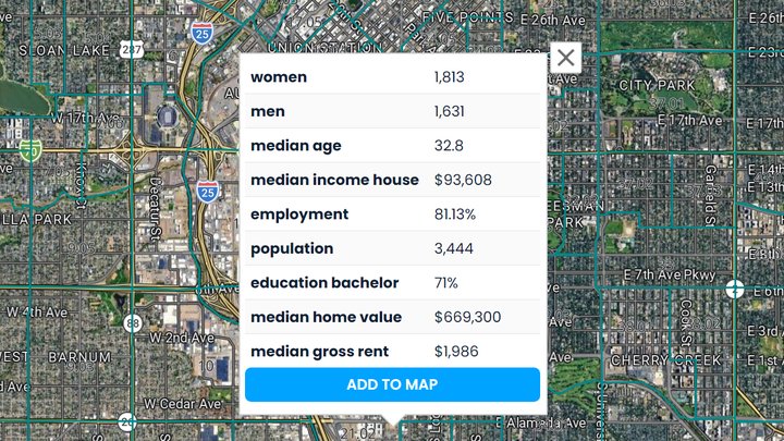
Population, income, age, education and housing for every US census tract, from the Census American Community Survey.
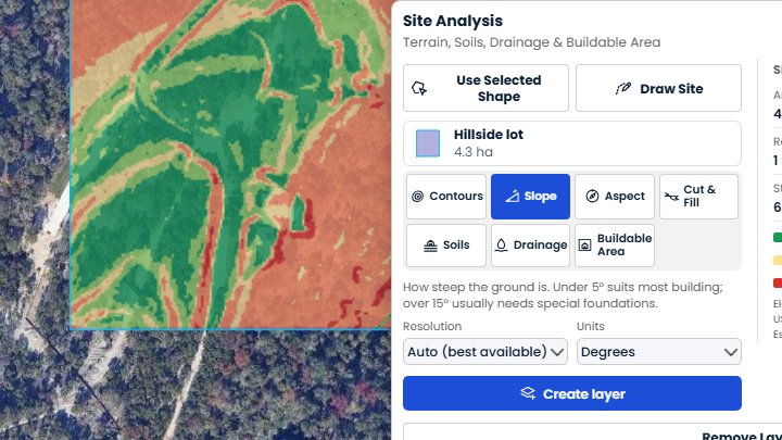
Contours, slope, cut and fill, soils, drainage and buildable area for a site up to 250 acres, from 1 m lidar across most of the US.
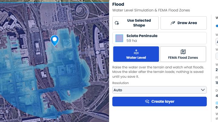
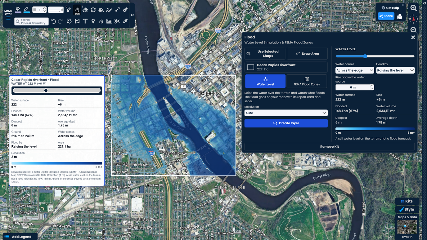
Raise the water on 1 m lidar terrain to see what floods, and read FEMA flood zones and base flood elevations.
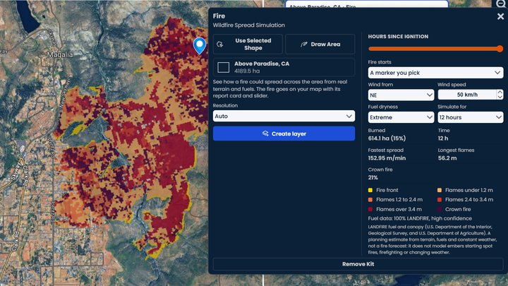
See how a wildfire could spread across an area, hour by hour, from real terrain, fuels and wind.
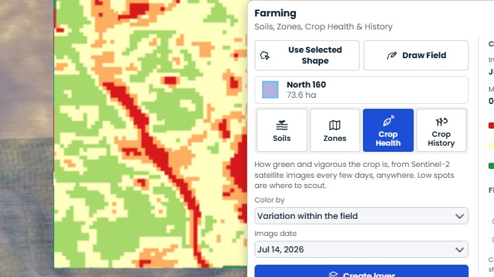
Soil maps, crop health from satellite and management zones you can export to your tractor, for any field in the world.
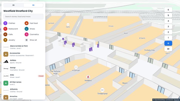
Floor plans with a store directory and step-by-step directions across floors, including step-free routes. Share the map or embed it for visitors.
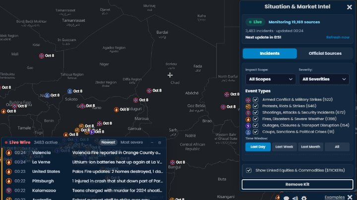
Live incidents and developments worldwide, with an AI brief for each report and the stocks and commodities they may affect.
We have made Scribble Maps since 2009. We have no outside investors and the business is cash-flow positive, so we answer to our customers. Mapping tools do disappear: Google Maps Engine closed in 2016, Mapzen in 2018 and Google Fusion Tables in 2019.
It is easy enough for anyone on the team, it is built on our own patent-pending interface technology, it has data like property lines and traffic counts built in, and it includes single sign-on for free. Most other tools are newer, many are venture-backed, and most keep single sign-on for enterprise plans.
Yes. There is a free plan with no credit card needed. Pro Basic is $14 a month and Pro Business is $90 a month, both billed yearly.
Yes. Export your maps to more than 30 file formats, including GeoJSON, TopoJSON, KML, GPX, CSV, Excel, Shapefile, DXF, DGN, GeoPackage, GeoParquet, FlatGeobuf, PMTiles, MBTiles, MapInfo, GML, SQLite, vector tiles, PDF and PNG. GIS and CAD formats need a Pro plan.