

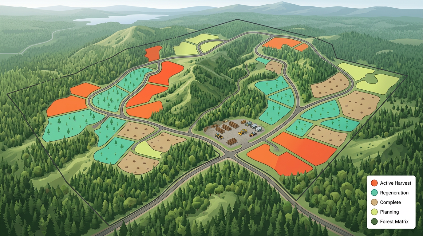
Cut block and harvest plans
Draw cut block boundaries, mark phase order and brief loggers and haulers with a clickable map.
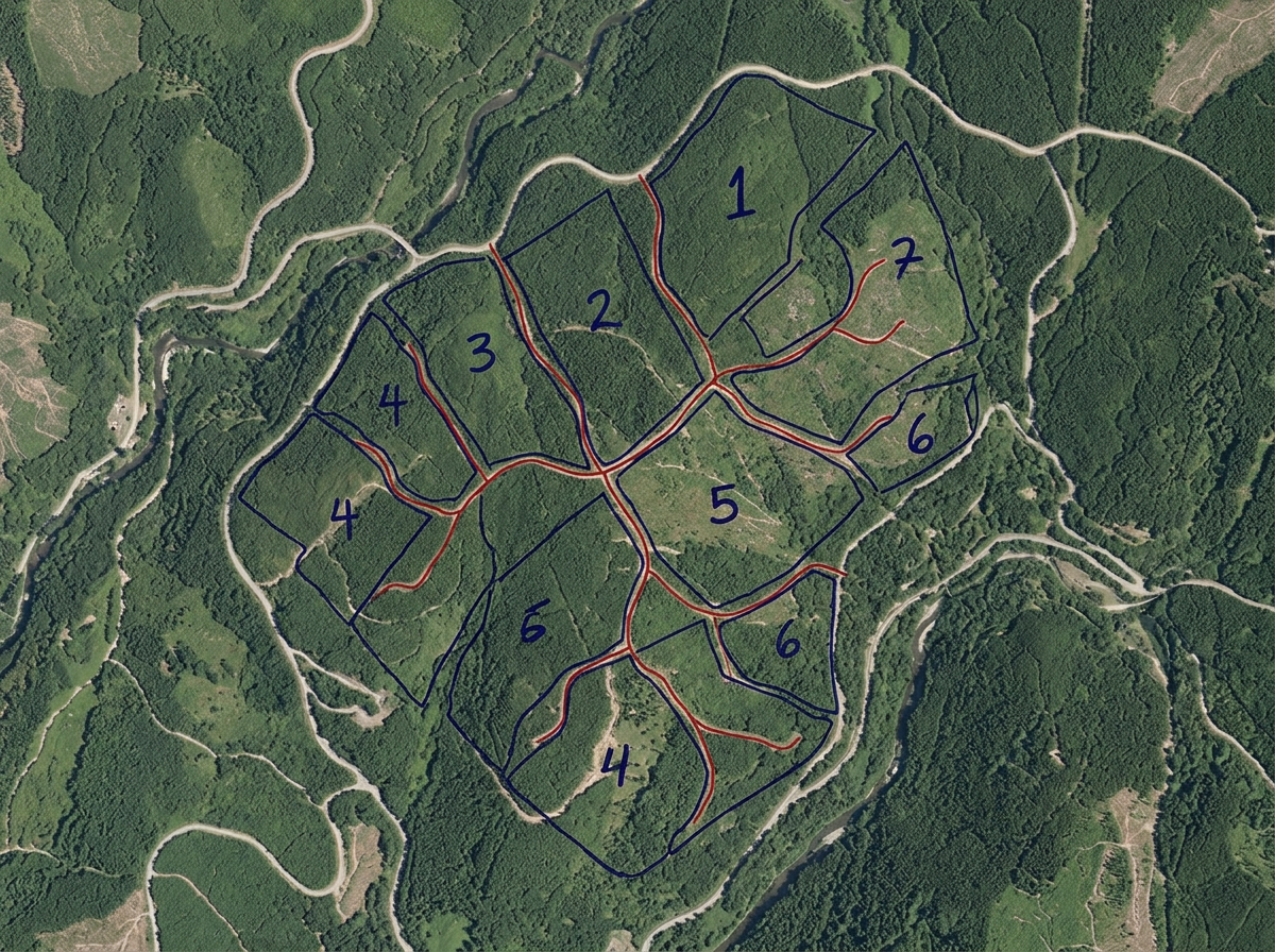
Sketch cut blocks, mark stand boundaries, plan haul roads and brief contractors, built for foresters, woodlot owners, log haulers and consulting foresters.
 4.7 / 5 · 200 avaliações no G2
★ ★ ★ ★ ★“The thing I like most about Scribble is how easy it is to use. I also love how I can create any maps from scratch. A lot of the maps that I have created are not geo referenced. This has been very helpful to me when I have been creating these farm maps.”
Sketch cut blocks, stand boundaries, riparian buffers and access roads on satellite imagery. No GIS training required.
Send the cut block map and haul plan to the logger or hauler. They open it on a phone. No app, no install.
Import KML, Shapefile, GeoJSON or GPX of stands, roads and inventory data. Layer it all on one shared map.
Draw cut block boundaries, mark phase order and brief loggers and haulers with a clickable map.
Sketch stands by species, age class and treatment for the management plan and contractor briefings.
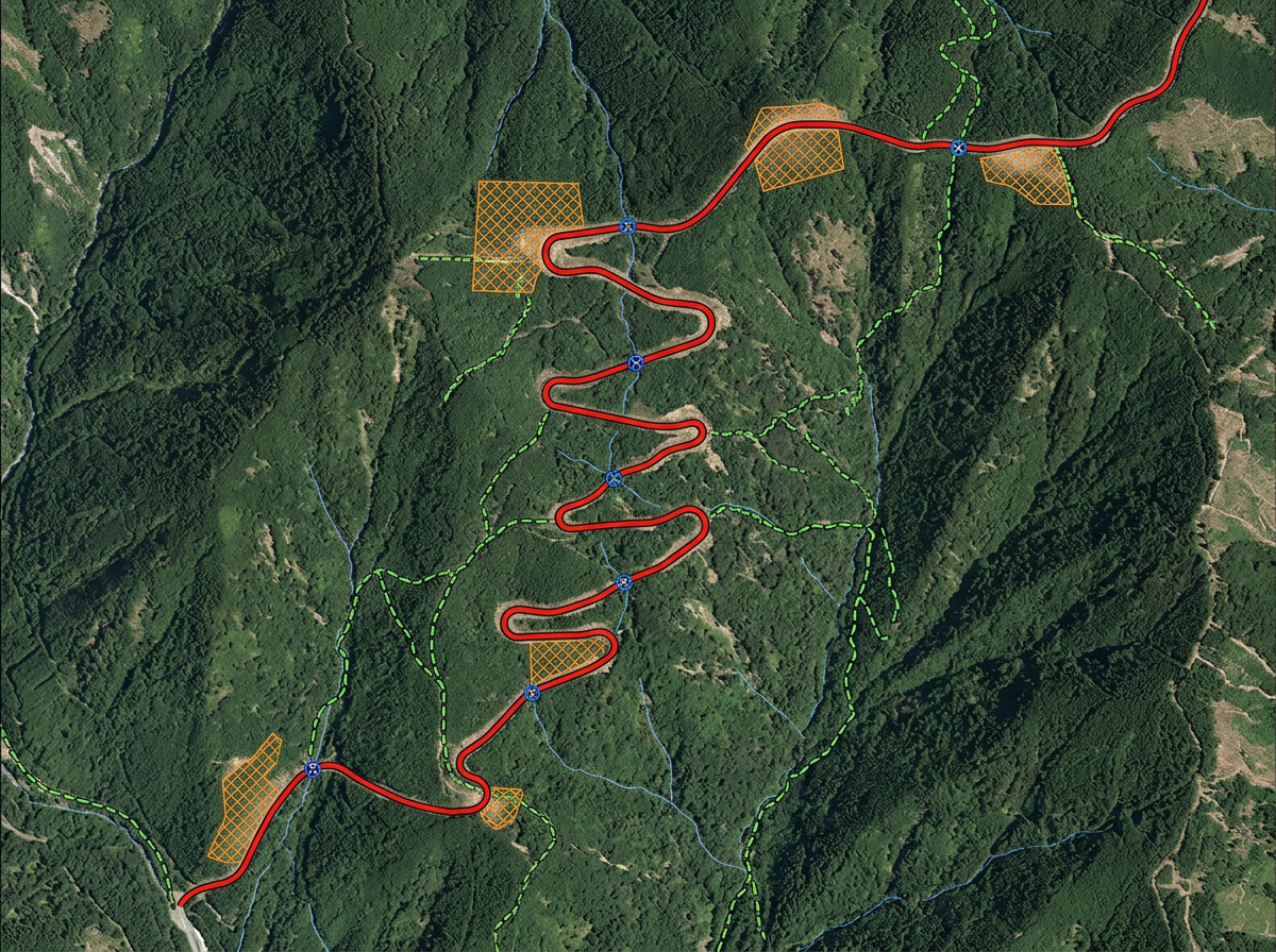
Plan haul roads, landings, switchbacks and water crossings on terrain or satellite for engineering and permit reviews.
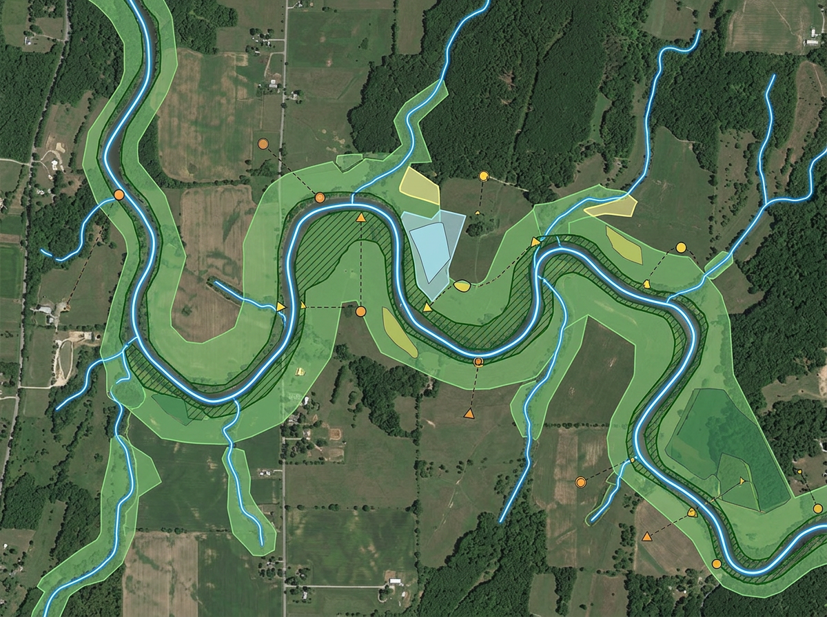
Draw riparian buffers, leave strips and wildlife corridors for permit packets and stakeholder meetings.
Scribble AI
Diga ao Scribble AI o que você precisa. Experimente “desenhe um buffer de 500 m em torno de cada local,” “importe este CSV e colorize por status,” ou “meça a rota do depósito até cada parada.” Ele faz em segundos. Sem necessidade de treinamento em GIS, e sua equipe recebe o mesmo mapa, pronto para compartilhar.
Experimente o Scribble AI →★ ★ ★ ★“The thing I like most about Scribble is how easy it is to use. I also love how I can create any maps from scratch.”
★ ★ ★ ★ ★“I can highlight areas, buildings, etc and measure for jobs that may be out of town, or even out of state.”
Yes. Import KML, Shapefile, GeoJSON or GPX. Existing stands and inventory data drop directly onto the map.
Yes. Click Share, copy the link and text it to the contractor. They open it on a phone. No app, no install.
Yes. Sketch the stream line, set a buffer distance and the buffer polygon is drawn for you.
Yes. Export any map to PDF, PNG, KML or GeoJSON for inclusion in permit and management packets.