

Nakładki taktyczne ze standardowymi symbolami
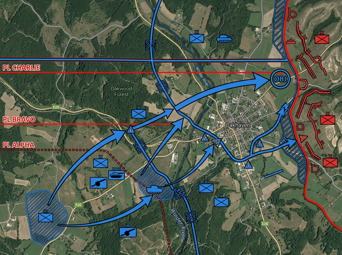
Twórz grafiki OPORD z symbolami MIL-STD-2525D. Oznaczaj jednostki własne i wrogie, rysuj linie fazowe i cele oraz udostępniaj na odprawy misyjne.
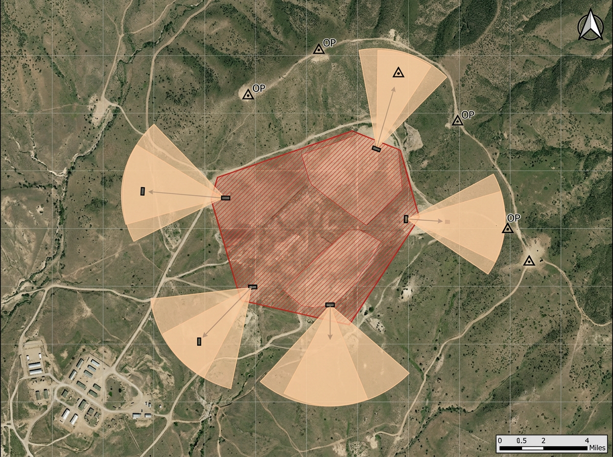
Umieszczaj standardowe symbole wojskowe na mapie, rysuj środki kontroli i udostępniaj przez link. Planowanie strzelnicy, nakładki ćwiczeń i odprawy taktyczne w dowolnej przeglądarce.
 4.7 / 5 · 200 recenzji na G2
★ ★ ★ ★ ★“Scribble Maps to jedno z nielicznych dostępnych oprogramowań, które pozwala stworzyć w pełni konfigurowalną mapę. Udało mi się stworzyć unikalne znaczniki dla różnych typów miejsc, aby goście mogli łatwo znaleźć to, czego szukają.”
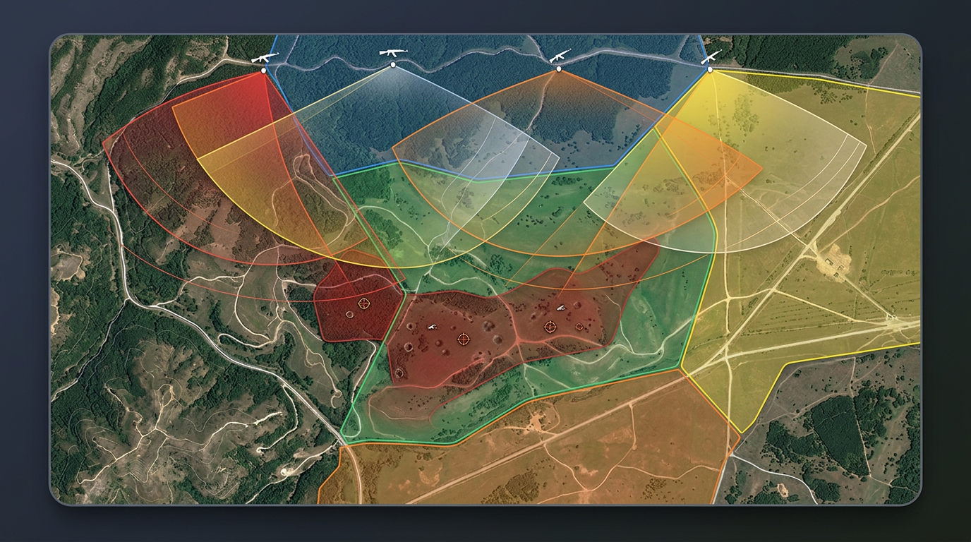
Umieszczaj symbole MIL-STD-2525D i NATO APP-6 na mapie. Wybierz typ jednostki, przynależność i szczebel. Rysuj linie fazowe, cele i środki kontroli.
Udostępnij nakładkę ćwiczeń lub plan strzelnicy swojemu zespołowi przez link. Otwierają go w przeglądarce. Bez instalacji, bez konta.
Importuj KML, Shapefile, GeoJSON lub GPX. Nakładaj mapy obszarów treningowych, dane tras i istniejące nakładki bez ponownego wprowadzania.
Twórz grafiki OPORD z symbolami MIL-STD-2525D. Oznaczaj jednostki własne i wrogie, rysuj linie fazowe i cele oraz udostępniaj na odprawy misyjne.
Prowadź gry planszowe z realistycznymi symbolami wojskowymi. Rozmieszczaj jednostki, rysuj środki kontroli i przechodź przez manewry krok po kroku.
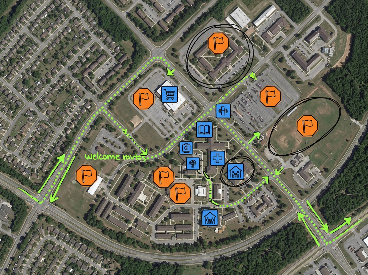
Mapuj punkty zbiórki ewakuacyjnej, dzielnice sponsorów, zasoby na bazie i trasy powitalne dla nowo przybyłych rodzin.

Mapuj trasę parady, obszar ceremonii lub wizytę VIP. Oznaczaj posterunki, bramy, zamknięcia dróg i strefy widokowe na jednej mapie.
Scribble AI
Powiedz Scribble AI, czego potrzebujesz. Spróbuj: „narysuj bufor 500m wokół każdej lokalizacji”, „zaimportuj ten CSV i pokoloruj według statusu” lub „zmierz trasę od magazynu do każdego przystanku”. Gotowe w kilka sekund. Żadnego szkolenia z GIS. Twój zespół dostaje tę samą mapę, gotową do udostępnienia.
Wypróbuj Scribble AI →★ ★ ★ ★“Scribble Maps to jedno z nielicznych dostępnych oprogramowań, które pozwala stworzyć w pełni konfigurowalną mapę. Udało mi się stworzyć unikalne znaczniki dla różnych typów miejsc, aby goście mogli łatwo znaleźć to, czego szukają.”
★ ★ ★“Pracuję w strategiach terytorialnych i to pomaga mi wizualizować moją pracę.”
Scribble Maps obsługuje symbolikę MIL-STD-2525D i NATO APP-6. Umieszczaj symbole jednostek lądowych, morskich, powietrznych, kosmicznych i podwodnych. Ustawiaj modyfikatory przynależności, szczebla i statusu.
Scribble Maps to komercyjny produkt chmurowy i nie jest autoryzowany do danych niejawnych. Używaj go do planowania niejawnego, spraw publicznych, gotowości rodzin i nakładek treningowych.
Tak. Scribble Maps obsługuje SAML/OIDC/SCIM, dzienniki aktywności i audytu oraz zarządzanie użytkownikami.
Tak. Importuj KML, Shapefile, GeoJSON, GPX lub CSV. Nakładaj na dowolną mapę podkładową i ponownie udostępniaj.
Tak. Scribble Maps obsługuje mapy prywatne, ochronę hasłem i szyfrowanie AES-256.