

Drone mission planning
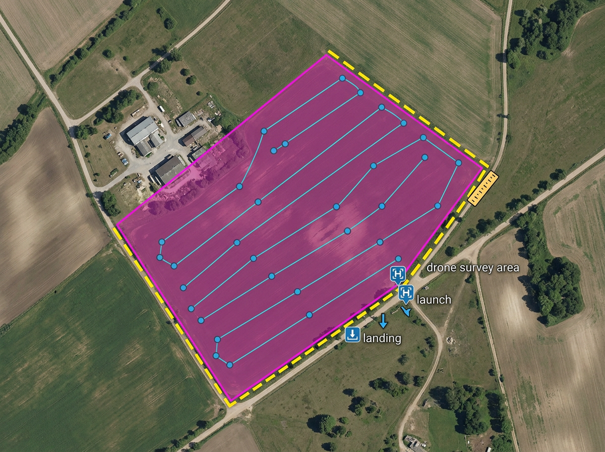
Outline the survey area, mark launch and landing points, drop waypoints and check distances against battery range.
Drone mission planning, flight zones, waypoint courses and pre-flight briefings, built fast and shared by link.
 4.7 / 5 · 200 recensioni su G2
★ ★ ★ ★ ★“I knew there must be a better solution, and then I found Scribble Maps.”
Draw flight areas, mark waypoints and outline survey grids on satellite imagery. No CAD program, no specialized software.
Share a pre-flight map with the pilot, observer and client. They open it in a browser. No install, no account.
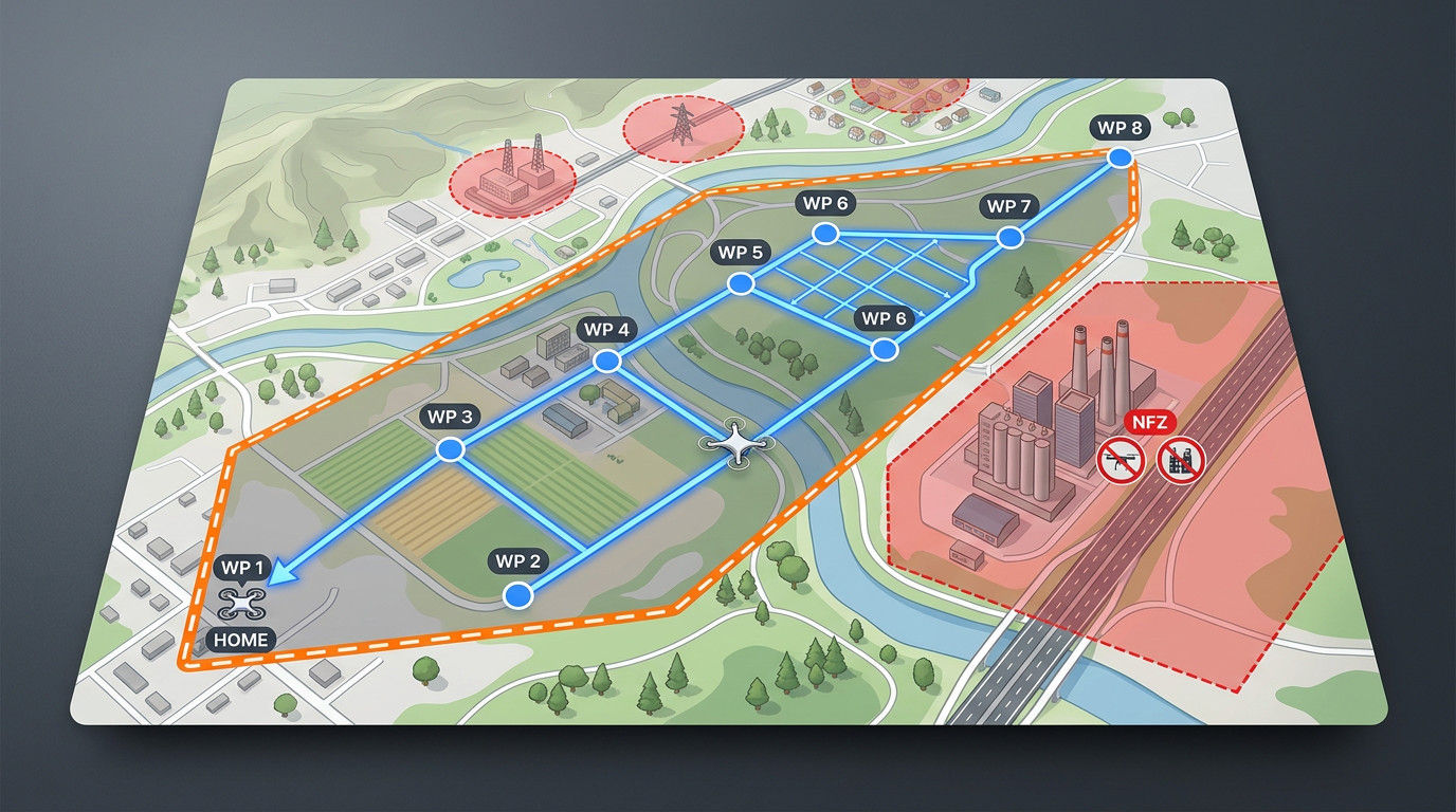
Import KML, Shapefile, GeoJSON or GPX. Layer airspace files, no-fly zones and existing mission boundaries onto a single map.
Outline the survey area, mark launch and landing points, drop waypoints and check distances against battery range.
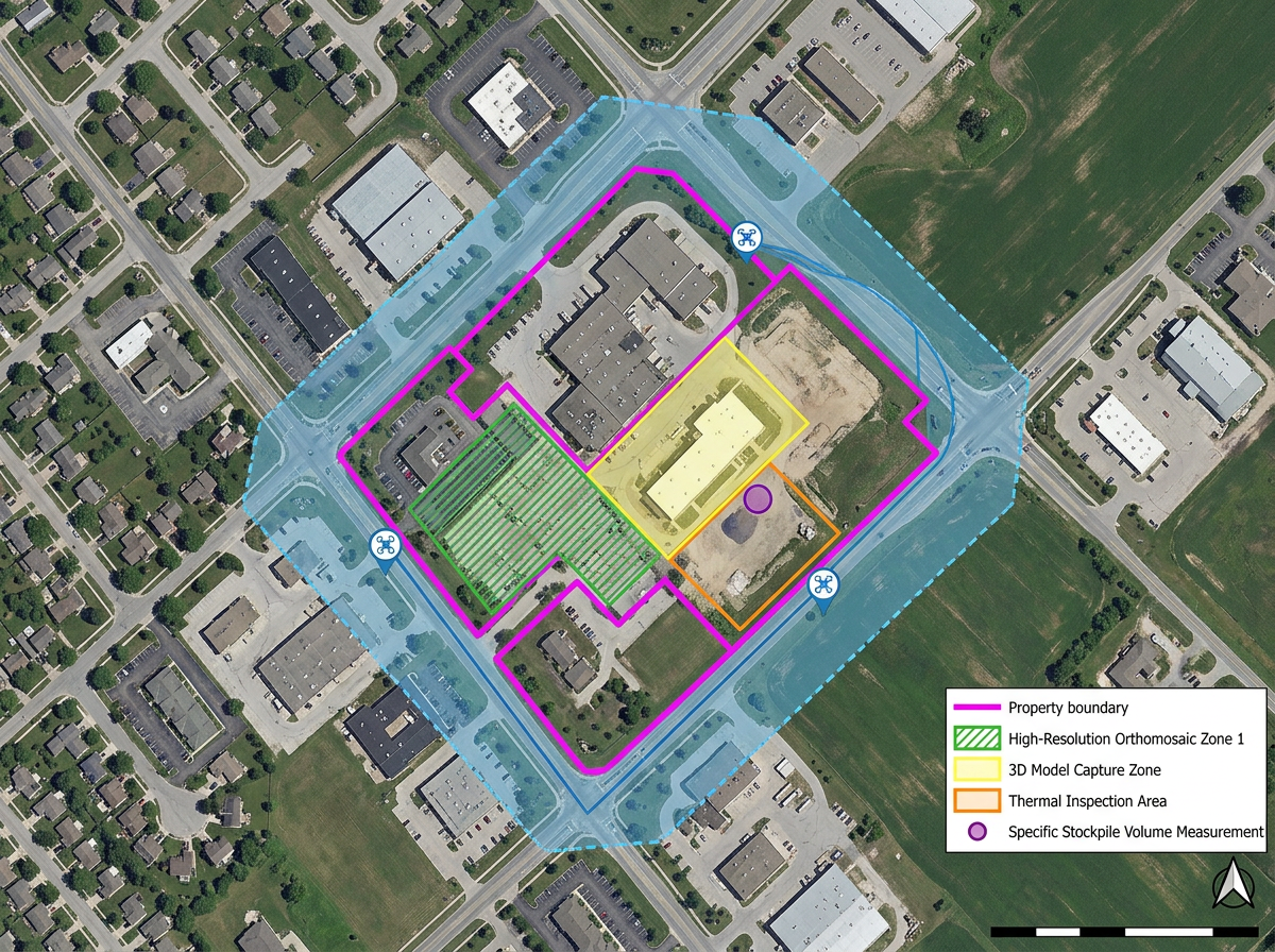
Build a clean, branded map for the client packet with the planned flight area, deliverables zone and any property boundaries.
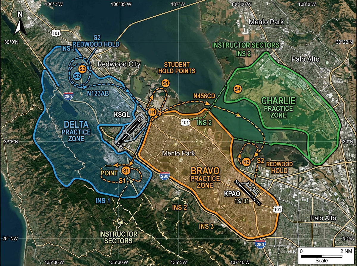
Map practice areas, student hold points and instructor zones for ground school and pre-flight briefings.
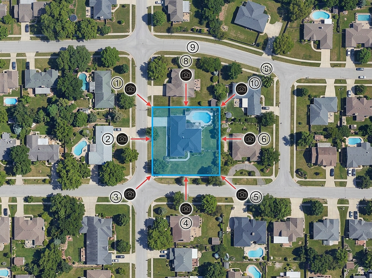
Outline the property or subject, mark the angles you want to capture and measure flight distances before the shoot.
Scribble AI
Di' a Scribble AI di cosa hai bisogno. Prova «disegna un buffer di 500 m attorno a ogni sito», «importa questo CSV e colora per stato» o «misura il percorso dal deposito a ogni tappa». Lo fa in pochi secondi. Nessuna formazione GIS necessaria, e il tuo team ottiene la stessa mappa, pronta da condividere.
Prova Scribble AI →★ ★ ★ ★ ★“I knew there must be a better solution, and then I found Scribble Maps.”
★ ★ ★ ★ ★“From plotting points to creating custom routes, this web-based application makes it easy to create dynamic and interactive maps.”
Scribble Maps focuses on planning and visualization rather than live airspace. Always cross-check airspace, NOTAMs and authorizations with your country's civil aviation authority before flying.
Yes. Import KML, Shapefile, GeoJSON or GPX. Layer airspace, no-fly zones and existing mission boundaries onto your plan.
Yes. Export waypoints as GPX or KML for use in most flight controller and ground station software.
Yes. Click Share and copy the link. Clients open it in any browser. No install, no account.