

Service area and coverage maps
Draw your service footprint and tower coverage rings. Share with prospects, regulators and partner ISPs.
Map service areas, plan tower coverage, sketch fiber routes and brief installers. Built for WISPs, fiber contractors and MDU installers who don't run a carrier-grade GIS.
 4.7 / 5 · 200 avis sur G2
★ ★ ★ ★ ★“Finding the locations and information before making a site visit. I can plan the route since the area is usually inhabited and inaccessible by standard transportation. Scribble Maps uses Google Maps as the base map, which is a perfect choice as users are already familiar with Google Maps' properties and layout. It decreases the learning curve by far.”
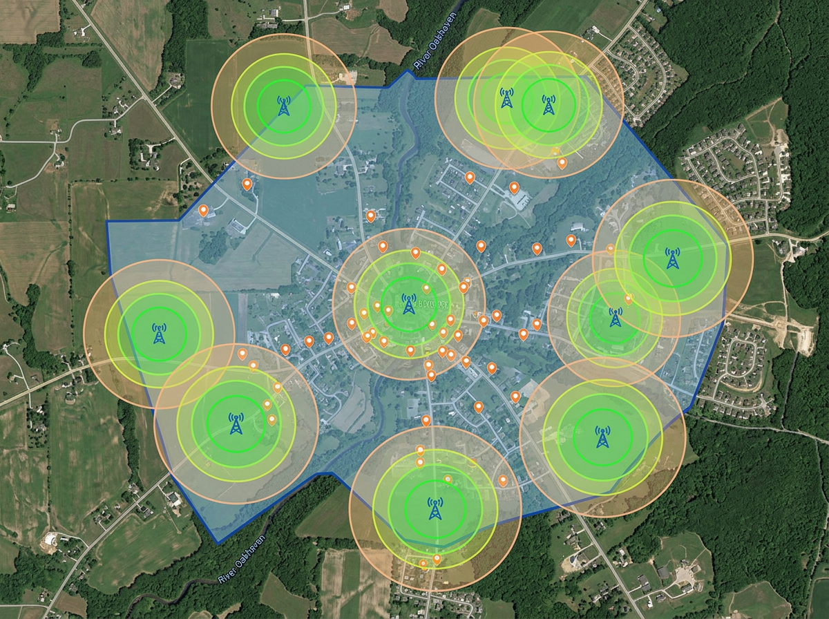
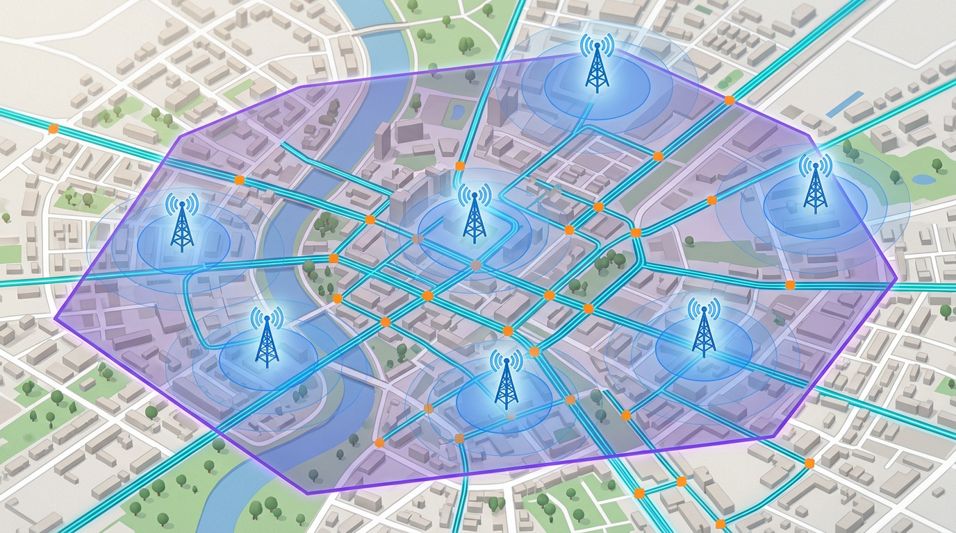
Draw tower coverage rings, fiber routes and service area boundaries on a real satellite view. No carrier-grade GIS deployment required.
Send the day's build map to the field crew. They open it on a phone. No app, no install, no friction.
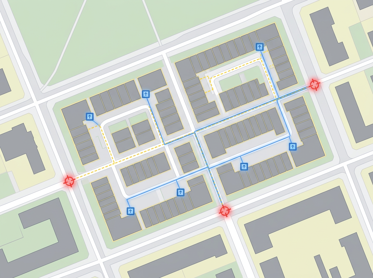
Import KML, Shapefile, GeoJSON and GPX of existing fiber routes, towers and splice points. Layer it all on one map.
Draw your service footprint and tower coverage rings. Share with prospects, regulators and partner ISPs.
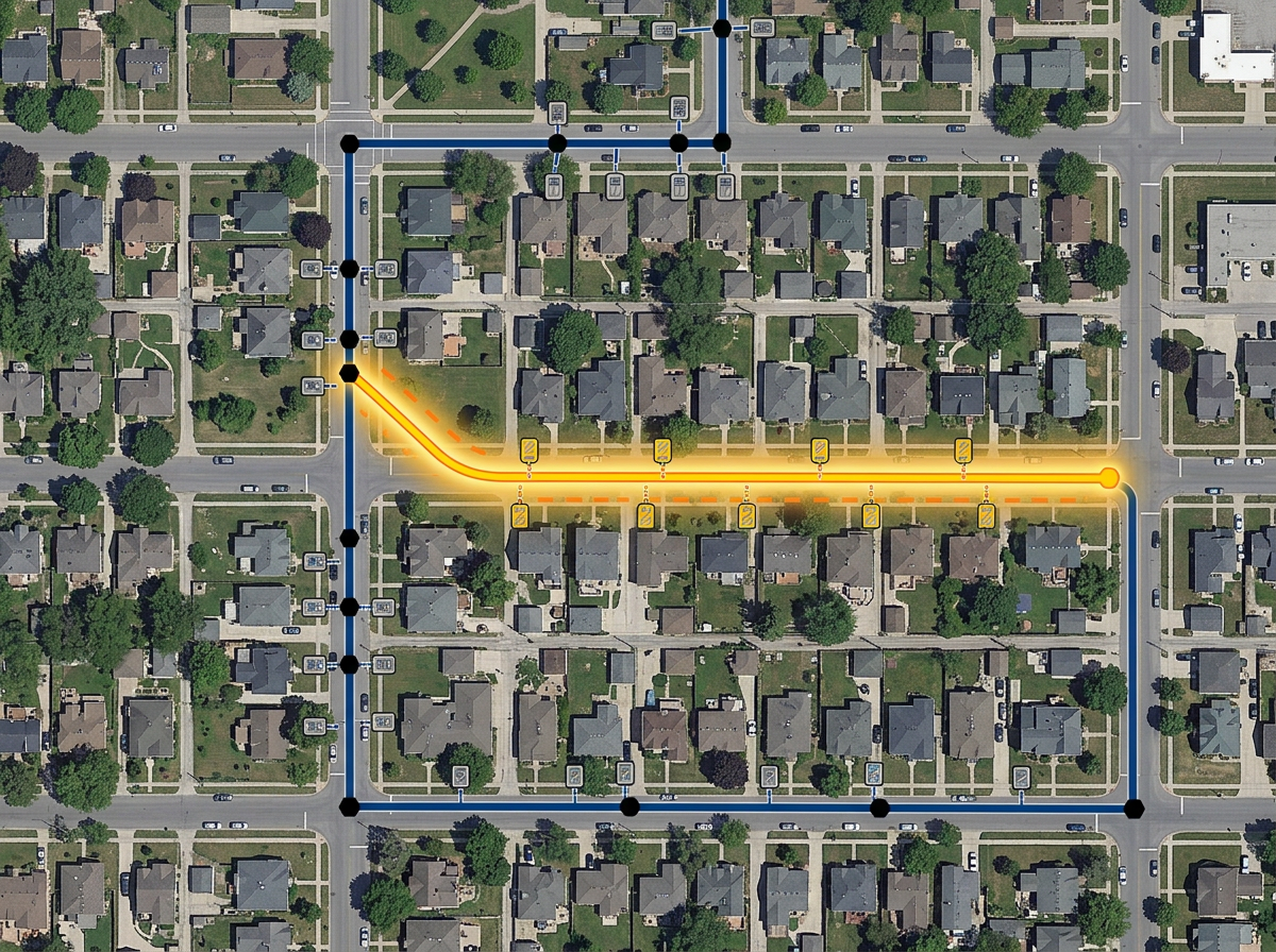
Sketch fiber routes along streets, mark splice points and pedestals, and brief the build crew with a clickable map.
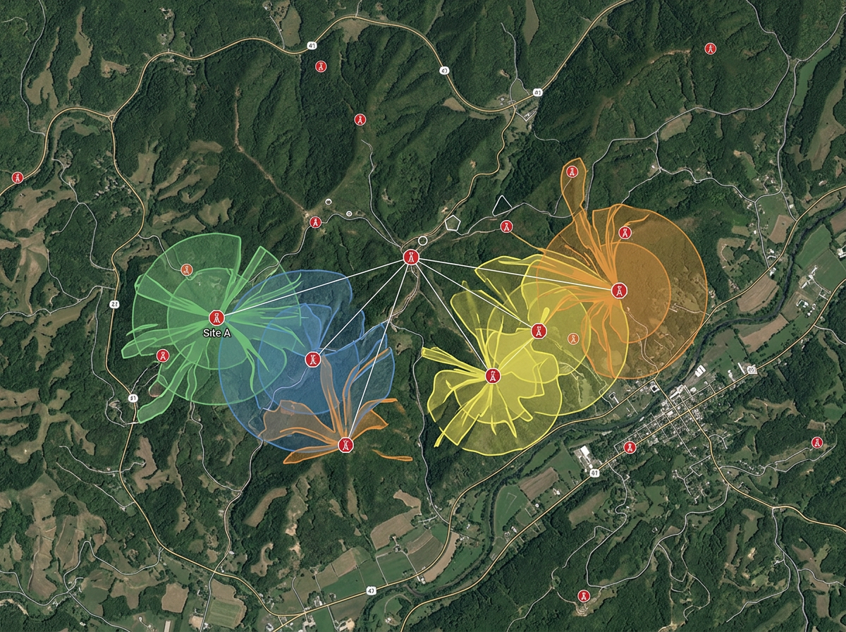
Drop candidate tower sites, draw line-of-sight buffers and compare against terrain on hybrid imagery.
Map every unit, riser and demarc point in an MDU build for the install crew and the property owner.
Scribble AI
Dites à Scribble AI ce dont vous avez besoin. Essayez « dessine une zone tampon de 500 m autour de chaque site », « importe ce CSV et colore par statut », ou « mesure l'itinéraire du dépôt à chaque arrêt ». C'est fait en quelques secondes. Aucune formation GIS requise, et votre équipe obtient la même carte, prête à partager.
Essayer Scribble AI →★ ★ ★ ★ ★“Finding the locations and information before making a site visit. I can plan the route since the area is usually inhabited and inaccessible by standard transportation.”
★ ★ ★ ★ ★“User-friendly website interface and ease of use.”
Yes. Generate an embed code and paste it into your website. Prospects can pan, zoom and check coverage without leaving the page.
Yes. Import KML, Shapefile, GeoJSON or GPX. Existing routes layer onto satellite imagery for re-use and re-share.
Yes. Click Share, copy the link and text it to the crew. They open it in any mobile browser. No install.
Yes. Drop a tower marker, set a radius and the buffer is drawn. Switch to terrain or satellite to compare against landscape.