Back

Plan tactical operations with standard military symbols

Build overlays with MIL-STD-2525D and NATO APP-6 symbols. Drop unit markers, draw control measures, and share the plan by link. Teams view it on any device.

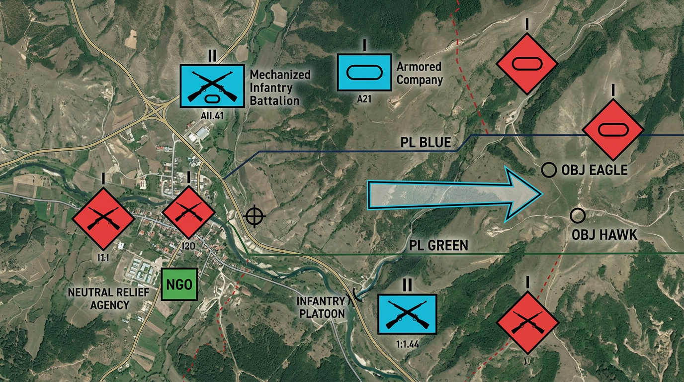
A tactical operations map rendered with strict MIL-STD-2525D / NATO APP-6 military symbology on satellite terrain. Friendly units shown as solid cyan-blue rectangular frames (1:1.44 aspect) containing black monochrome icons such as crossed rifles for infantry and a horizontal oval for armor, with small black echelon indicators centered above the top edge of the frame (one dot for squad, vertical bar for section, two bars for platoon, I for company, II for battalion, X for brigade). Hostile units shown as solid red diamond / quatrefoil frames at 45 degrees containing the same black monochrome interior icons. Neutral units shown as solid green squares. Control measures include a solid dark line labeled PL BLUE and PL GREEN running across the terrain, small black circles labeled OBJ EAGLE and OBJ HAWK, and a wide hollow arrow indicating axis of advance. Pure 2D top-down vector symbols, flat color fills, no 3D shading on the symbols themselves, no fictional or decorative shapes.
★ ★ ★ ★ ★

“Scribble Maps is one of the only software available that lets you make a fully customizable map.”

via G2

Why Scribble Maps for Tactical Operations Planning

Standard symbols, fast placement

Drop MIL-STD-2525D and NATO APP-6 symbols on the map. Infantry, armor, aviation, naval units, and more. Pick affiliation, echelon, and status from a menu.

Brief on any screen

Share the overlay by link. Teams open it on a laptop, tablet, or phone. No install and no account required. Everyone sees the same picture.

Layer your own data

Import KML, GeoJSON, or CSV. Layer terrain data, routes, and boundaries under the tactical symbols. Build a complete picture from multiple sources.

Built for Tactical Operations Planning teams

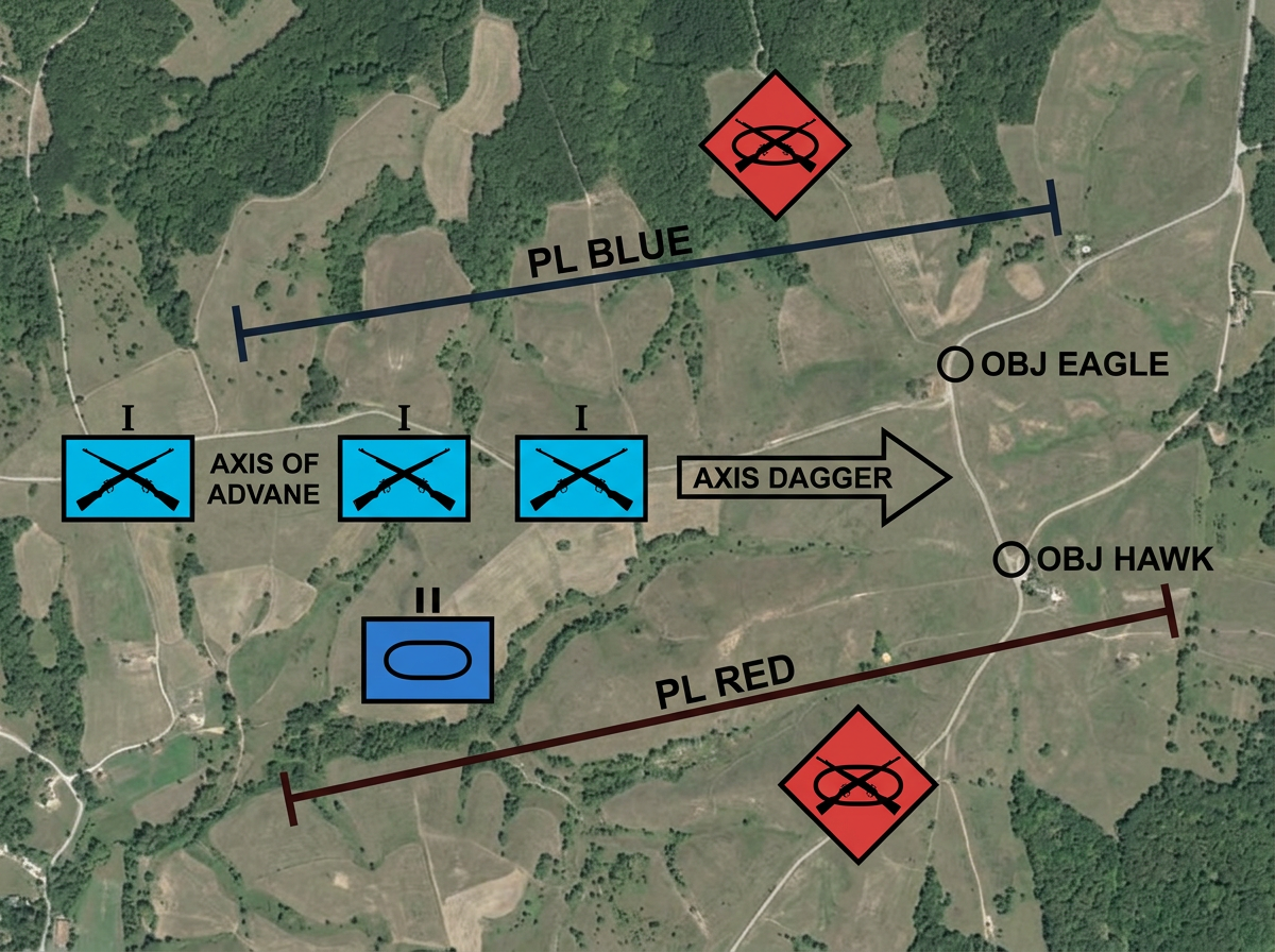
An OPORD graphic drawn on a satellite basemap using strict MIL-STD-2525D symbology. Three friendly infantry company symbols shown as solid cyan-blue rectangular frames (1:1.44 aspect) with black crossed-rifle icons inside and a black 'I' echelon indicator centered above the frame, staged along an axis of advance. One friendly armor platoon symbol shown as a solid blue rectangle with a black horizontal oval icon inside and two short vertical bars above for platoon echelon. Two hostile mechanized infantry symbols shown as solid red diamond frames at 45 degrees containing black crossed rifles with a horizontal oval behind them. Two solid dark lines crossing the terrain labeled PL BLUE and PL RED in black block letters with tick marks at each end. Two small black-outlined circles labeled OBJ EAGLE and OBJ HAWK. A wide hollow black arrow labeled AXIS DAGGER pointing from line of departure toward the objectives. Pure 2D top-down vector military symbols, flat color fills, no decorative shapes.

Operations orders and overlays

Build OPORD graphics with phase lines, objectives, and unit positions. Mark friendly forces in blue, hostile in red, and neutral in green. Share the overlay for mission briefs.

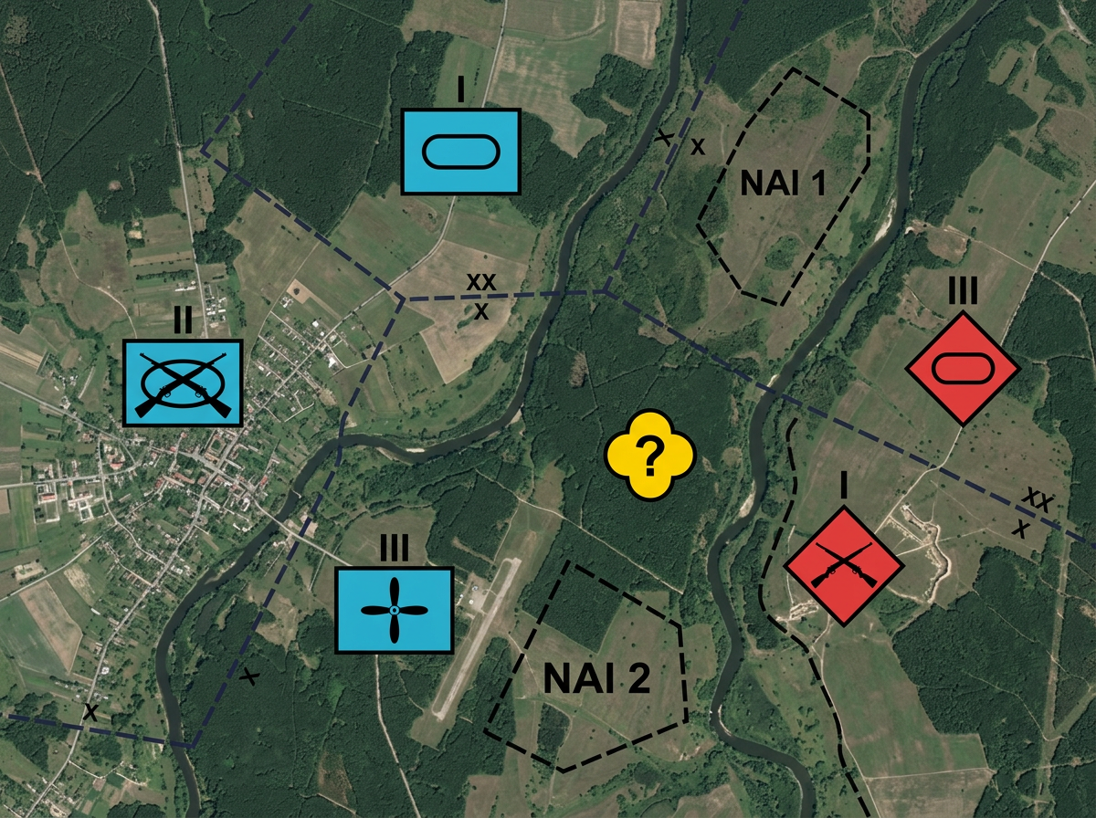
A common operating picture on a satellite terrain basemap rendered with strict MIL-STD-2525D and NATO APP-6 symbology. Friendly forces shown as solid cyan-blue rectangular frames (1:1.44 aspect) containing black monochrome interior icons (crossed rifles for infantry, horizontal oval for armor, propeller for aviation), with black echelon indicators centered above the top edge (I for company, II for battalion, X for brigade). Hostile forces shown as solid red diamond frames at 45 degrees with the same black interior icons. One unknown contact shown as a yellow quatrefoil with a black question mark. Boundary lines drawn as long dashed dark lines with a small echelon indicator (XX for division, X for brigade) straddling each boundary. Two irregular polygons outlined in black dashes labeled NAI 1 and NAI 2. Pure 2D top-down vector symbols, flat color fills, no 3D shading on the symbols themselves, no fictional or decorative shapes.

Common operating picture

Create a shared view of the battlespace. Mark known positions, suspected locations, and areas of interest. Update the map and everyone sees the change.
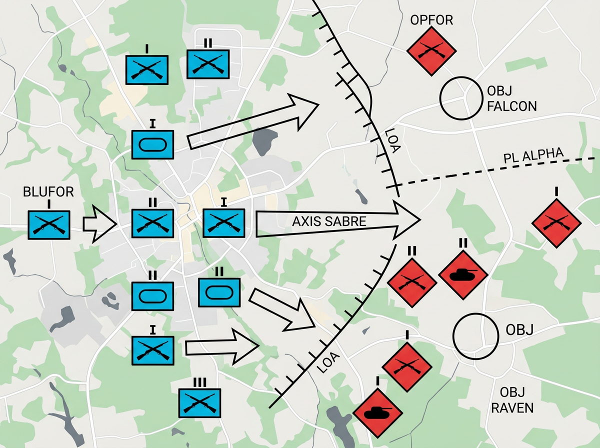
A training exercise map on a clean 2D road basemap rendered with strict MIL-STD-2525D symbology. BLUFOR units shown as solid cyan-blue rectangular frames (1:1.44 aspect) containing black monochrome icons including crossed rifles for infantry and a horizontal oval for armor, with black echelon indicators centered above each frame (vertical bar for section, two bars for platoon, I for company). OPFOR units shown as solid red diamond frames at 45 degrees with the same black interior icons. Several wide hollow black arrows showing maneuver, one labeled AXIS SABRE pointing east. A solid black line labeled LOA labeled with tick marks for Limit of Advance, and a dashed black line labeled PL ALPHA for a phase line. Two black-outlined circles labeled OBJ FALCON and OBJ RAVEN. Pure 2D top-down vector military symbols, flat color fills, no decorative shapes.

Exercise and training scenarios

Set up tabletop exercises with realistic symbols. Walk through maneuvers, test plans, and capture lessons learned. Reset and run again.

Features that matter

  • MIL-STD-2525D military symbology
  • NATO APP-6 symbology support
  • Land, sea, air, space, and subsurface domains
  • Unit echelon from team to army group
  • Status modifiers for anticipated, present, and planned
  • Affiliation colors for friendly, hostile, neutral, and unknown
  • Draw phase lines, boundaries, and control measures
  • Measure distance, area, and bearing
  • Import KML, GeoJSON, Shapefile, GPX, and CSV
  • Export to PDF, PNG, KML, or GeoJSON
  • AES-256 encryption for sensitive overlays
  • Works offline once loaded

Scribble AI

Build maps with plain English

Tell Scribble AI what you need. Try “draw a 500m buffer around every site,” “import this CSV and color by status,” or “measure the route from the depot to each stop.” It does it in seconds. No GIS training needed, and your team gets the same map, ready to share.

Try Scribble AI →

Frequently asked questions

What military symbol standards do you support?

Scribble Maps supports MIL-STD-2525D and NATO APP-6 symbology. You can place symbols for land, sea, air, space, and subsurface units with full affiliation and echelon options.

Can I use this for classified planning?

No. Scribble Maps is a commercial cloud product for unclassified use. Use it for training, exercises, public affairs, and unclassified planning.

Do I need GIS training to use the symbols?

No. Pick a symbol category, choose the unit type, and set the affiliation. The symbol appears on the map ready to move and resize.

Can teams view the map without an account?

Yes. Share a link and anyone can view the map in a browser. No account, no install, and no training needed.

Can I import existing overlays?

Yes. Import KML, GeoJSON, Shapefile, or GPX. Layer your data under the tactical symbols and build a complete picture.

Map your tactical operations planning project today

Start Planning