

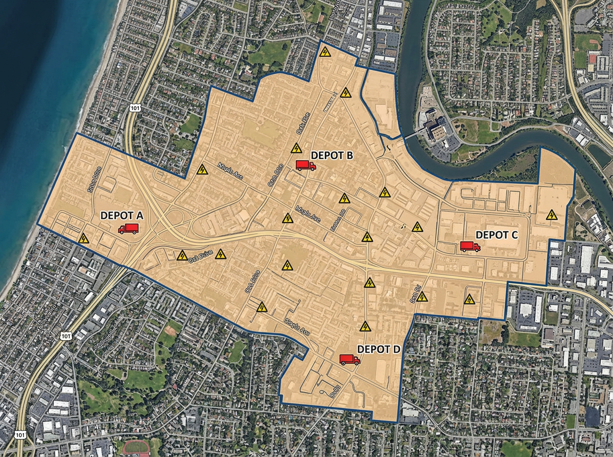
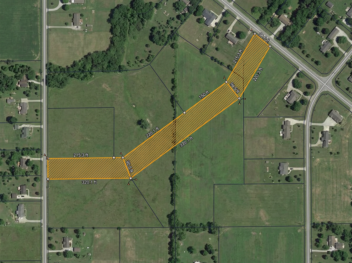
Service area and territory maps
Draw your service territory or franchise area, label substations and depots, and share with members, regulators and partner utilities.
Outage mock-ups, vegetation management routes, joint-use coordination and easement diagrams. Built for the smaller co-ops, contractors and districts who don't have a Utility Network deployment.
 4.7 / 5 · 200 reviews on G2
★ ★ ★ ★ ★“What I appreciate most about Scribble Maps is its intuitive interface and versatility. It enables me to easily draw, label, and personalize maps without needing advanced GIS expertise. Being able to view distances between points and share this information with workers has made it an invaluable tool for planning and communicating on my job sites.”
Sketch service lines, easements, vegetation zones and outage areas directly on satellite imagery. No CAD program, no GIS deployment.
Share a map link with the line crew, contractor or member-customer. They open it on a phone. No app, no install.
Import KML, Shapefile and GeoJSON of poles, lines, valves and meters. Layer it all on a single shared map.
Draw your service territory or franchise area, label substations and depots, and share with members, regulators and partner utilities.
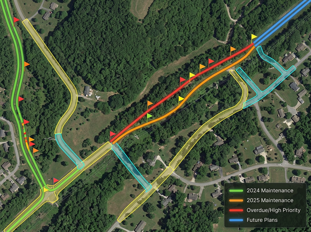
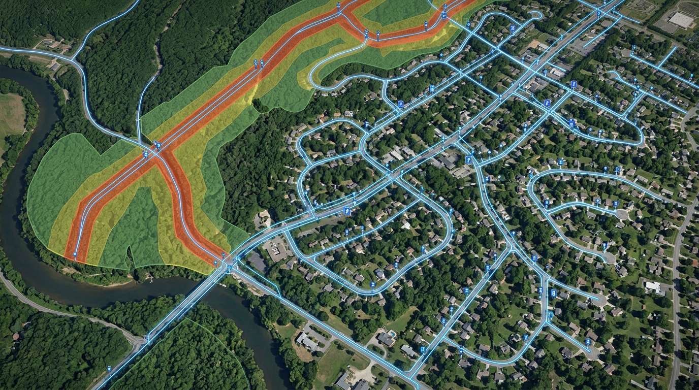
Plan annual ROW clearing and vegetation cycles. Mark priority spans, segment by year and share with crews and contractors.
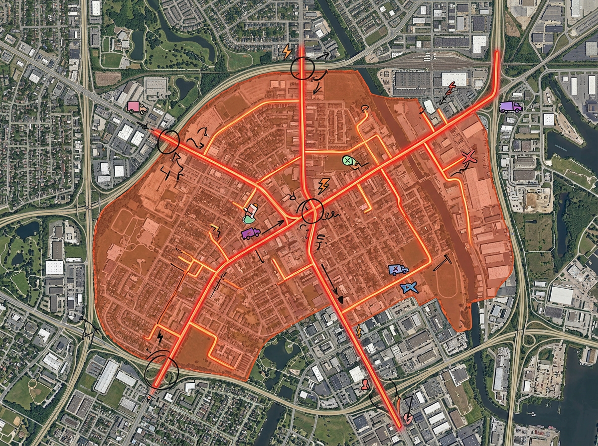
Sketch an outage area on satellite imagery, mark the affected feeders and share with crews, dispatch and mutual-aid partners.
Build easement and joint-use exhibits for landowners, attorneys and partner utilities. Print to PDF for the file packet.
Scribble AI
Tell Scribble AI what you need. Try “draw a 500m buffer around every site,” “import this CSV and color by status,” or “measure the route from the depot to each stop.” It does it in seconds. No GIS training needed, and your team gets the same map, ready to share.
Try Scribble AI →★ ★ ★ ★ ★“What I appreciate most about Scribble Maps is its intuitive interface and versatility. It enables me to easily draw, label, and personalize maps without needing advanced GIS expertise.”
★ ★ ★ ★“This website helps us mark road chainage of our construction work activity. We can label location important points very effectively and we can label many different definitions which we can't find in normal Google Maps.”
No. Scribble Maps is for sketches, field exhibits, vegetation plans, outage mock-ups and shareable diagrams. It works alongside enterprise GIS for the everyday work that doesn't need the heavy stack.
Yes. Import KML, Shapefile, GeoJSON or CSV. Layer existing assets onto satellite imagery and annotate from there.
Yes. Scribble Maps supports private maps, password protection and AES-256 encryption.
Yes. Click Share, copy the link and email it. They open it in any browser. No install, no account.