

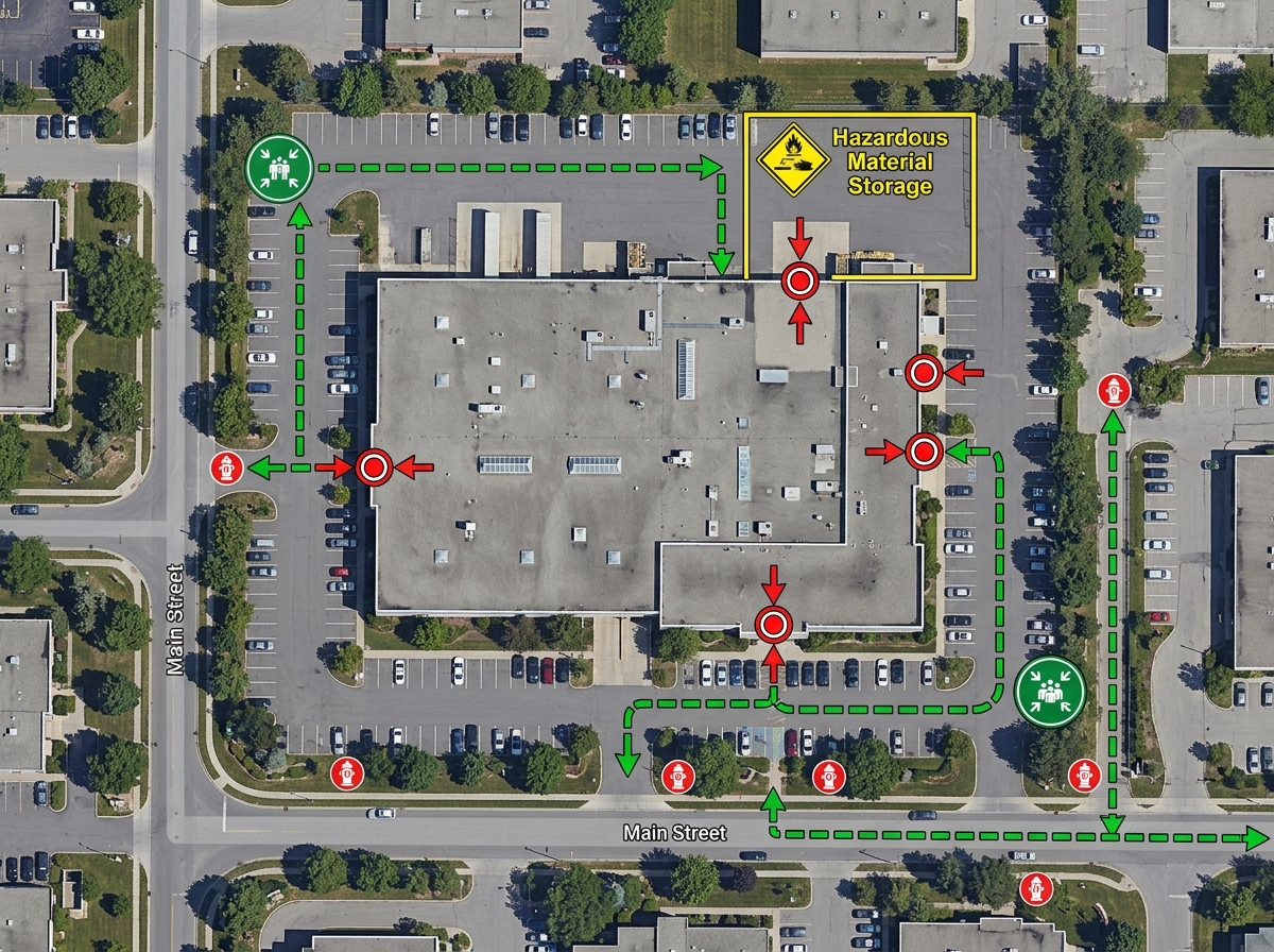
Pre-plans and target hazards
Map building access, hydrant locations, hazardous materials and evacuation zones for high-risk occupancies your crews need to know cold.
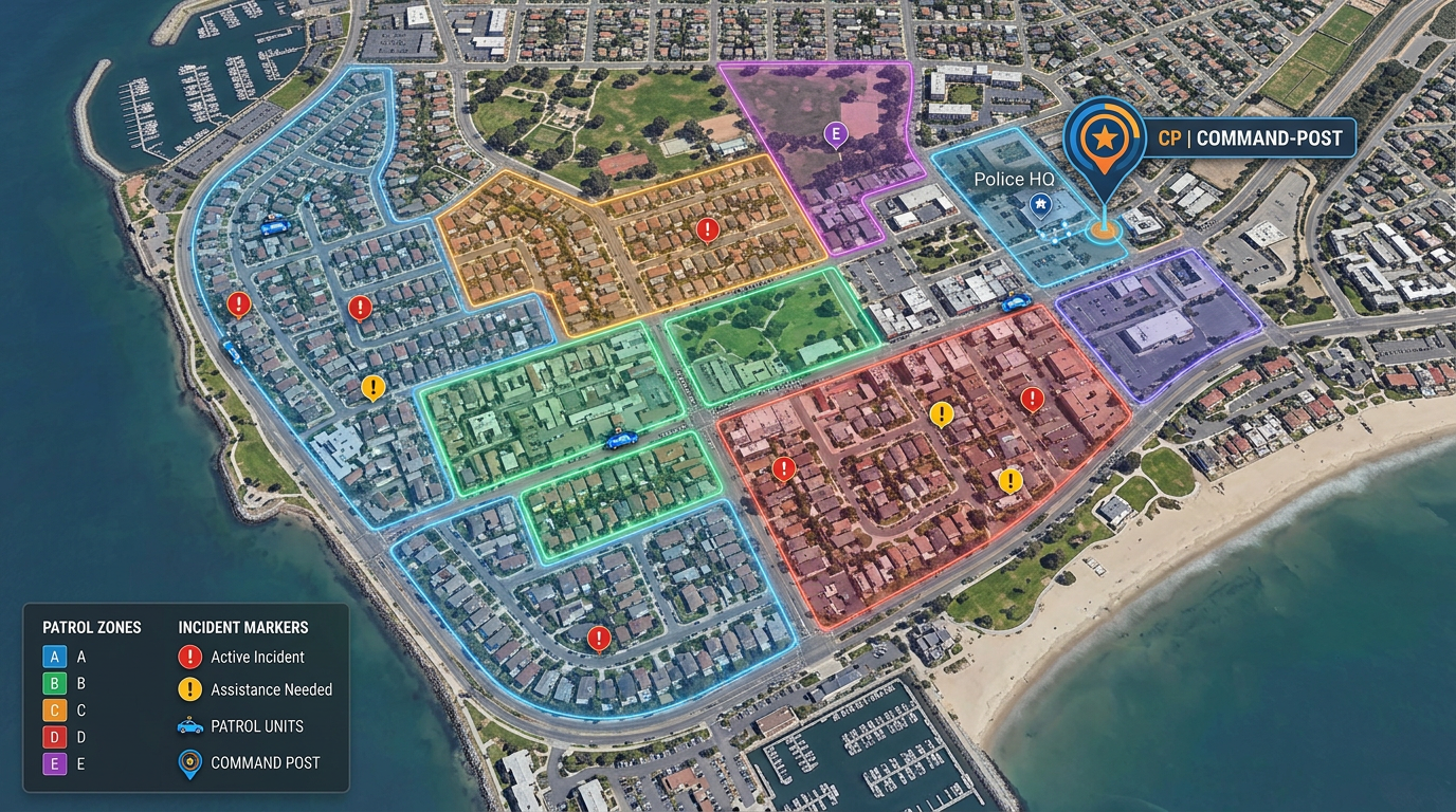
Patrol zones, pre-plans, tabletop exercises and event security maps you can build in minutes and share with command, mutual aid and partners.
 4.7 / 5 · 200 reviews on G2
★ ★ ★ ★ ★“The support we've received from Scribble Maps has been amazing.”
Draw building footprints, hydrants, hazards and access points directly on satellite imagery. No CAD license, no enterprise stack.
Share a link with command, mutual aid, EMS and city partners. They open it in a browser. No install, no account.
Import KML, Shapefile, GeoJSON or CSV. Hydrant inventories, beat boundaries, address point files. Style and re-share instantly.
Map building access, hydrant locations, hazardous materials and evacuation zones for high-risk occupancies your crews need to know cold.
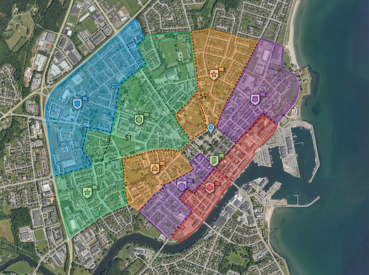
Draw beat boundaries, color-code by sector and share read-only with watch commanders and detached personnel.
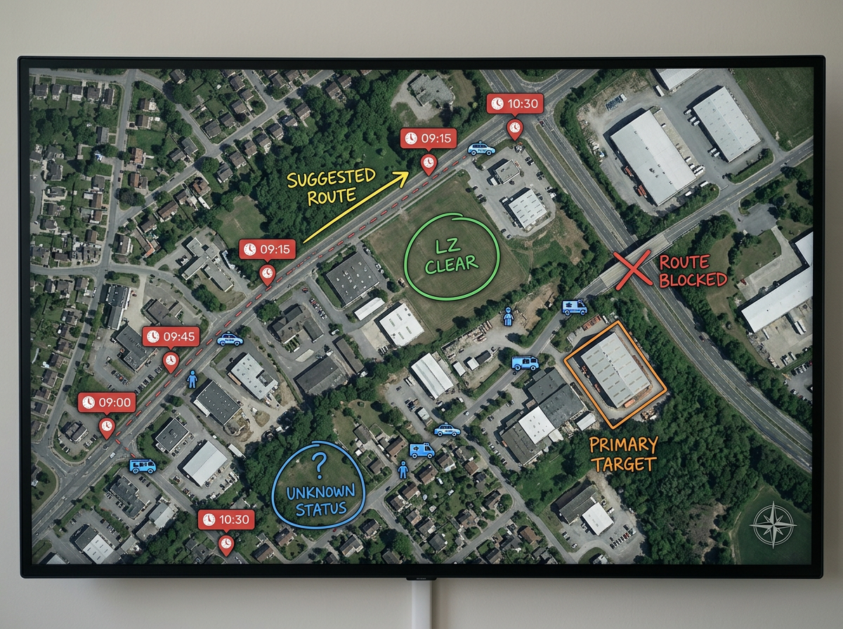
Diagram a scenario, walk a team through it on the same screen and capture annotations for the after-action report.
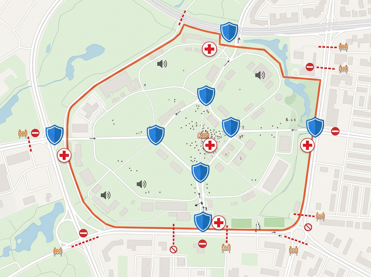
Map a parade route, festival footprint or sporting event. Mark posts, gates, road closures and medical stations on one shared map.
Scribble AI
Tell Scribble AI what you need. Try “draw a 500m buffer around every site,” “import this CSV and color by status,” or “measure the route from the depot to each stop.” It does it in seconds. No GIS training needed, and your team gets the same map, ready to share.
Try Scribble AI →★ ★ ★ ★ ★“The support we've received from Scribble Maps has been amazing.”
★ ★ ★ ★ ★“As a trial lawyer, I often need to show the jury a map of the scene or a route. Scribble Maps is far superior to other tools, like Google Maps, for making maps for presentations.”
Yes. Scribble Maps supports private maps, password protection and AES-256 encryption. Sharing links can be revoked at any time.
No. Crews open shared links in any browser on a phone, tablet or laptop. There is nothing to install.
Yes. Import KML, Shapefile, GeoJSON, GPX or CSV. Layer the import on top of any base map and re-share.
Yes. Scribble Maps supports SAML/OIDC/SCIM, activity and audit logs, and user management.