

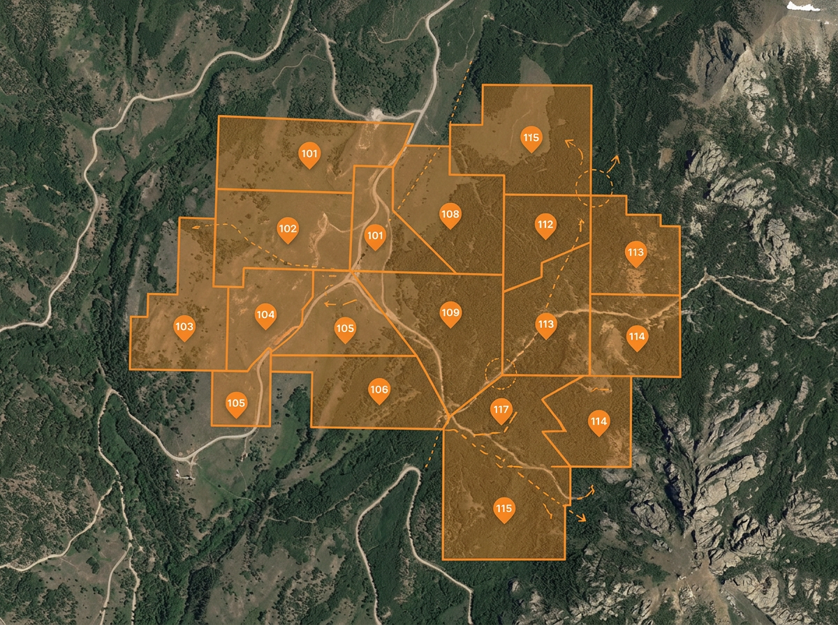
Claim and tenure sketches
Draw claim blocks, license boundaries and tenure outlines for staking, JV negotiations and government filings.
Sketch claims, mark drill targets, plan haul roads and build reclamation exhibits. Built for junior miners, exploration teams and small operations who don't run an enterprise GIS.
 4.7 / 5 · 200 reviews on G2
★ ★ ★ ★ ★“The thing I like most about Scribble is how easy it is to use. I also love how I can create any maps from scratch. A lot of the maps that I have created are not geo referenced. This has been very helpful to me when I have been creating these farm maps.”
Sketch claim blocks, drill targets and exploration grids on satellite or terrain. No GIS analyst required.
Share an exploration or haul plan with the field crew, geologist or contractor. They open it on a phone. No install.
Import KML, Shapefile, GeoJSON or GPX of existing claims, drill collars and infrastructure. Layer it all on one map.
Draw claim blocks, license boundaries and tenure outlines for staking, JV negotiations and government filings.
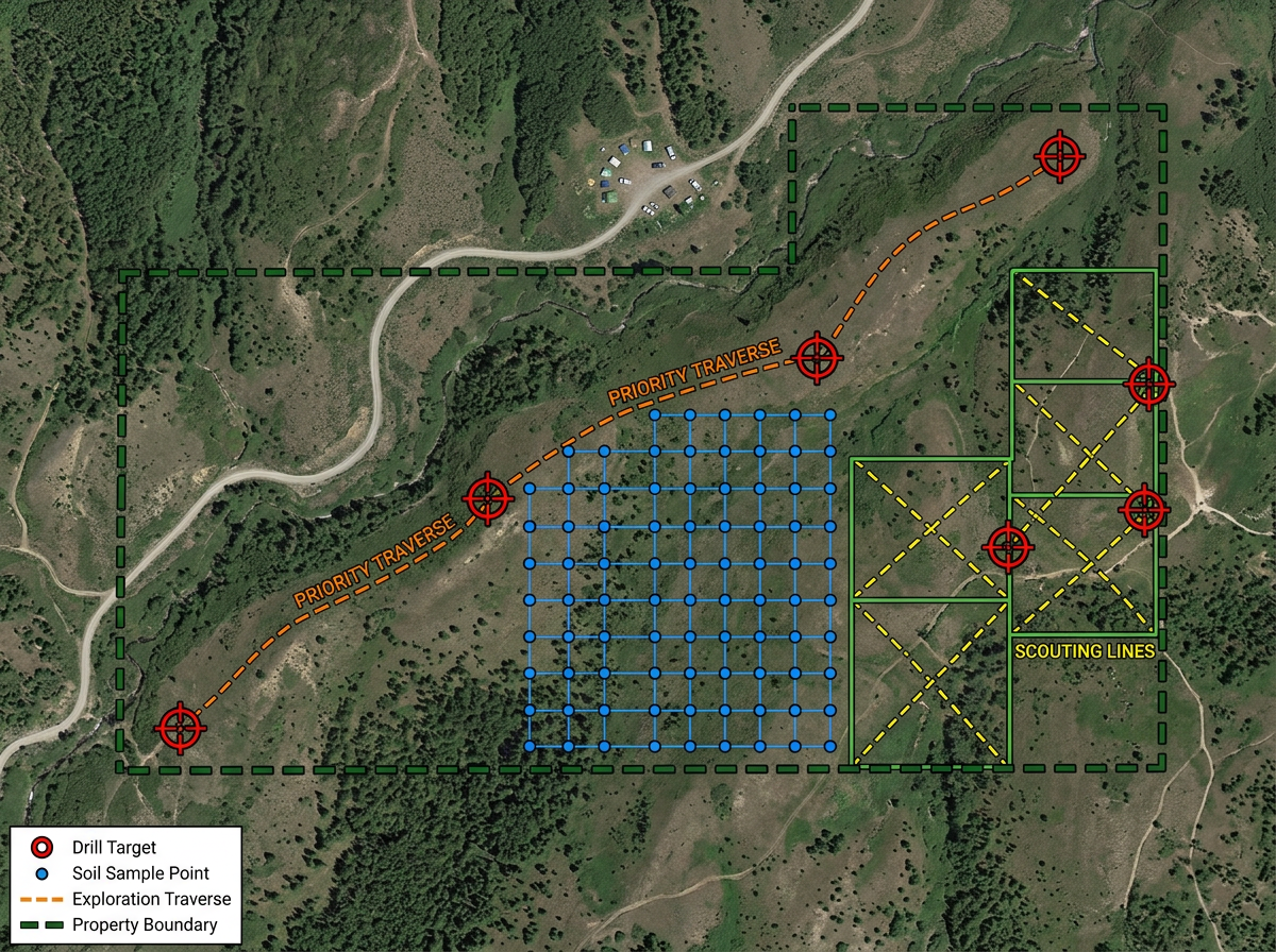
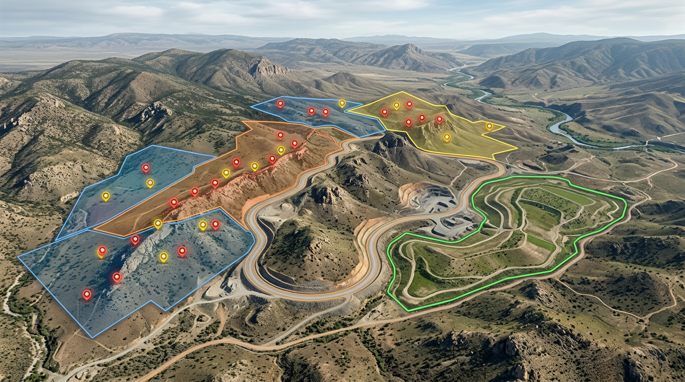
Mark drill targets, soil sample grids and prospecting traverses for the field crew and the program report.
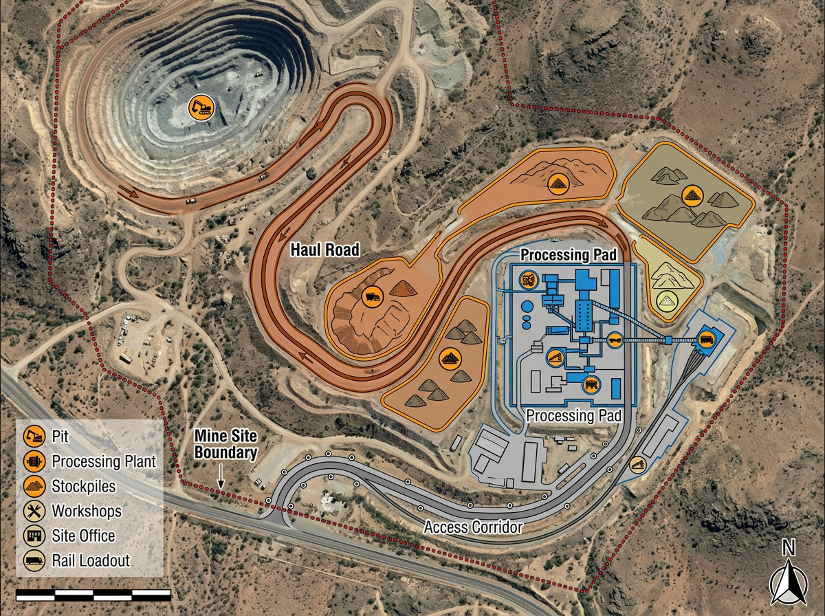
Sketch haul roads, stockpile areas, processing pads and access corridors for engineering and permit reviews.
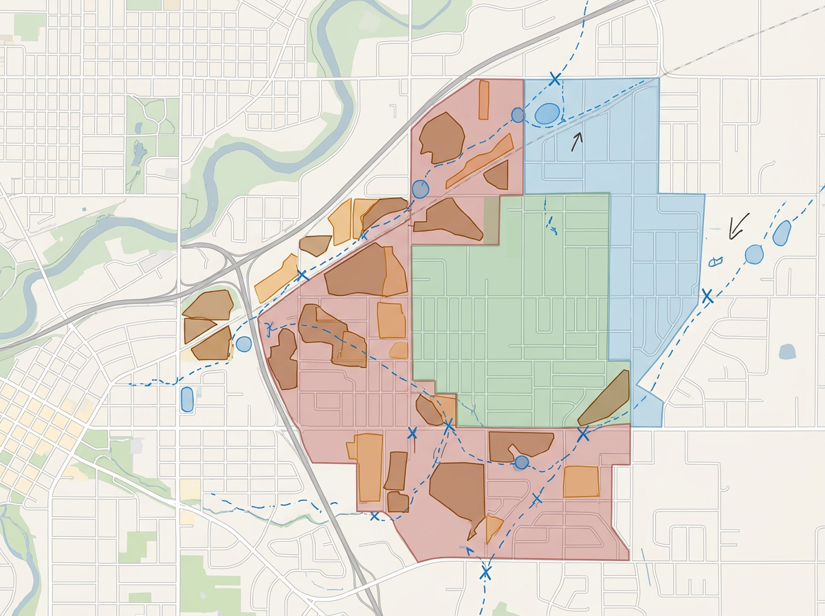
Build reclamation exhibits, disturbed-area outlines and progressive rehab plans for permit packets and stakeholders.
Scribble AI
Tell Scribble AI what you need. Try “draw a 500m buffer around every site,” “import this CSV and color by status,” or “measure the route from the depot to each stop.” It does it in seconds. No GIS training needed, and your team gets the same map, ready to share.
Try Scribble AI →★ ★ ★ ★“The thing I like most about Scribble is how easy it is to use. I also love how I can create any maps from scratch.”
★ ★ ★ ★ ★“What I appreciate most about Scribble Maps is its intuitive interface and versatility. It enables me to easily draw, label, and personalize maps without needing advanced GIS expertise.”
Yes. Import KML, Shapefile, GeoJSON or GPX. Existing claims and tenure data drop directly onto the map.
Yes. Click Share, copy the link and text it to the crew. They open it on a phone. No install.
Yes. Scribble Maps supports private maps, password protection and AES-256 encryption.
Yes. Export to PDF, PNG, KML or GeoJSON for inclusion in permit, JV or stakeholder packets.